Old Maps of Frankfort, Kentucky for Metal Detecting
Plan your next treasure hunt with 23 historic maps of Frankfort. Find old homesites, ghost towns, trails, and gathering spots that may be lost to time — perfect for identifying promising metal detecting locations.
- Locate forgotten sites: Uncover places like long-lost settlements, abandoned rail lines, or gathering spots.
- Plan better hunts: Use map overlays combined with LiDAR or satellite views to narrow in on historically rich areas.
- Made for detectorists: Thousands of hobbyists use these maps to discover relics, coins, and hidden history.
Use these historic maps to boost your research and find new opportunities beneath the surface of Frankfort.
Frankfort, KY maps
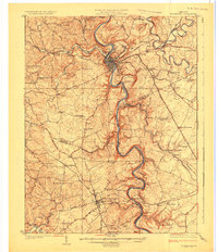
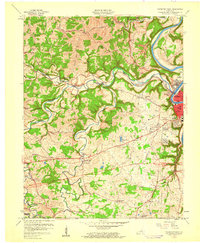
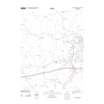
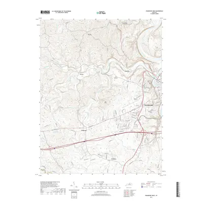
(23)- 1922 Map of Frankfort
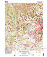
 1922 Frankfort1922 Print · USGSCentral Kentucky's river valleys and rolling uplands are captured here in the early twenties, showing a landscape defined by water and rail. Trace family history at Lanes Mill Fox Gap School or follow the river to Youngs High Bridge and Shryocks Ferry.
 - 1924 Map of Frankfort
 1924 Frankfort1924 Print · USGSThe Kentucky River valley and surrounding Bluegrass uplands are documented here during the mid-1920s. Genealogists and researchers can trace rural life through dozens of named district schools and river landmarks like Youngs High Bridge, Lanes Mill, and Shryocks Ferry.2 unique versions available
 - 1953 Map of Frankfort West, 1955 Print
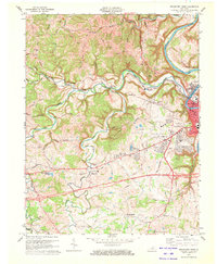
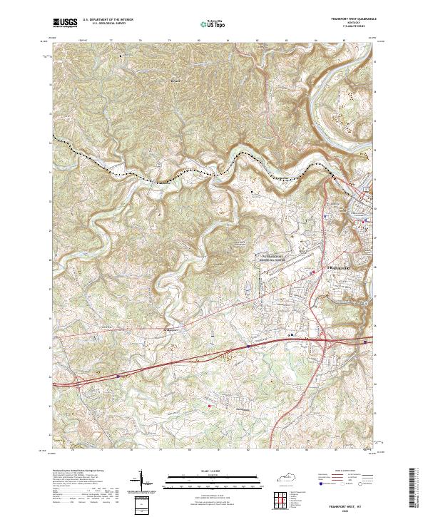
 1953 Frankfort West1955 Print · USGSThe Kentucky state capital and its western hills are captured in the early 1950s, showing the intersection of river transport and rail development. Genealogists and historians can trace family roots through landmarks like Mt Zion Ch, the Stewart Home, and the village of Bridgeport.
 - 1953 Map of Frankfort East, 1955 Print
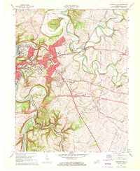
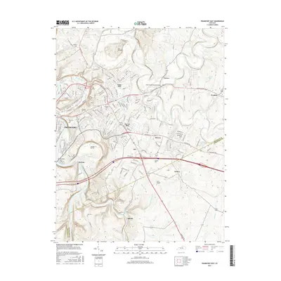
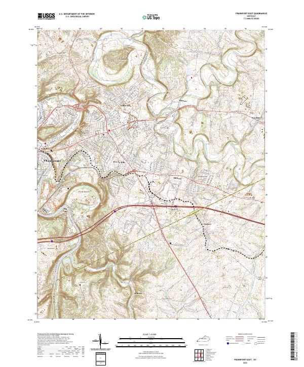
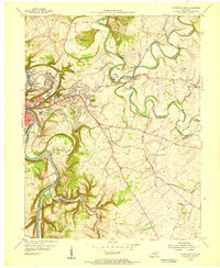 1953 Frankfort East1955 Print · USGSFrankfort and the surrounding bluegrass country are shown in the early fifties as the capital city expanded eastward into the river bluffs. Researchers can locate vanished landmarks like the State Training Home Farm and trace historic routes through Slickway, Stedmantown, and Duckers.
 - 1956 Map of Louisville, 1971 Print
 1956 Louisville1971 Print · USGSThe Ohio River valley and the Kentucky Bluegrass are captured here during a period of rapid mid-century growth and industrial activity. Genealogists and historians can trace rail-centered towns and military land use at Fort Knox and the Jefferson Proving Ground.2 unique versions available
 - 1959 Map of Frankfort East, 1960 Print
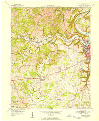
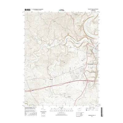
 1959 Frankfort East1960 Print · USGSThe Kentucky state capital and its rolling eastern environs are captured here during the growth of the late fifties. Genealogists and local historians can trace suburban development and rural outposts like Stedmantown, Forks of Elkhorn, and Duckers.2 unique versions available
 - 1959 Map of Frankfort West, 1960 Print
 1959 Frankfort West1960 Print · USGSFrankfort and the Kentucky River valley are shown here just as the capital's postwar suburbs were expanding into the surrounding hills. Researchers can trace historic family routes along Old Harrodsburg Road and identify local landmarks like Bridgeport, the Stewart Home, and Mt Zion Ch.2 unique versions available
 - 1964 Map of Louisville
 1964 Louisville1964 Print · USGSThe Ohio River valley and Kentucky Bluegrass are captured in the mid-1960s, showing a region balanced between industrial growth and its agrarian roots. Genealogists and historians can trace the development of county seats like Shelbyville and Paris, or locate established institutions such as Georgetown College and Bernheim Forest.
 - 1970 Map of Frankfort East, 1972 Print
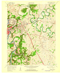
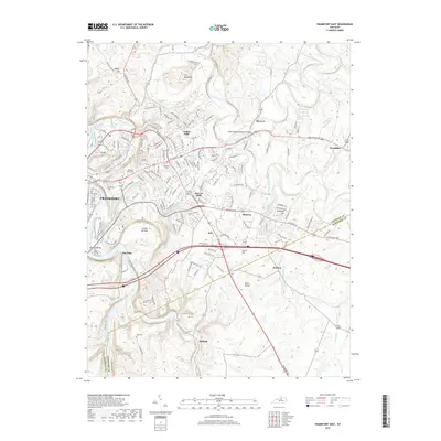
 1970 Frankfort East1972 Print · USGSFrankfort and the surrounding Bluegrass region are captured here in the early seventies as the capital city expanded along the Kentucky River. Researchers can trace historic institutions and rural landmarks from Ky State College and the Penitentiary to the Forks of Elkhorn Ch.6 unique versions available
 - 1970 Map of Frankfort West, 1972 Print
 1970 Frankfort West1972 Print · USGSThe Kentucky state capital and its rural western environs are captured here in the early seventies as the city expanded toward Pea Ridge. Genealogists can trace family landmarks like Sudduth Cem and rural centers such as Bridgeport and Choateville.5 unique versions available
 - 1986 Map of Lexington
 1986 Lexington1986 Print · USGSCentral Kentucky’s Bluegrass region is captured in the mid-eighties as urban centers like Lexington and Frankfort expand alongside deep-rooted rural hubs. Researchers can trace historic rail lines like the Southern Railway and find landmarks such as the Lexington Blue Grass Army Depot and Tacketts Mill.
 - 1996 Map of Frankfort East, 1999 Print
 1996 Frankfort East1999 Print · USGSThe state capital and its eastern surrounds appear in the 1990s as the suburbs of Indian Hills expanded toward the South Elkhorn Creek. Genealogists can trace family sites at Greenhill Cem and Cooke Cem or locate the historic Peaks of Elkhorn Ch.
 - 1997 Map of Frankfort West, 2000 Print
 1997 Frankfort West2000 Print · USGSFrankfort’s western hills and the winding Kentucky River are captured here in the late nineties as urban growth meets rural tradition. Researchers can trace family history at Sudduth Cem or locate local landmarks like the Boone National Guard Center and Bridgeport.
 - 2010 Map of Frankfort East, 2010 Print
 2010 Frankfort East2010 Print · USGSCovers Frankfort, including Duckers, Bon Air Hills, and other nearby areas
 - 2010 Map of Frankfort West, 2010 Print
 2010 Frankfort West2010 Print · USGSCovers Frankfort, including Kennebec, Bryant, and other nearby areas
 - 2013 Map of Frankfort East, 2013 Print
 2013 Frankfort East2013 Print · USGSCovers Frankfort, including Duckers, Bon Air Hills, and other nearby areas
 - 2013 Map of Frankfort West, 2013 Print
 2013 Frankfort West2013 Print · USGSCovers Frankfort, including Kennebec, Bryant, and other nearby areas
 - 2016 Map of Frankfort East, 2016 Print
 2016 Frankfort East2016 Print · USGSCovers Frankfort, including Duckers, Bon Air Hills, and other nearby areas
 - 2016 Map of Frankfort West, 2016 Print
 2016 Frankfort West2016 Print · USGSCovers Frankfort, including Kennebec, Bryant, and other nearby areas
 - 2019 Map of Frankfort East, 2019 Print
 2019 Frankfort East2019 Print · USGSCovers Frankfort, including Duckers, Bon Air Hills, and other nearby areas
 - 2019 Map of Frankfort West, 2019 Print
 2019 Frankfort West2019 Print · USGSCovers Frankfort, including Kennebec, Bryant, and other nearby areas
 - 2022 Map of Frankfort West, 2022 Print
 2022 Frankfort West2022 Print · USGSFrankfort and the Kentucky River valley are shown here in the 2020s, highlighting the state capital alongside rural Franklin County. Researchers can locate the Franklin County Courthouse, trace family ties at Choateville Church Cem, and explore old routes near Bridgeport.
 - 2022 Map of Frankfort East, 2022 Print
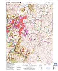
 2022 Frankfort East2022 Print · USGSThe state capital and its surrounding Bluegrass hills are captured here in the early 2020s as the riverfront and suburbs continue to evolve. Researchers can locate the historic Frankfort Cem, trace the bends of Elkhorn Creek, and find smaller settlements like Duckers and Millville.
End of results
Showing maps 1-23 of 23
Top cities near Frankfort
- Lexington historical maps
- Lawrenceburg historical maps
- Versailles historical maps
- Midway historical maps
- Stamping Ground historical maps
- Monterey historical maps
Top neighborhoods of Frankfort
Frequently asked questions
- What are the different types of historical maps available for Frankfort?
- What is the oldest map of Frankfort?
- Where can I purchase historical maps of Frankfort for my home or office?
- Where can I download high-res historical maps of Frankfort?
- Are there historical topographic maps available for Frankfort?
- Is there historical aerial imagery available for Frankfort?
- Where are historical maps of Frankfort sourced from?