Old Maps of Vine Grove, Kentucky for Metal Detecting
Plan your next treasure hunt with 29 historic maps of Vine Grove. Find old homesites, ghost towns, trails, and gathering spots that may be lost to time — perfect for identifying promising metal detecting locations.
- Locate forgotten sites: Uncover places like long-lost settlements, abandoned rail lines, or gathering spots.
- Plan better hunts: Use map overlays combined with LiDAR or satellite views to narrow in on historically rich areas.
- Made for detectorists: Thousands of hobbyists use these maps to discover relics, coins, and hidden history.
Use these historic maps to boost your research and find new opportunities beneath the surface of Vine Grove.
Vine Grove, KY maps
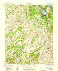
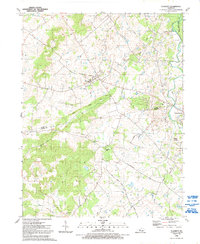
(29)- 1936 Map of Vine Grove
 1936 Vine Grove1936 Print · USGSHardin and Bullitt counties are shown here during a period of massive military expansion before the mid-century. Researchers can trace the development of Fort Knox alongside established communities like Vine Grove and old rural landmarks like Stovall Chapel or the Glenbeddis Sch.
 - 1941 Map of Ekron
 1941 Ekron1941 Print · USGSNorthern Kentucky and the Ohio River shoreline are captured here in the early 1940s, showing the rural communities of Meade and Hardin Counties. Genealogists can trace family locations near Ekron, Shumate School, and the historic Sherman Landing.
 - 1943 Map of Vine Grove
 1943 Vine Grove1943 Print · USGSHardin and Meade Counties appear here during a period of massive mid-century growth at Fort Knox. Genealogists can trace family homesteads near landmarks like Stovall Chapel, Red Hill, and the many rural schools including Hays Sch and Deckard Sch.
 - 1946 Map of Vine Grove
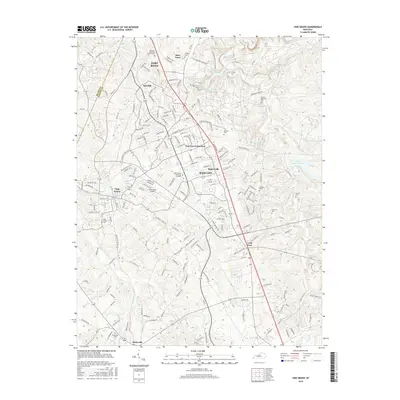
 1946 Vine Grove1946 Print · USGSHardin County settlements and the southern edge of Fort Knox are frozen in time just after the war. Researchers can locate family landmarks such as Lincoln Memorial Cem, the Illinois Central rail line, and the village of Vine Grove.
 - 1946 Map of Vine Grove, 1959 Print
 1946 Vine Grove1959 Print · USGSMid-century Hardin County is defined by the massive expansion of the Fort Knox Military Reservation and its surrounding rail-and-highway hubs. Researchers can trace dozens of family cemeteries and vanished landmarks like the Woolridge Ferry Bridge, Sherrard Sch, and the community of Pitts Point.
 - 1947 Map of Ekron, 1959 Print
 1947 Ekron1959 Print · USGSMeade County and the riverfronts of the Ohio Valley come alive in this late 1940s survey. Genealogists and historians can trace the foundations of Garnettsville, locate rural landmarks like Doe Run Mill, or search for family connections at Cedar Farm Cem and St Martins Sch.
 - 1948 Map of Flaherty
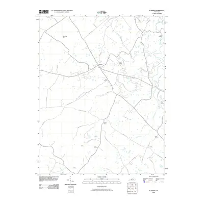
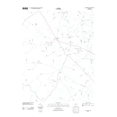
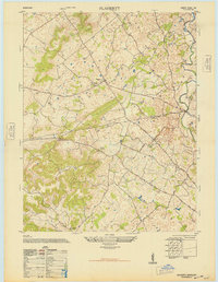 1948 Flaherty1948 Print · USGSMid-century Hardin County reveals a landscape of upland farms and rural schools shortly after the war. Genealogists can trace family roots at St Martins Church Cem and School, Salem Church and Cemetery, and the old Miller School.
 - 1954 Map of Evansville
 1954 Evansville1954 Print · USGSThe Ohio River borderlands between Indiana and Kentucky appear here during a period of robust industrial and military growth. Genealogists and researchers can trace the rail corridors of the Illinois Central and find landmarks like US Lock and Dam No 48 or Camp Breckinridge.
 - 1957 Map of Winchester, 1968 Print
 1957 Winchester1968 Print · USGSCentral Kentucky's landscape in the mid-twentieth century features the sprawling Fort Knox and the early parkway system. Genealogists and historians can trace rail lines like the Southern Railway and find landmarks from Bernheim Forest to Pilot Knob.3 unique versions available
 - 1957 Map of Evansville, 1969 Print
 1957 Evansville1969 Print · USGSIndiana and Kentucky meet along the Ohio River in this mid-century survey of a vital industrial and transport corridor. Genealogists and historians can trace the development of river towns like Owensboro and Newburgh or locate old rail lines like the Southern Ry.3 unique versions available
 - 1960 Map of Winchester
 1960 Winchester1960 Print · USGSCentral Kentucky's diverse landscape is shown here at mid-century, from the bluegrass plains to the rugged Pottsville Escarpment. Genealogists and historians can trace the rail-and-river network connecting towns like Bardstown and Stanford alongside landmarks like Lake Cumberland.
 - 1960 Map of Vine Grove, 1961 Print
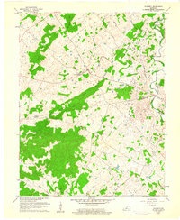
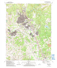
 1960 Vine Grove1961 Print · USGSHardin County during the early sixties shows the interface between military growth and rural Kentucky life. Trace family roots at St Brigids Cem or follow the Illinois Central tracks through Vine Grove and Radcliff.5 unique versions available
 - 1960 Map of Flaherty, 1961 Print
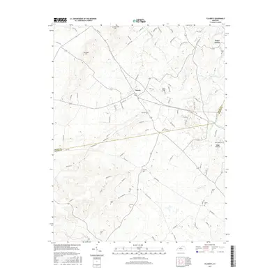
 1960 Flaherty1961 Print · USGSMeade and Hardin counties in the early sixties are captured here at the edge of the military expansion. Genealogists can trace family names through rural landmarks like St Martins Ch, Hynes Cem, and the cluster of homes at Flaherty.3 unique versions available
 - 1961 Map of Evansville
 1961 Evansville1961 Print · USGSThe Ohio River valley and its surrounding coalfields are captured here during the late fifties and early sixties. Trace the industrial rail networks of the Illinois Central RR and explore regional landmarks like Mammoth Cave National Park and Angel Mounds State Memorial.2 unique versions available
 - 1981 Map of Elizabethtown, 1983 Print
 1981 Elizabethtown1983 Print · USGSCentral Kentucky in the early eighties shows a landscape of military installations, state parks, and historic sites. Genealogists and historians can trace rail lines like the Louisville and Nashville or locate sites like Lebanon National Cemetery and the Lincoln Memorial National Historic Site.
 - 1986 Map of Tell City
 1986 Tell City1986 Print · USGSThe Ohio River valley and the Kentucky interior come alive in this mid-eighties record of industry and recreation. Genealogists and historians can trace small rural settlements like Victoria Crossroads, local landmarks such as St Rose, and the extensive shoreline of Rough River Lake.
 - 1991 Map of Tell City
 1991 Tell City1991 Print · USGSThe Ohio River valley at the start of the nineties reveals a landscape of riverfront industry and sprawling conservation lands. Genealogists can locate family landmarks like Wesley Chapel and rural communities such as Reynolds Station and Maceo.
 - 1991 Map of Flaherty, 1992 Print
 1991 Flaherty1992 Print · USGSThe rural borders of Meade and Hardin Counties are captured here in the early nineties, where the Fort Knox Military Reservation meets local farmland. Researchers can trace numerous family burial sites and country churches, including Swan Cem, Tarplay Cem, and Hilltop Ch.
 - 1991 Map of Vine Grove, 1992 Print
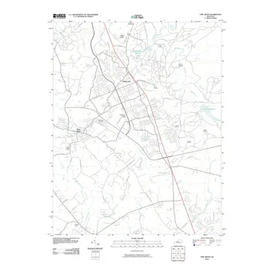
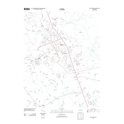
 1991 Vine Grove1992 Print · USGSRadcliff and Vine Grove appear at a moment of significant residential growth in the early nineties, bordered by the federal lands of Fort Knox. Researchers can trace family roots at Stovall Ch, Stanton Cem, and old settlements like Rogersville.
 - 2010 Map of Vine Grove, 2010 Print
 2010 Vine Grove2010 Print · USGSCovers Vine Grove, including Elizabethtown, Radcliff, and other nearby areas
 - 2010 Map of Flaherty, 2010 Print
 2010 Flaherty2010 Print · USGSCovers Vine Grove, including Hardin County, Meade County, and other nearby areas
 - 2013 Map of Vine Grove, 2013 Print
 2013 Vine Grove2013 Print · USGSCovers Vine Grove, including Elizabethtown, Radcliff, and other nearby areas
 - 2013 Map of Flaherty, 2013 Print
 2013 Flaherty2013 Print · USGSCovers Vine Grove, including Hardin County, Meade County, and other nearby areas
 - 2016 Map of Vine Grove, 2016 Print
 2016 Vine Grove2016 Print · USGSCovers Vine Grove, including Elizabethtown, Radcliff, and other nearby areas
 - 2016 Map of Flaherty, 2016 Print
 2016 Flaherty2016 Print · USGSCovers Vine Grove, including Hardin County, Meade County, and other nearby areas
Showing maps 1-25 of 29
Top cities near Vine Grove
- Louisville historical maps
- Elizabethtown historical maps
- Radcliff historical maps
- Rineyville historical maps
- Brandenburg historical maps
- Ekron historical maps
See more
Frequently asked questions
- What are the different types of historical maps available for Vine Grove?
- What is the oldest map of Vine Grove?
- Where can I purchase historical maps of Vine Grove for my home or office?
- Where can I download high-res historical maps of Vine Grove?
- Are there historical topographic maps available for Vine Grove?
- Is there historical aerial imagery available for Vine Grove?
- Where are historical maps of Vine Grove sourced from?