Old Maps of Madisonville, Kentucky for Metal Detecting
Plan your next treasure hunt with 34 historic maps of Madisonville. Find old homesites, ghost towns, trails, and gathering spots that may be lost to time — perfect for identifying promising metal detecting locations.
- Locate forgotten sites: Uncover places like long-lost settlements, abandoned rail lines, or gathering spots.
- Plan better hunts: Use map overlays combined with LiDAR or satellite views to narrow in on historically rich areas.
- Made for detectorists: Thousands of hobbyists use these maps to discover relics, coins, and hidden history.
Use these historic maps to boost your research and find new opportunities beneath the surface of Madisonville.
Madisonville, KY maps
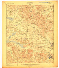
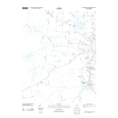
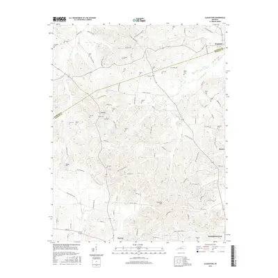
(34)- 1907 Map of Earlington
 1907 Earlington1907 Print · USGSWestern Kentucky coal and farm country comes alive in the early 1900s, centered on the growing hubs of Madisonville and Earlington. Genealogists and historians can trace dozens of rural schools and churches like Ramsey School, Nebo, and Mt Carmel Church.
 - 1909 Map of Earlington
 1909 Earlington1909 Print · USGSWestern Kentucky’s coal and rail corridor comes into focus in the years before the Great War. Researchers can trace ancestral locations through a dense network of local landmarks like Silent Run PO, Johnson Island Church, and Oakland Store.3 unique versions available
 - 1909 Map of Madisonville
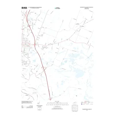
 1909 Madisonville1909 Print · USGSWestern Kentucky at the peak of the coal and rail era shows a landscape defined by river crossings and growing mining towns. Researchers can locate dozens of early rural landmarks, from Island Ford and Barnsley to the New Providence School and Brier Creek Church.3 unique versions available
 - 1952 Map of Hanson, 1954 Print
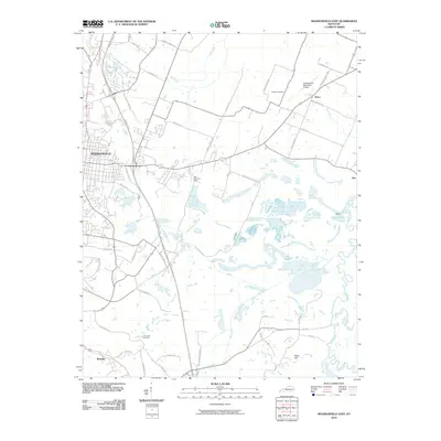
 1952 Hanson1954 Print · USGSHopkins County in the early 1950s shows a landscape of rural family homesteads and early oil extraction along the Louisville and Nashville railroad. Genealogists can trace local roots through numerous sites like the County Farm, Slaughtersville, and Old Salem Cem.
 - 1953 Map of Madisonville East, 1954 Print
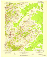
 1953 Madisonville East1954 Print · USGSThe coal-rich corridor of Hopkins County is revealed in the early fifties, showing the heavy intersection of industry and community. Genealogists and researchers can trace family landmarks like St Marys Ch, Barnsley, and the extensive Strip Mines that shaped this landscape.
 - 1954 Map of Evansville
 1954 Evansville1954 Print · USGSThe Ohio River borderlands between Indiana and Kentucky appear here during a period of robust industrial and military growth. Genealogists and researchers can trace the rail corridors of the Illinois Central and find landmarks like US Lock and Dam No 48 or Camp Breckinridge.
 - 1954 Map of Slaughters, 1955 Print
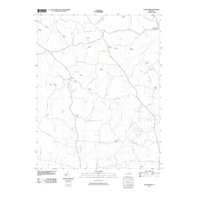
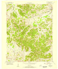 1954 Slaughters1955 Print · USGSSlaughters and the rugged Shake Rag Hills are documented here in the mid-fifties, during a period of transition for the Webster and Hopkins County line. Genealogists can locate numerous family burial sites like Tapp Cem and country churches such as Oakley Home Ch.2 unique versions available
 - 1954 Map of Earlington, 1958 Print
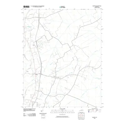
 1954 Earlington1958 Print · USGSHopkins and Webster Counties in the mid-fifties show a landscape shaped by coal extraction and rail transit. Researchers can trace the heritage of vanished homesteads and local landmarks like Sixth Vein Mine, Slaughtersville, and Munns Sch.
 - 1957 Map of Evansville, 1969 Print
 1957 Evansville1969 Print · USGSIndiana and Kentucky meet along the Ohio River in this mid-century survey of a vital industrial and transport corridor. Genealogists and historians can trace the development of river towns like Owensboro and Newburgh or locate old rail lines like the Southern Ry.3 unique versions available
 - 1961 Map of Evansville
 1961 Evansville1961 Print · USGSThe Ohio River valley and its surrounding coalfields are captured here during the late fifties and early sixties. Trace the industrial rail networks of the Illinois Central RR and explore regional landmarks like Mammoth Cave National Park and Angel Mounds State Memorial.2 unique versions available
 - 1962 Map of Madisonville West, 1964 Print
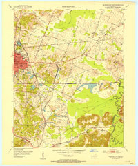
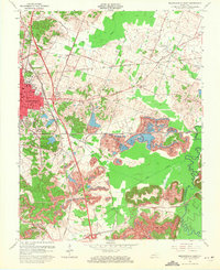
 1962 Madisonville West1964 Print · USGSMid-century Hopkins County is defined here by the expansion of coal operations and suburban growth near Madisonville. Genealogists and historians can trace rail-side settlements like Manitou or locate family sites at Richland Cem and Carter Chapel.2 unique versions available
 - 1963 Map of Madisonville East, 1971 Print
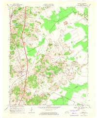
 1963 Madisonville East1971 Print · USGSThe coal country of eastern Hopkins County is captured here in the early sixties, as surface mining began to reshape the land. Genealogists and historians can trace the foundations of Madisonville, the grounds of the Tuberculosis Hospital, and the rural community at Bethlehem Ch.
 - 1969 Map of Hanson, 1971 Print
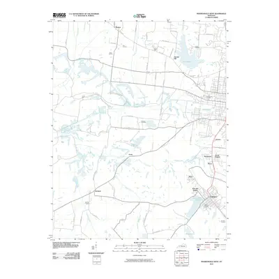
 1969 Hanson1971 Print · USGSNorth of Madisonville in the late sixties, this Hopkins and Webster County landscape shows a mix of coal-country industry and traditional rural life. Researchers can locate family landmarks like Pritchetts Chapel, Slaughters Lake, and the West Lawn Cem.
 - 1983 Map of Madisonville, 1984 Print
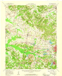
 1983 Madisonville1984 Print · USGSThe Western Kentucky coalfields and river valleys come into focus in the early eighties as the rail-and-river economy matured. Genealogists can trace family footprints across Dawson Springs, Mortons Gap, and Slaughters, or locate landmarks like Shake Rag Hills and Lake Malone.
 - 2010 Map of Slaughters, 2010 Print
 2010 Slaughters2010 Print · USGSCovers Madisonville, including Hanson, Slaughters, and other nearby areas
 - 2010 Map of Madisonville East, 2010 Print
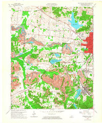
 2010 Madisonville East2010 Print · USGSCovers Madisonville, including Earlington, Mortons Gap, and other nearby areas
 - 2010 Map of Hanson, 2010 Print
 2010 Hanson2010 Print · USGSCovers Madisonville, including Hanson, Slaughters, and other nearby areas
 - 2010 Map of Madisonville West, 2010 Print
 2010 Madisonville West2010 Print · USGSCovers Madisonville, including Earlington, Dozier Heights, and other nearby areas
 - 2013 Map of Madisonville West, 2013 Print
 2013 Madisonville West2013 Print · USGSCovers Madisonville, including Earlington, Dozier Heights, and other nearby areas
 - 2013 Map of Hanson, 2013 Print
 2013 Hanson2013 Print · USGSCovers Madisonville, including Hanson, Slaughters, and other nearby areas
 - 2013 Map of Slaughters, 2013 Print
 2013 Slaughters2013 Print · USGSCovers Madisonville, including Hanson, Slaughters, and other nearby areas
 - 2013 Map of Madisonville East, 2013 Print
 2013 Madisonville East2013 Print · USGSCovers Madisonville, including Earlington, Mortons Gap, and other nearby areas
 - 2016 Map of Slaughters, 2016 Print
 2016 Slaughters2016 Print · USGSCovers Madisonville, including Hanson, Slaughters, and other nearby areas
 - 2016 Map of Hanson, 2016 Print
 2016 Hanson2016 Print · USGSCovers Madisonville, including Hanson, Slaughters, and other nearby areas
 - 2016 Map of Madisonville East, 2016 Print
 2016 Madisonville East2016 Print · USGSCovers Madisonville, including Earlington, Mortons Gap, and other nearby areas
Showing maps 1-25 of 34
Top cities near Madisonville
- Providence historical maps
- Dawson Springs historical maps
- Earlington historical maps
- Nortonville historical maps
- Mortons Gap historical maps
- White Plains historical maps
See more
Top neighborhoods of Madisonville
Frequently asked questions
- What are the different types of historical maps available for Madisonville?
- What is the oldest map of Madisonville?
- Where can I purchase historical maps of Madisonville for my home or office?
- Where can I download high-res historical maps of Madisonville?
- Are there historical topographic maps available for Madisonville?
- Is there historical aerial imagery available for Madisonville?
- Where are historical maps of Madisonville sourced from?