1960s Maps of Louisville, Kentucky
Explore 23 historic maps of Louisville from the 1960s. These maps offer a rare glimpse into what life looked like during the 1960s — showing old roads, neighborhoods, homes, and landmarks that have changed or disappeared over time.
Whether you're researching your family's past, planning a metal detecting trip, or studying how Louisville's landscape evolved across the 1960s, these high-resolution maps are a powerful tool for exploring the history of this region.
- Focus on a specific era: All maps on this page are from the 1960s, giving you a focused view of this time period.
- See what’s changed: Compare century-old streets, trails, and buildings to today's modern landscape using overlays and satellite layers.
- Research with precision: Use these maps for genealogy, historical research, land use analysis, or educational projects.
- View, download, or print: Maps are fully viewable online in high resolution, and can be downloaded or printed for your own records.
Start exploring Louisville's history through authentic maps from the 1960s. This is your window into the past.
Louisville, KY maps
(23)- 1960 Map of Winchester
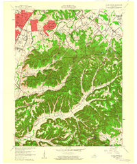
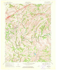
 1960 Winchester1960 Print · USGSCentral Kentucky's diverse landscape is shown here at mid-century, from the bluegrass plains to the rugged Pottsville Escarpment. Genealogists and historians can trace the rail-and-river network connecting towns like Bardstown and Stanford alongside landmarks like Lake Cumberland.
 - 1960 Map of Valley Station
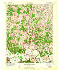
 1960 Valley Station1960 Print · USGSJefferson County and Bullitt County neighborhoods were rapidly evolving in the early sixties as suburbs reached into the knobs. Genealogists can locate family landmarks like Bethany Memorial Cem, Medora Sch, and the community at Fairdale.2 unique versions available
 - 1960 Map of Waterford, 1961 Print
 1960 Waterford1961 Print · USGSCentral Kentucky's rural river valleys and county boundaries are captured here in the early 1960s. Genealogists and local historians can locate Waterford, Whitfield, and the Carrithers Chapel among the winding paths of the Salt River.
 - 1960 Map of Fort Knox, 1961 Print
 1960 Fort Knox1961 Print · USGSFort Knox and the surrounding river valleys are captured here during the height of the Cold War era. Researchers can trace the layout of the U S Bullion Depository and Godman Army Airfield or locate family plots like Boone Cem and McIntire Cem.3 unique versions available
 - 1960 Map of Lanesville, 1961 Print
 1960 Lanesville1961 Print · USGSHarrison County, Indiana, and the Jefferson County shoreline are documented here in the early sixties. Genealogists can trace family names at Lottick Corner or locate ancestral sites like St Johns Church and the Tabler Cemetery near the river bluffs.2 unique versions available
 - 1960 Map of Kosmosdale, 1961 Print
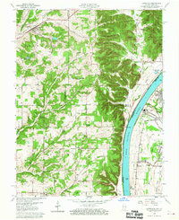
 1960 Kosmosdale1961 Print · USGSThe Ohio River valley near the Harrison and Jefferson County line is captured here during a period of significant growth. You can trace the development of residential neighborhoods like Meadow Lawn and Valley Station alongside older sites like Elizabeth Ch and Kosmosdale.3 unique versions available
 - 1960 Map of Crestwood, 1961 Print
 1960 Crestwood1961 Print · USGSThe rail towns of the Louisville and Nashville line prosper in the 1960s along the Oldham and Jefferson county border. Genealogists can trace family names at Pleasant Hill Cem, find the St Aloysius Sch, and locate the Pewee Valley Sanatorium.2 unique versions available
 - 1960 Map of Anchorage, 1961 Print
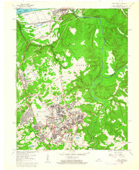
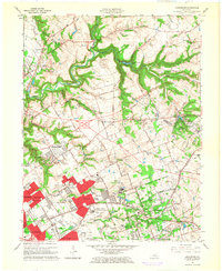
 1960 Anchorage1961 Print · USGSEastern Jefferson County is shown at a peak of institutional and suburban growth in the early sixties. Genealogists and historians can trace family locations near the Kentucky Military Institute, Anchorage, and Ormsby Village.
 - 1960 Map of Jeffersonville, 1961 Print
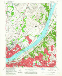
 1960 Jeffersonville1961 Print · USGSJeffersonville and Louisville are shown at a peak of mid-century growth as the river-and-rail economy defined the border between Indiana and Kentucky. Researchers can trace historic institutions and transport hubs, including the Zachary Taylor National Cemetery, the Indiana Arsenal, and the State Railway Museum.
 - 1960 Map of Jeffersontown, 1961 Print
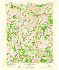
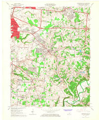
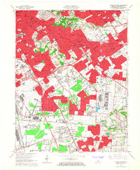
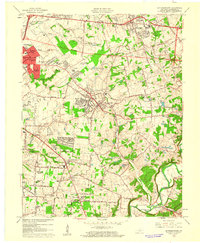 1960 Jeffersontown1961 Print · USGSEastern Jefferson County comes alive in this early 1960s survey, showing the transition from farmland to suburban neighborhoods. Genealogists and local historians can pinpoint family landmarks like Bullitt Cem, Tucker Station, and the Spring Meadows Childrens Home.
 - 1960 Map of Fisherville, 1961 Print
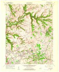
 1960 Fisherville1961 Print · USGSEastern Jefferson County and its neighboring borders are captured here in the early sixties, showing a landscape defined by rail lines and river bends. Genealogists can locate Lincoln Institute at Lincoln Ridge or trace ancestral sites like Bethlehem Ch and Fisherville.
 - 1960 Map of Louisville East, 1961 Print
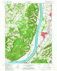
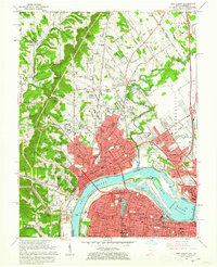
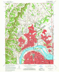
 1960 Louisville East1961 Print · USGSLouisville is captured during its mid-century expansion, as residential subdivisions and new expressways began to link the historic city core with its eastern suburbs. Trace the development of local institutions like Appliance Park, the runways of Bowman Field, and the grounds of Cave Hill Cemetery.
 - 1960 Map of Louisville West, 1961 Print
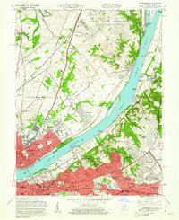
 1960 Louisville West1961 Print · USGSLouisville and its southern suburbs are captured here during a era of major post-war expansion and highway development. Genealogists and historians can trace family roots through numerous neighborhood landmarks like Hazelwood Sanatorium, St Denis, and Churchill Downs.
 - 1960 Map of New Albany, 1962 Print
 1960 New Albany1962 Print · USGSThe Ohio River borderlands are captured here in the early sixties, showing the industrial heart of New Albany and northern Louisville. Researchers can trace old neighborhood lines through Portland, locate local parish schools like St Marys Sch, and find historical landmarks including Blackiston Mill.
 - 1963 Map of Charlestown, 1964 Print
 1963 Charlestown1964 Print · USGSCharlestown and the surrounding Clark County countryside are captured here in the early sixties as the industrial and military presence reshaped the landscape. Genealogists and local researchers can locate numerous family landmarks like Worrell Cemetery, Pleasant Grove Church, and the massive Indiana Arsenal.4 unique versions available
 - 1964 Map of Louisville
 1964 Louisville1964 Print · USGSThe Ohio River valley and Kentucky Bluegrass are captured in the mid-1960s, showing a region balanced between industrial growth and its agrarian roots. Genealogists and historians can trace the development of county seats like Shelbyville and Paris, or locate established institutions such as Georgetown College and Bernheim Forest.
 - 1964 Map of Jeffersontown, 1967 Print
 1964 Jeffersontown1967 Print · USGSEastern Jefferson County is shown at a peak of mid-century suburbanization as residential tracts begin to surround established towns like Jeffersontown and Middletown. Genealogists can trace family roots through sites like the Chenoweth Run Cemetery, Seatonville, and the Davis Memorial Chapel.2 unique versions available
 - 1965 Map of Anchorage, 1966 Print
 1965 Anchorage1966 Print · USGSEastern Jefferson County was undergoing a major residential and institutional transition in the mid-sixties. Researchers can trace the grounds of the Ormsby Village State Reservation, the Kentucky Military Institute, and the rail lines through Anchorage.2 unique versions available
 - 1965 Map of Jeffersonville, 1966 Print
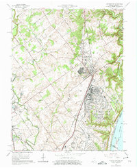
 1965 Jeffersonville1966 Print · USGSThe riverfronts of southern Indiana and northern Kentucky are captured here in the mid-sixties, a period of significant suburban expansion. Researchers can trace historic sites like the Locust Grove Historical Home, Zachary Taylor National Cemetery, and the State Railway Museum.2 unique versions available
 - 1965 Map of Louisville West, 1966 Print
 1965 Louisville West1966 Print · USGSThe southwest Louisville corridor in the mid-sixties shows an urban landscape balancing industrial rail hubs with burgeoning suburbs. Researchers can trace the footprints of the U S Naval Ordnance Plant, the Hazelwood Sanatorium, and family sites like Farnsley Cem.
 - 1965 Map of New Albany, 1966 Print
 1965 New Albany1966 Print · USGSSpanning the Falls of the Ohio in the mid-sixties, this area shows the vital river connection between New Albany and Louisville. Genealogists and historians can trace neighborhood growth through dozens of named churches and schools, from Blackiston Mill to the McAlpine Locks and Sherman Minton Bridge.2 unique versions available
 - 1965 Map of Louisville East, 1967 Print
 1965 Louisville East1967 Print · USGSJefferson County experienced massive growth in the 1960s as the modern expressway system reshaped the eastern Louisville suburbs. Genealogists can trace family plots in Cave Hill Cemetery and Evergreen Cemetery or locate parish schools like St Ignatius Martyr Sch.2 unique versions available
 - 1969 Map of Crestwood, 1971 Print
 1969 Crestwood1971 Print · USGSThe rail-and-creek landscape of Oldham and Jefferson Counties is captured here in the late sixties as suburban growth meets established rural institutions. Researchers can trace historic sites like the Confederate Cem, Pewee Valley Sanitarium, and the State Prison near Floyds Fork.
End of results
Showing maps 1-23 of 23
Top cities near Louisville
- Jeffersonville historical maps
- New Albany historical maps
- Jeffersontown historical maps
- Clarksville historical maps
- Shively historical maps
- Mount Washington historical maps
See more
Top neighborhoods of Louisville
- Beechland Beach historical maps
- Glenview Heights historical maps
- Juniper Beach historical maps
- Gulthrie Beach historical maps
- Harrods Creek historical maps
- Riverside Beach historical maps
See more
Frequently asked questions
- What are the different types of historical maps available for Louisville?
- What is the oldest map of Louisville?
- Where can I purchase historical maps of Louisville for my home or office?
- Where can I download high-res historical maps of Louisville?
- Are there historical topographic maps available for Louisville?
- Is there historical aerial imagery available for Louisville?
- Where are historical maps of Louisville sourced from?