2020s Maps of Louisville, Kentucky
Explore 16 historic maps of Louisville from the 2020s. These maps offer a rare glimpse into what life looked like during the 2020s — showing old roads, neighborhoods, homes, and landmarks that have changed or disappeared over time.
Whether you're researching your family's past, planning a metal detecting trip, or studying how Louisville's landscape evolved across the 2020s, these high-resolution maps are a powerful tool for exploring the history of this region.
- Focus on a specific era: All maps on this page are from the 2020s, giving you a focused view of this time period.
- See what’s changed: Compare century-old streets, trails, and buildings to today's modern landscape using overlays and satellite layers.
- Research with precision: Use these maps for genealogy, historical research, land use analysis, or educational projects.
- View, download, or print: Maps are fully viewable online in high resolution, and can be downloaded or printed for your own records.
Start exploring Louisville's history through authentic maps from the 2020s. This is your window into the past.
Louisville, KY maps
(16)- 2022 Map of Kosmosdale, 2022 Print
 2022 Kosmosdale2022 Print · USGSThe riverfront south of Louisville comes alive in this modern survey of the Kentucky-Indiana border. Genealogists can trace local roots through several burial grounds like McNutt Cemetery and Mill Creek Cemetery or explore the ridges of Rosewood.
 - 2022 Map of Mount Washington, 2022 Print
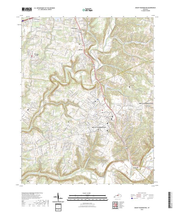 2022 Mount Washington2022 Print · USGSMount Washington and its surrounding Bullitt County communities are captured here in the early 2020s as residential growth meets the river valleys. Researchers can trace local heritage through numerous burial sites like Mount Washington Cem or explore the geography of Floyds Fork and Smithville.
 - 2022 Map of Anchorage, 2022 Print
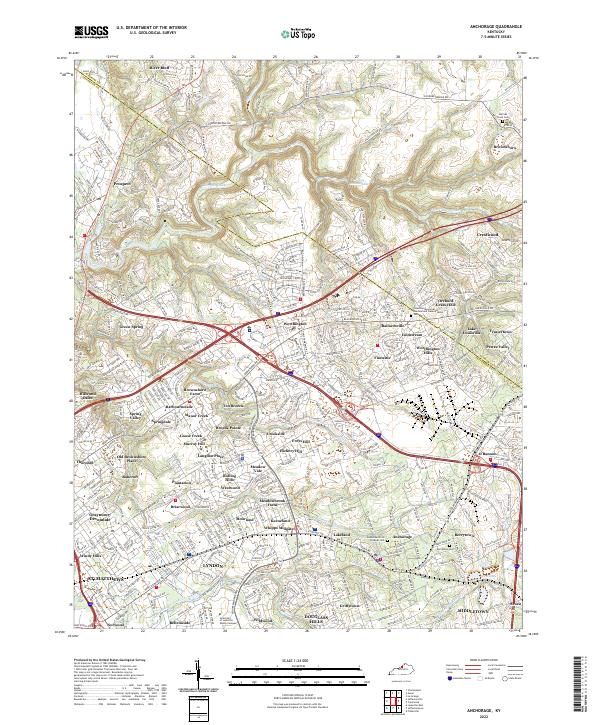 2022 Anchorage2022 Print · USGSThe eastern outskirts of Louisville are seen here in the early 2020s, showing a landscape of established neighborhoods and waterways. Trace family history at Berrytown Cem or explore the developments around Pewee Valley and Harrods Creek.
 - 2022 Map of Louisville East, 2022 Print
 2022 Louisville East2022 Print · USGSThe eastern suburbs of Louisville are shown in the early 2020s, highlighting a landscape defined by historic neighborhoods and institutional anchors. Local researchers can trace family plots at Cave Hill Cemetery or explore the transit corridors of the L & N RR and Bowman Field.
 - 2022 Map of Charlestown, 2022 Print
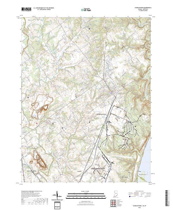 2022 Charlestown2022 Print · USGSSouthern Indiana's riverfront and upland communities come into focus in the early 2020s as suburban growth reaches toward the Ohio River. Genealogists can trace family heritage through numerous burial sites including Saint Michaels Cem, Bottorff Cem, and Friends Cem.
 - 2022 Map of Jeffersonville, 2022 Print
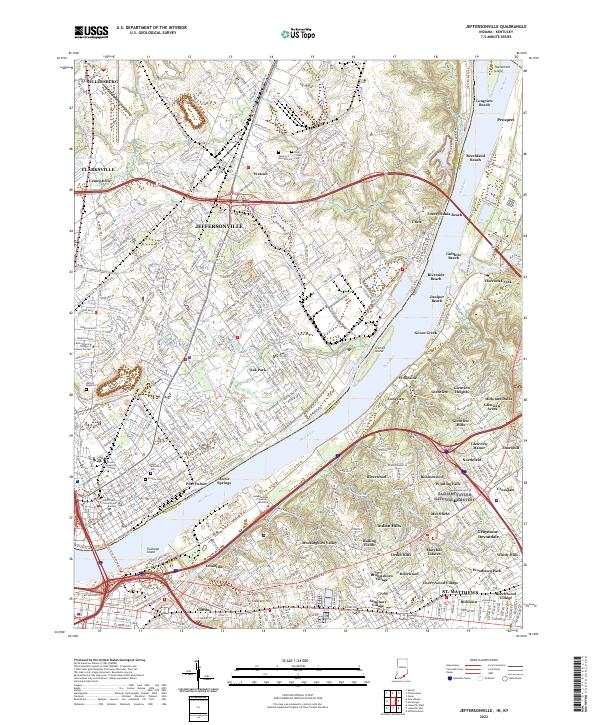 2022 Jeffersonville2022 Print · USGSThe riverfront communities of Indiana and Kentucky are shown here in the early twenty-first century as they flank the Ohio River. Researchers can trace local landmarks and neighborhood growth from the Clark County Government Building to family plots at Walnut Ridge Cem and Saint Anthonys Cem.
 - 2022 Map of Waterford, 2022 Print
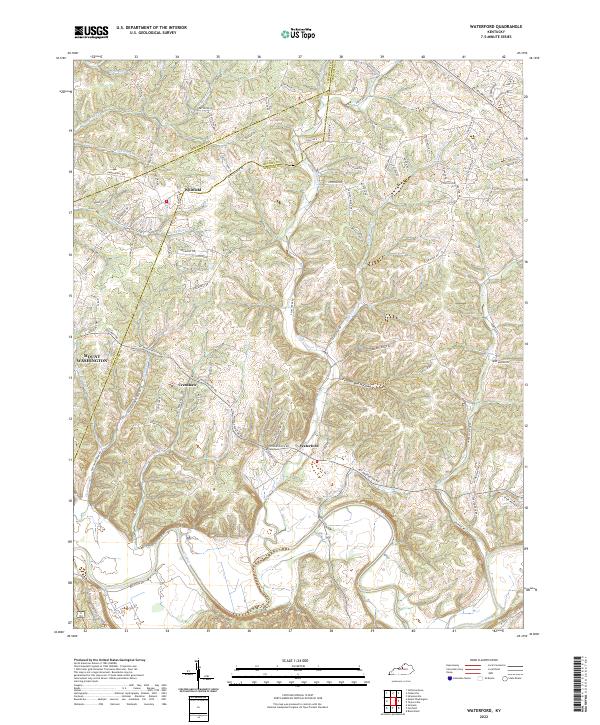 2022 Waterford2022 Print · USGSThe Salt River valley and the historic settlement of Waterford are captured in this modern survey of the Spencer County countryside. Researchers can trace family landmarks along Plum Creek, the drainage of Feather Bed Hollow, and the rural crossroads of Whitfield.
 - 2022 Map of Lanesville, 2022 Print
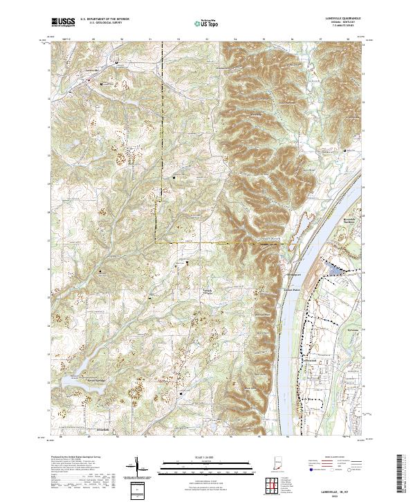 2022 Lanesville2022 Print · USGSThe Indiana-Kentucky borderlands along the Ohio River appear here in the early 2020s, showing a landscape of deep ridges and rural family homesteads. Genealogists can locate numerous burial sites such as Tabler Cem and Saint Marys Catholic Cem near Lanesville.
 - 2022 Map of Valley Station, 2022 Print
 2022 Valley Station2022 Print · USGSSouth of Louisville as the suburbs meet the Kentucky knobs, this map reveals a landscape defined by family-named ridges and hollows. Genealogists can trace family names at the Bethany Memorial Cem, Horine Cem, and McDaniel Cem.
 - 2022 Map of Jeffersontown, 2022 Print
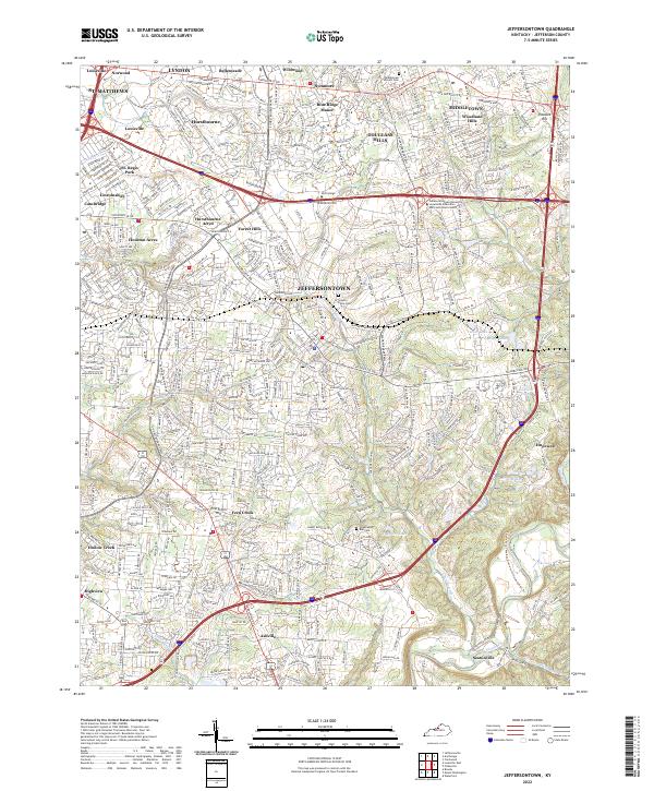 2022 Jeffersontown2022 Print · USGSEastern Jefferson County in the early 2020s shows a landscape of established suburban neighborhoods and historical corridors. Genealogists and local historians can trace burial sites like Middletown Historic Cem and the small-town roots of Jeffersontown and Ashville.
 - 2022 Map of Fisherville, 2022 Print
 2022 Fisherville2022 Print · USGSEastern Jefferson County at the dawn of the 2020s shows a landscape of suburban growth meeting traditional rural roots. Trace the expansion from Middletown to Fisherville and find family-named landmarks like Long Run Hill and Sheckels Run.
 - 2022 Map of Brooks, 2022 Print
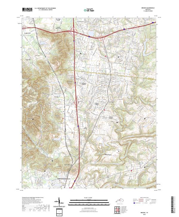 2022 Brooks2022 Print · USGSNorthern Bullitt County at the start of the twenty-twenties shows a suburban landscape woven through distinctive terrain. Trace family histories at the Terry Cem and Ferguson Cem, or locate landmarks like Blue Lick Airport and Wagonbed Knob.
 - 2022 Map of Crestwood, 2022 Print
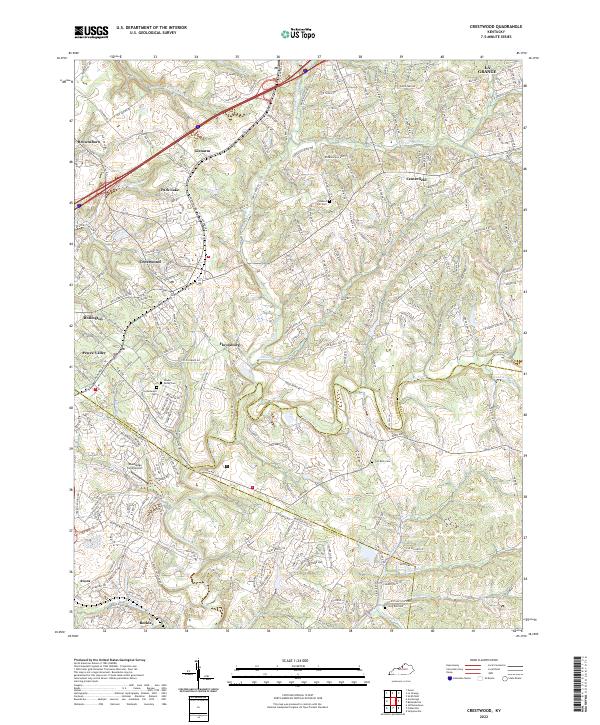 2022 Crestwood2022 Print · USGSCrestwood and Pewee Valley appear at a moment of modern growth where historic crossroads meet suburban expansion. Trace local family history through numerous burial sites like Confederate Cem and Pleasant Hill Cem along the winding Floyds Fork.
 - 2022 Map of Louisville West, 2022 Print
 2022 Louisville West2022 Print · USGSWest Louisville and Shively are shown in remarkable detail in this contemporary survey, tracing the urban development along the Ohio River. Researchers can locate numerous historic burial sites like Greenwood Cem and the Manslick Road Cem alongside the tracks of the Kentucky & Indiana Terminal RR.
 - 2022 Map of Fort Knox, 2022 Print
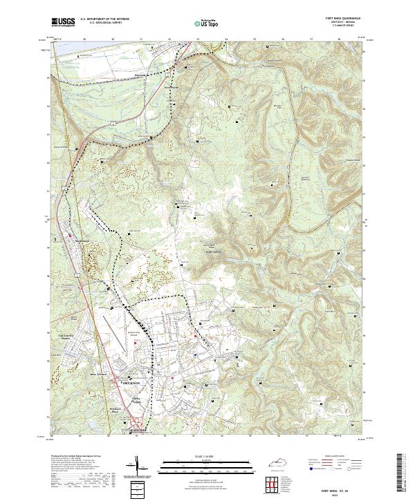 2022 Fort Knox2022 Print · USGSThe military landscape of Hardin County and the confluence of the Ohio and Salt Rivers are seen here in the early 2020s. Genealogists can locate family burial sites like Geoghegan Cem and the Fort Knox Post Cem alongside Godman Army Airfield.
 - 2023 Map of New Albany, 2023 Print
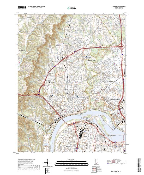 2023 New Albany2023 Print · USGSNew Albany and the northern edge of Louisville are shown here in the 2020s, highlighting the enduring river-and-rail geography of the Ohio River. Researchers can locate many historic burial sites and civic landmarks, from the New Albany National Cemetery to the Floyd County Courthouse and Portland Cemetery.
End of results
Showing maps 1-16 of 16
Top cities near Louisville
- Jeffersonville historical maps
- New Albany historical maps
- Jeffersontown historical maps
- Clarksville historical maps
- Shively historical maps
- Mount Washington historical maps
See more
Top neighborhoods of Louisville
- Beechland Beach historical maps
- Glenview Heights historical maps
- Juniper Beach historical maps
- Gulthrie Beach historical maps
- Harrods Creek historical maps
- Riverside Beach historical maps
See more
Frequently asked questions
- What are the different types of historical maps available for Louisville?
- What is the oldest map of Louisville?
- Where can I purchase historical maps of Louisville for my home or office?
- Where can I download high-res historical maps of Louisville?
- Are there historical topographic maps available for Louisville?
- Is there historical aerial imagery available for Louisville?
- Where are historical maps of Louisville sourced from?