1980s Maps of Laurel County, Kentucky
Explore 3 historic maps of Laurel County from the 1980s. These maps offer a rare glimpse into what life looked like during the 1980s — showing old roads, neighborhoods, homes, and landmarks that have changed or disappeared over time.
Whether you're researching your family's past, planning a metal detecting trip, or studying how Laurel County's landscape evolved across the 1980s, these high-resolution maps are a powerful tool for exploring the history of this region.
- Focus on a specific era: All maps on this page are from the 1980s, giving you a focused view of this time period.
- See what’s changed: Compare century-old streets, trails, and buildings to today's modern landscape using overlays and satellite layers.
- Research with precision: Use these maps for genealogy, historical research, land use analysis, or educational projects.
- View, download, or print: Maps are fully viewable online in high resolution, and can be downloaded or printed for your own records.
Start exploring Laurel County's history through authentic maps from the 1980s. This is your window into the past.
Laurel County, KY maps
(3)- 1980 Map of Sawyer, 1981 Print
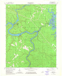 1980 Sawyer1981 Print · USGSThe Rockcastle and Laurel Rivers meet in the Daniel Boone National Forest during the early 1980s. Trace local history through Pointers Chapel, Price Cem, and the old settlement at Sawyer before the landscape was reshaped by reservoir waters.2 unique versions available
 - 1981 Map of Corbin, 1984 Print
 1981 Corbin1984 Print · USGSThe Kentucky and Tennessee borderlands in the early eighties were characterized by coal towns and deep mountain ridges. Trace family history or rail routes through Stearns, Williamsburg, and the mining settlements near Jellico Mountain along the L & N RR.
 - 1982 Map of Somerset, 1983 Print
 1982 Somerset1983 Print · USGSThe Lake Cumberland region and the Daniel Boone National Forest appear here in the early eighties. Researchers can trace rural lineages through Broughtontown, Science Hill, and Sinking Valley Church while exploring the rail lines of the Southern Railway.
End of results
Showing maps 1-3 of 3
Top cities of Laurel County
Frequently asked questions
- What are the different types of historical maps available for Laurel County?
- What is the oldest map of Laurel County?
- Where can I purchase historical maps of Laurel County for my home or office?
- Where can I download high-res historical maps of Laurel County?
- Are there historical topographic maps available for Laurel County?
- Is there historical aerial imagery available for Laurel County?
- Where are historical maps of Laurel County sourced from?