Old Maps of Laurel County, Kentucky for Metal Detecting
Plan your next treasure hunt with 134 historic maps of Laurel County. Find old homesites, ghost towns, trails, and gathering spots that may be lost to time — perfect for identifying promising metal detecting locations.
- Locate forgotten sites: Uncover places like long-lost settlements, abandoned rail lines, or gathering spots.
- Plan better hunts: Use map overlays combined with LiDAR or satellite views to narrow in on historically rich areas.
- Made for detectorists: Thousands of hobbyists use these maps to discover relics, coins, and hidden history.
Use these historic maps to boost your research and find new opportunities beneath the surface of Laurel County.
Laurel County, KY maps
(134)- 1886 Map of Cumberland Gap
 1886 Cumberland Gap1886 Print · USGSThe tri-state border region around the Cumberland Gap appears here in the 1880s, before modern development transformed these mountain passes. Genealogists and historians can trace early river crossings and settlements like Flat Lick, Tye Ferry, and Campbell Ford.
 - 1888 Map of Cumberland Gap
 1888 Cumberland Gap1888 Print · USGSThe tri-state wilderness of the Appalachians is captured in the late 1880s, centered on the strategic crossing at the Cumberland Gap. Trace the early river-and-road economy through features like Tye's Ferry, McHenry Ford, and the old town sites of Barboursville and Pineville.
 - 1890 Map of Williamsburg
 1890 Williamsburg1890 Print · USGSThe Kentucky and Tennessee borderlands come alive in the late nineteenth century as the coal industry and railroads expand. Genealogists can trace family roots in Williamsburgh or locate early industrial sites like Beaver Mines and Steels Mill.2 unique versions available
 - 1891 Map of Manchester
 1891 Manchester1891 Print · USGSEastern Kentucky's mountain settlements and early salt industry come to life in the years following the Reconstruction era. Genealogists and historians can locate early family landmarks such as Moore Store, the Salt Works, and Boush Store.7 unique versions available
 - 1891 Map of Cumberland Gap
 1891 Cumberland Gap1891 Print · USGSThe tri-state mountain corridor appears here in the late nineteenth century, showing the critical gateways through the Cumberland Mountains. Researchers can trace early river crossings like Mshenry Ford and historic settlements such as Barboursville and Pineville.7 unique versions available
 - 1893 Map of London
 1893 London1893 Print · USGSSoutheast Kentucky's plateau country was undergoing a railway-driven transformation in the early 1890s. Genealogists and local historians can trace family roots through numerous small communities like Broadhead, Gum Sulphur, and Altamont along the Louisville and Nashville Railroad.
 - 1894 Map of Williamsburg
 1894 Williamsburg1894 Print · USGSThe Cumberland River valley and the Kentucky-Tennessee borderlands are captured here during the late nineteenth-century coal and rail expansion. Researchers can trace early industrial sites like Beaver Mines and Kensee Coal Mine or locate family roots in Whitley and Chitwood.5 unique versions available
 - 1897 Map of London
 1897 London1897 Print · USGSThe Kentucky interior near the close of the nineteenth century centers on the vital Louisville and Nashville Railroad corridor. Genealogists can trace early homesteads and rail stops from Mt. Vernon to Bee Lick and Hazlepatch.5 unique versions available
 - 1952 Map of Portersburg, 1953 Print
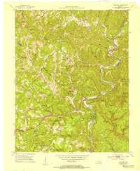
 1952 Portersburg1953 Print · USGSClay and Laurel Counties in the early fifties show a landscape defined by isolated homesteads and a remarkable density of local country schools. Genealogists can trace family roots through sites like New Salem Ch, Fogertown, and Langnau Sch.2 unique versions available
 - 1952 Map of Corbin, 1953 Print
 1952 Corbin1953 Print · USGSCorbin and its surrounding coal-country settlements are captured here in the early fifties, showing the vital Louisville and Nashville rail corridor. Researchers can trace family sites at Resthaven Cem or locate community centers like Bacon Creek Sch and Harts Chapel.
 - 1952 Map of Heidrick, 1953 Print
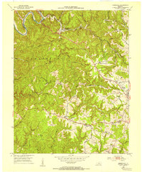
 1952 Heidrick1953 Print · USGSKnox County was a hub of coal mining and rail transport in the early fifties, with ridges carved by new industry. Researchers can trace family homesteads near Jarvis Store, find small community centers like Baileys Switch, or locate old burial sites such as Dozier Cem.2 unique versions available
 - 1952 Map of Hima, 1953 Print
 1952 Hima1953 Print · USGSClay County's narrow hollows and ridge-line communities are shown here in the early 1950s. Genealogists and local historians can locate several family cemeteries and rural schoolhouses including Antioch Sch, Cottongim Cem, and New Home.2 unique versions available
 - 1952 Map of Blackwater, 1953 Print
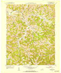
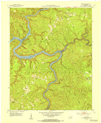
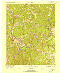
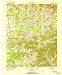 1952 Blackwater1953 Print · USGSLaurel County at the start of the 1950s reveals a landscape deeply connected to its pioneers and local congregations. Genealogists can trace family names through the Wilderness Road corridor and numerous rural landmarks like Camp Ground Sch and Bush Ch.2 unique versions available
 - 1952 Map of Lily, 1953 Print
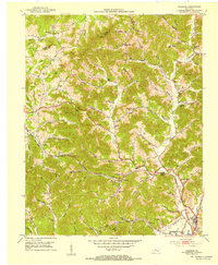
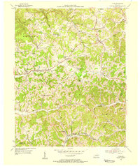
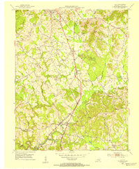 1952 Lily1953 Print · USGSLaurel County in the early fifties shows a landscape balancing its frontier heritage with post-war development near the Louisville and Nashville Railroad. Researchers can trace old family footprints at Old Union Ch, the McHargue School, and through the wooded paths of Levi Jackson Wilderness Road State Park.
 - 1952 Map of London SW, 1953 Print
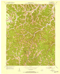
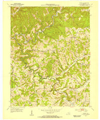
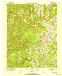 1952 London SW1953 Print · USGSLaurel County's deeply wooded ridges and creek valleys are captured here in the early fifties before modern development reshaped the region. Genealogists can trace family roots through numerous rural landmarks like Moores Chapel, Oak Ridge Sch, and the Bald Rock Lookout Tower.2 unique versions available
 - 1952 Map of Vox, 1953 Print
 1952 Vox1953 Print · USGSWhitley and Laurel counties appear here in the early fifties, showing a rugged landscape centered on the Laurel River. Genealogists can locate family-named sites like Steele Chapel, Barton Chapel, and the McFarland Cem tucked away in the hollows.2 unique versions available
 - 1952 Map of Billows, 1954 Print
 1952 Billows1954 Print · USGSThe Rockcastle River valley and Cumberland National Forest appear here in the early fifties, showing a rural landscape defined by steep ridges and small settlements. Genealogists can locate family landmarks like Whitaker Cem, several local schools, and the Indian Trail Lookout Tower.3 unique versions available
 - 1952 Map of Ano, 1954 Print
 1952 Ano1954 Print · USGSThe Rockcastle River forms a dramatic boundary between Laurel and Pulaski Counties in the early fifties, cutting through the heavy timber of the Cumberland National Forest. Researchers can trace the rural life of Ano and Goodwater through sites like the Hindsfield Sch and Garson Cem.3 unique versions available
 - 1952 Map of Bernstadt, 1954 Print
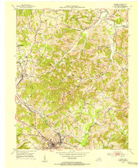
 1952 Bernstadt1954 Print · USGSLaurel County at the dawn of the fifties shows a landscape of deep hollows and ridge-top settlements before modern development changed the terrain. Trace local history through the Wilderness Road, the Swiss Colony community, and rural landmarks like Lake View Ch.2 unique versions available
 - 1952 Map of Sawyer, 1954 Print
 1952 Sawyer1954 Print · USGSThe confluence of the Rockcastle and Laurel Rivers in the early fifties shows a landscape of deep hollows and high ridges within the Cumberland National Forest. Researchers can trace old family sites and rural institutions like Sawyer, Franklin Sch No 2, and Poynters Ch.2 unique versions available
 - 1952 Map of London, 1954 Print
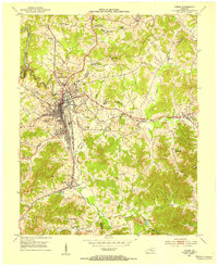
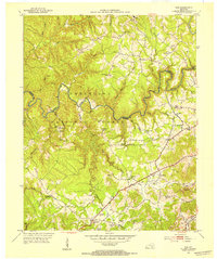
 1952 London1954 Print · USGSLaurel County during the early 1950s was a landscape of expanding coal operations and established mountain communities. Researchers can trace the Louisville and Nashville rail lines through East Bernstadt and Pittsburg or locate rural landmarks like Sue Bennett College and Landrum Cem.2 unique versions available
 - 1953 Map of Livingston, 1954 Print
 1953 Livingston1954 Print · USGSThe Rockcastle River valley and Cumberland National Forest appear here during the early fifties, showing a landscape shaped by the Louisville and Nashville railroad. Researchers can trace the historic Wilderness Road past Livingston and locate landmarks like the Camp Wildcat Battle Monument or the Sand Hill Lookout Tower.2 unique versions available
 - 1953 Map of Tyner, 1955 Print
 1953 Tyner1955 Print · USGSJackson County hill country is shown here in the early fifties as the regional road network around Tyner and Annville was maturing. Researchers can locate numerous rural landmarks like the Tyner High Sch, the Terrell Creek Tabernacle, and the Collier Sch.2 unique versions available
 - 1953 Map of Parrot, 1955 Print
 1953 Parrot1955 Print · USGSJackson and Laurel counties appear in the early fifties as a landscape of ridge-top settlements and isolated hollows within the Cumberland National Forest. Researchers can trace old family names and community centers like Parrot (Letter Box), Seven Pines, and the Carpenter Sch.3 unique versions available
 - 1955 Map of Johnson City
 1955 Johnson City1955 Print · USGSEast Tennessee and the bordering highlands of Virginia and Kentucky appear here during the post-war industrial boom. You can trace the complex network of mountain ridges and new TVA lakes, from Johnson City to the coalfields near Middlesboro and Lynch.
Showing maps 1-25 of 134
Top cities of Laurel County
Frequently asked questions
- What are the different types of historical maps available for Laurel County?
- What is the oldest map of Laurel County?
- Where can I purchase historical maps of Laurel County for my home or office?
- Where can I download high-res historical maps of Laurel County?
- Are there historical topographic maps available for Laurel County?
- Is there historical aerial imagery available for Laurel County?
- Where are historical maps of Laurel County sourced from?