2020s Maps of Laurel County, Kentucky
Explore 16 historic maps of Laurel County from the 2020s. These maps offer a rare glimpse into what life looked like during the 2020s — showing old roads, neighborhoods, homes, and landmarks that have changed or disappeared over time.
Whether you're researching your family's past, planning a metal detecting trip, or studying how Laurel County's landscape evolved across the 2020s, these high-resolution maps are a powerful tool for exploring the history of this region.
- Focus on a specific era: All maps on this page are from the 2020s, giving you a focused view of this time period.
- See what’s changed: Compare century-old streets, trails, and buildings to today's modern landscape using overlays and satellite layers.
- Research with precision: Use these maps for genealogy, historical research, land use analysis, or educational projects.
- View, download, or print: Maps are fully viewable online in high resolution, and can be downloaded or printed for your own records.
Start exploring Laurel County's history through authentic maps from the 2020s. This is your window into the past.
Laurel County, KY maps
(16)- 2022 Map of Heidrick, 2022 Print
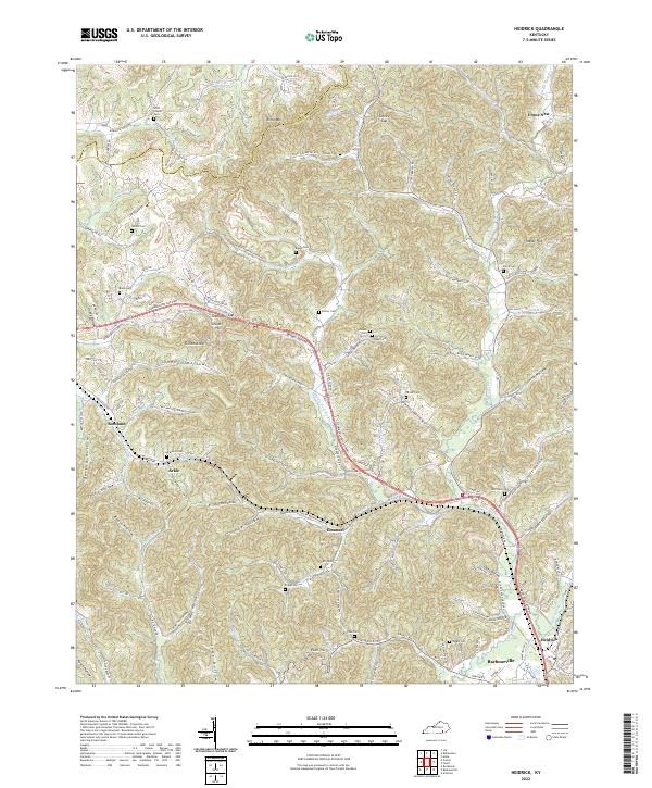 2022 Heidrick2022 Print · USGSKnox County at the start of the 2020s shows a landscape of dense hollows and highland gaps shaped by the Richland Creek watershed. Genealogists can trace family burial sites like Brafford Cemetery and Pfaff Cemetery near Arkle and Emanuel.
 - 2022 Map of Corbin, 2022 Print
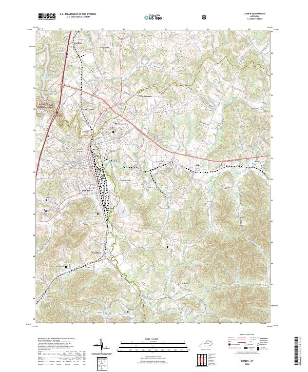 2022 Corbin2022 Print · USGSCorbin and the surrounding tri-county area are shown in this contemporary study of Whitley and Knox counties. Genealogists can locate several local burial sites like Rest Haven Cem and Harts Cem alongside landmarks like Corn Creek Church.
 - 2022 Map of Sawyer, 2022 Print
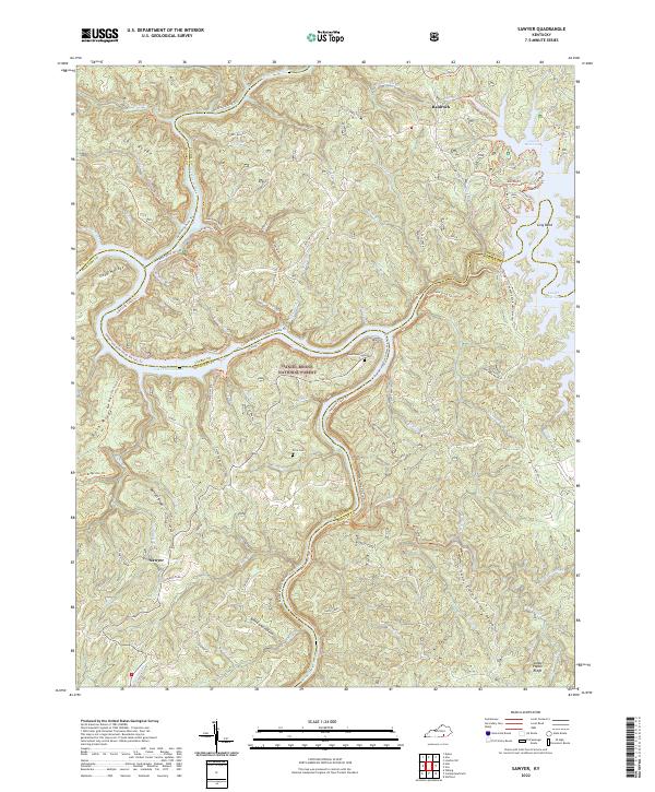 2022 Sawyer2022 Print · USGSThe upland ridges and river valleys of Laurel and McCreary Counties come into focus in this contemporary survey. Researchers can trace family-named sites like Price Cem or explore the reach of the Rockcastle River and Lake Cumberland near Sawyer.
 - 2022 Map of Billows, 2022 Print
 2022 Billows2022 Print · USGSModern Kentucky wilderness and rural life meet where the Rockcastle River divides three counties. Local historians can trace family roots through sites like Bustle Cem, the community of Squib, and the rugged landscape of Halsey Rough.
 - 2022 Map of Parrot, 2022 Print
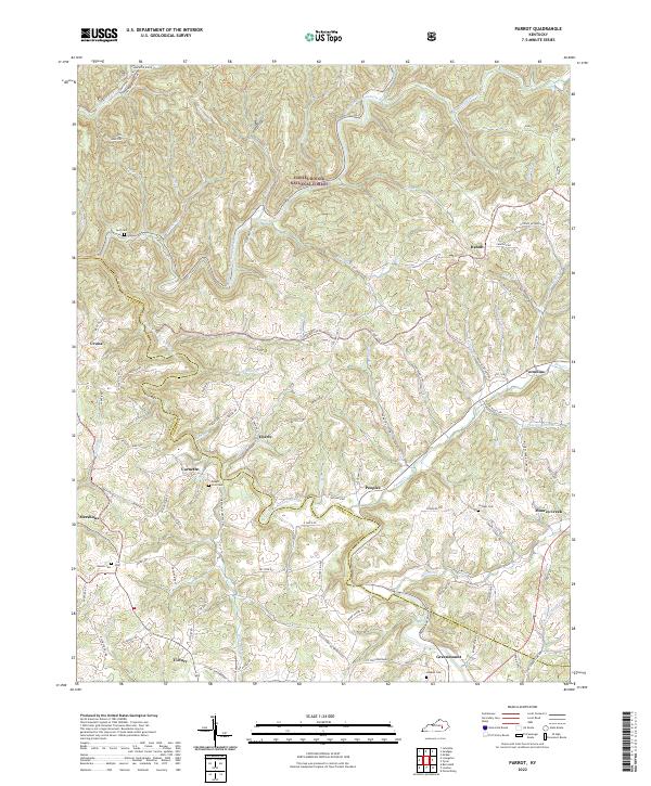 2022 Parrot2022 Print · USGSJackson and Laurel Counties appear here in the early 2020s, showing a landscape defined by the Daniel Boone National Forest. Researchers can trace old family names at Mount Zion Cem and locate rural communities such as Victory, Dabolt, and Greenmount.
 - 2022 Map of Livingston, 2022 Print
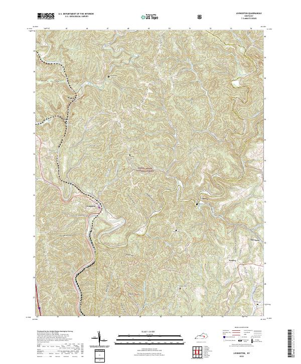 2022 Livingston2022 Print · USGSThe Rockcastle River valley in the early 2020s remains a landscape of deep hollows and timbered ridges. Researchers can trace rural cemetery locations like Jep Hill Cem and Robinson Cem or follow the Sheltoee Trace Trl through Livingston.
 - 2022 Map of Hima, 2022 Print
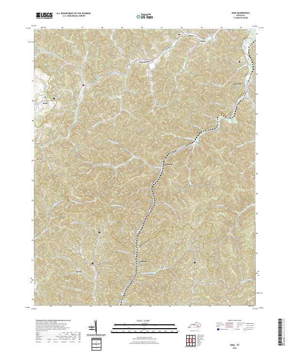 2022 Hima2022 Print · USGSThe northern edge of the Kentucky coalfields near Hima and Woollum appears here in the early 2020s. Researchers can locate numerous family burial grounds including Harris Cem and Engine Cem tucked along the banks of Goose Creek.
 - 2022 Map of Vox, 2022 Print
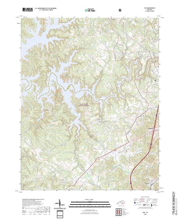 2022 Vox2022 Print · USGSThe western outskirts of Corbin and the forested ridges of Whitley County come into focus in the early 2020s. Genealogists and local historians can locate rural landmarks such as Chestnut Grove Cem and the small settlements of Vox and Keavy.
 - 2022 Map of Ano, 2022 Print
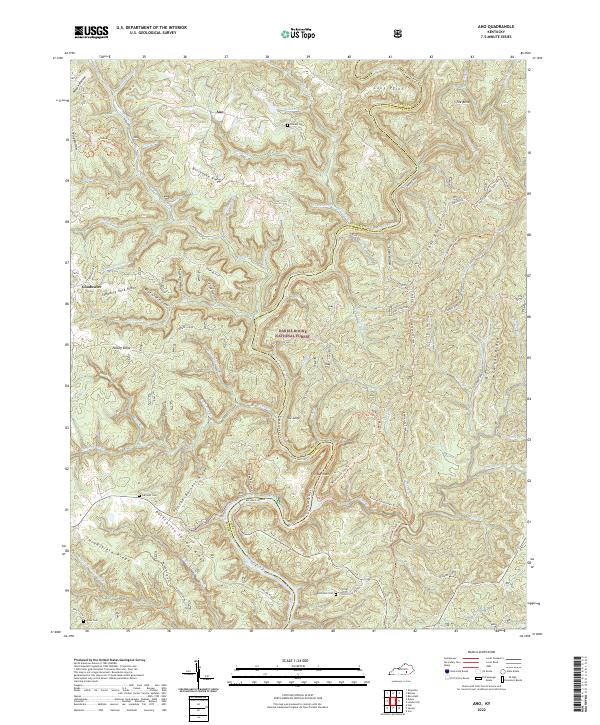 2022 Ano2022 Print · USGSThe Rockcastle River and its deep gorges at the Pulaski-Laurel border are captured here in modern detail. Trace family connections at Chaney Cem and Bald Rock Cem, or explore the winding paths of the Sheltowee Trace Trl and the Narrows.
 - 2022 Map of Tyner, 2022 Print
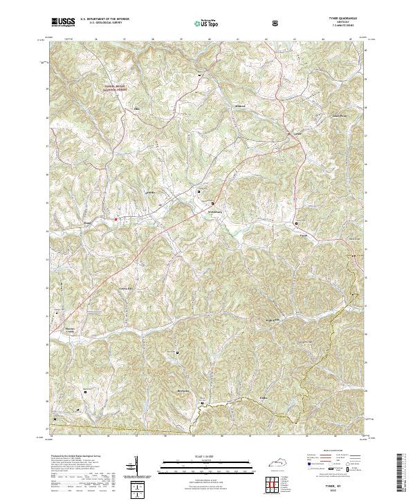 2022 Tyner2022 Print · USGSJackson County is documented here in the early 2020s, showing a landscape of ridge-top settlements and winding creek valleys. Researchers can trace family history through sites like Castee Cem or explore the area around Annville and Moores Creek.
 - 2022 Map of Bernstadt, 2022 Print
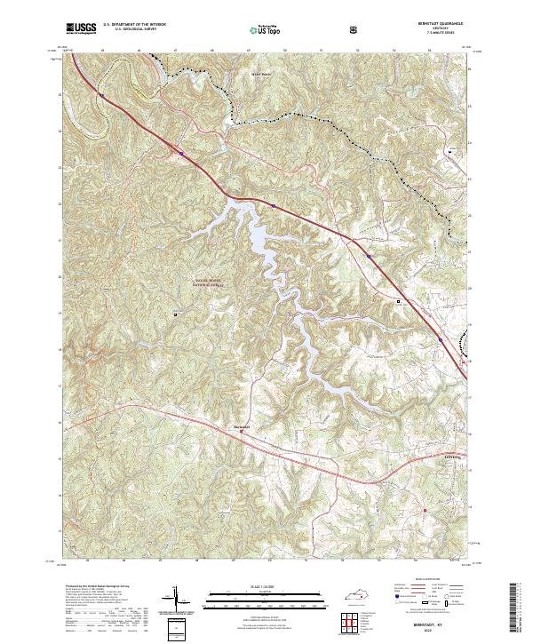 2022 Bernstadt2022 Print · USGSLaurel County at the edge of the plateau shows a landscape of deep hollows and historic ridges just north of London. Researchers can trace early routes along the Sheltowee Trace Trail and locate family sites like Whitt Cemetery or the settlement of Bernstadt.
 - 2022 Map of Portersburg, 2022 Print
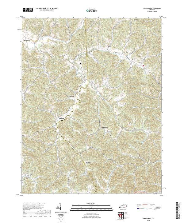 2022 Portersburg2022 Print · USGSClay and Laurel Counties at the start of the 2020s show a landscape of high ridges and winding creek-side settlements. Researchers can trace family history through local landmarks like Lincks Cem and named rural routes near Portersburg, Fogertown, and Deer Lick.
 - 2022 Map of London, 2022 Print
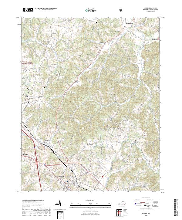 2022 London2022 Print · USGSLondon and the surrounding Laurel County landscape are captured in this recent survey. Local researchers can trace family roots through numerous cemeteries like Mount Carmel Cem or explore the rural hubs of East Bernstadt and Maplesville.
 - 2022 Map of London SW, 2022 Print
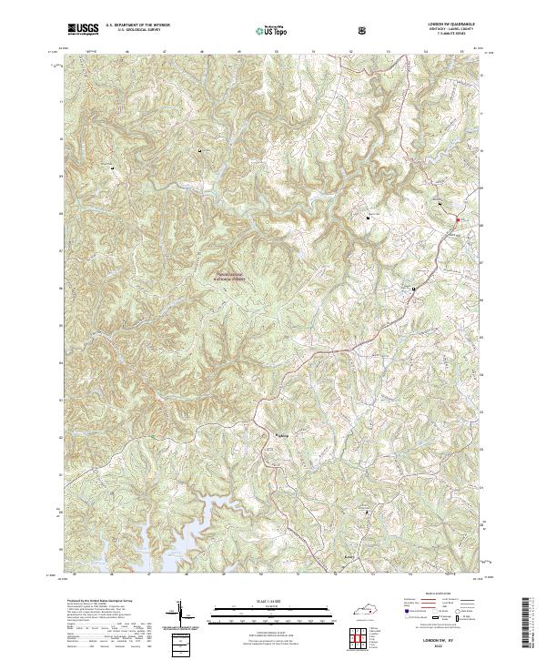 2022 London SW2022 Print · USGSThe Daniel Boone National Forest defines this corner of Kentucky, where ridge-top communities look over the headwaters of Laurel River Lake. Genealogists can locate family landmarks like Nix Cem and Early Cem or trace the Sheltowee Trace Trl.
 - 2022 Map of Lily, 2022 Print
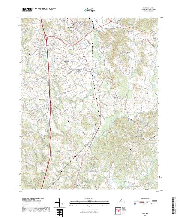 2022 Lily2022 Print · USGSLaurel County comes into focus in this recent survey of the corridor between London and Lily. Researchers can trace family history at Wigington Cem and Owsley Cem or explore the landscape around Levi Jackson State Park and Fariston.
 - 2022 Map of Blackwater, 2022 Print
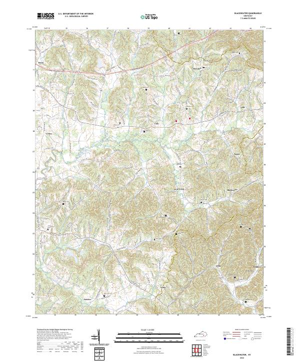 2022 Blackwater2022 Print · USGSThe Laurel County countryside near the Clay and Knox borders is shown here in the modern era, centered on the Laurel River valley. Genealogists can trace family heritage through dozens of burial sites like Camp Ground Cem and Pilgrims Rest Cem.
End of results
Showing maps 1-16 of 16
Top cities of Laurel County
Frequently asked questions
- What are the different types of historical maps available for Laurel County?
- What is the oldest map of Laurel County?
- Where can I purchase historical maps of Laurel County for my home or office?
- Where can I download high-res historical maps of Laurel County?
- Are there historical topographic maps available for Laurel County?
- Is there historical aerial imagery available for Laurel County?
- Where are historical maps of Laurel County sourced from?