1900s (20th Century) Maps of Laurel County, Kentucky
Explore 46 historic maps of Laurel County from the 1900s (20th Century). These maps offer a rare glimpse into what life looked like during the 1900s — showing old roads, neighborhoods, homes, and landmarks that have changed or disappeared over time.
Whether you're researching your family's past, planning a metal detecting trip, or studying how Laurel County's landscape evolved across the 1900s, these high-resolution maps are a powerful tool for exploring the history of this region.
- Focus on a specific era: All maps on this page are from the 1900s, giving you a focused view of this time period.
- See what’s changed: Compare century-old streets, trails, and buildings to today's modern landscape using overlays and satellite layers.
- Research with precision: Use these maps for genealogy, historical research, land use analysis, or educational projects.
- View, download, or print: Maps are fully viewable online in high resolution, and can be downloaded or printed for your own records.
Start exploring Laurel County's history through authentic maps from the 1900s. This is your window into the past.
Laurel County, KY maps
(46)- 1952 Map of Portersburg, 1953 Print
 1952 Portersburg1953 Print · USGSClay and Laurel Counties in the early fifties show a landscape defined by isolated homesteads and a remarkable density of local country schools. Genealogists can trace family roots through sites like New Salem Ch, Fogertown, and Langnau Sch.2 unique versions available
 - 1952 Map of Corbin, 1953 Print
 1952 Corbin1953 Print · USGSCorbin and its surrounding coal-country settlements are captured here in the early fifties, showing the vital Louisville and Nashville rail corridor. Researchers can trace family sites at Resthaven Cem or locate community centers like Bacon Creek Sch and Harts Chapel.
 - 1952 Map of Heidrick, 1953 Print
 1952 Heidrick1953 Print · USGSKnox County was a hub of coal mining and rail transport in the early fifties, with ridges carved by new industry. Researchers can trace family homesteads near Jarvis Store, find small community centers like Baileys Switch, or locate old burial sites such as Dozier Cem.2 unique versions available
 - 1952 Map of Hima, 1953 Print
 1952 Hima1953 Print · USGSClay County's narrow hollows and ridge-line communities are shown here in the early 1950s. Genealogists and local historians can locate several family cemeteries and rural schoolhouses including Antioch Sch, Cottongim Cem, and New Home.2 unique versions available
 - 1952 Map of Blackwater, 1953 Print
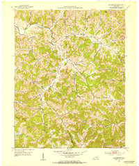
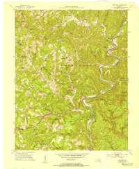
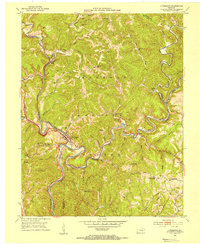
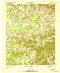 1952 Blackwater1953 Print · USGSLaurel County at the start of the 1950s reveals a landscape deeply connected to its pioneers and local congregations. Genealogists can trace family names through the Wilderness Road corridor and numerous rural landmarks like Camp Ground Sch and Bush Ch.2 unique versions available
 - 1952 Map of Lily, 1953 Print
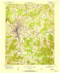
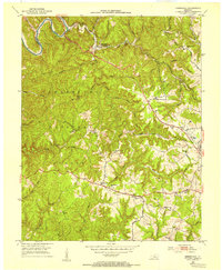
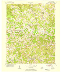
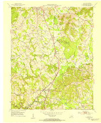 1952 Lily1953 Print · USGSLaurel County in the early fifties shows a landscape balancing its frontier heritage with post-war development near the Louisville and Nashville Railroad. Researchers can trace old family footprints at Old Union Ch, the McHargue School, and through the wooded paths of Levi Jackson Wilderness Road State Park.
 - 1952 Map of London SW, 1953 Print
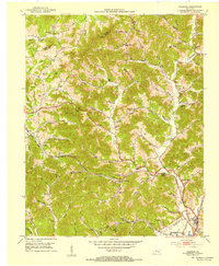
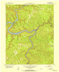
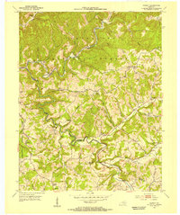
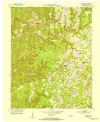 1952 London SW1953 Print · USGSLaurel County's deeply wooded ridges and creek valleys are captured here in the early fifties before modern development reshaped the region. Genealogists can trace family roots through numerous rural landmarks like Moores Chapel, Oak Ridge Sch, and the Bald Rock Lookout Tower.2 unique versions available
 - 1952 Map of Vox, 1953 Print
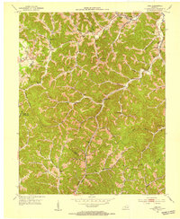
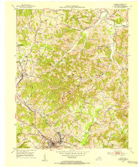
 1952 Vox1953 Print · USGSWhitley and Laurel counties appear here in the early fifties, showing a rugged landscape centered on the Laurel River. Genealogists can locate family-named sites like Steele Chapel, Barton Chapel, and the McFarland Cem tucked away in the hollows.2 unique versions available
 - 1952 Map of Billows, 1954 Print
 1952 Billows1954 Print · USGSThe Rockcastle River valley and Cumberland National Forest appear here in the early fifties, showing a rural landscape defined by steep ridges and small settlements. Genealogists can locate family landmarks like Whitaker Cem, several local schools, and the Indian Trail Lookout Tower.3 unique versions available
 - 1952 Map of Ano, 1954 Print
 1952 Ano1954 Print · USGSThe Rockcastle River forms a dramatic boundary between Laurel and Pulaski Counties in the early fifties, cutting through the heavy timber of the Cumberland National Forest. Researchers can trace the rural life of Ano and Goodwater through sites like the Hindsfield Sch and Garson Cem.3 unique versions available
 - 1952 Map of Bernstadt, 1954 Print
 1952 Bernstadt1954 Print · USGSLaurel County at the dawn of the fifties shows a landscape of deep hollows and ridge-top settlements before modern development changed the terrain. Trace local history through the Wilderness Road, the Swiss Colony community, and rural landmarks like Lake View Ch.2 unique versions available
 - 1952 Map of Sawyer, 1954 Print
 1952 Sawyer1954 Print · USGSThe confluence of the Rockcastle and Laurel Rivers in the early fifties shows a landscape of deep hollows and high ridges within the Cumberland National Forest. Researchers can trace old family sites and rural institutions like Sawyer, Franklin Sch No 2, and Poynters Ch.2 unique versions available
 - 1952 Map of London, 1954 Print
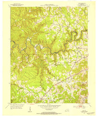
 1952 London1954 Print · USGSLaurel County during the early 1950s was a landscape of expanding coal operations and established mountain communities. Researchers can trace the Louisville and Nashville rail lines through East Bernstadt and Pittsburg or locate rural landmarks like Sue Bennett College and Landrum Cem.2 unique versions available
 - 1953 Map of Livingston, 1954 Print
 1953 Livingston1954 Print · USGSThe Rockcastle River valley and Cumberland National Forest appear here during the early fifties, showing a landscape shaped by the Louisville and Nashville railroad. Researchers can trace the historic Wilderness Road past Livingston and locate landmarks like the Camp Wildcat Battle Monument or the Sand Hill Lookout Tower.2 unique versions available
 - 1953 Map of Tyner, 1955 Print
 1953 Tyner1955 Print · USGSJackson County hill country is shown here in the early fifties as the regional road network around Tyner and Annville was maturing. Researchers can locate numerous rural landmarks like the Tyner High Sch, the Terrell Creek Tabernacle, and the Collier Sch.2 unique versions available
 - 1953 Map of Parrot, 1955 Print
 1953 Parrot1955 Print · USGSJackson and Laurel counties appear in the early fifties as a landscape of ridge-top settlements and isolated hollows within the Cumberland National Forest. Researchers can trace old family names and community centers like Parrot (Letter Box), Seven Pines, and the Carpenter Sch.3 unique versions available
 - 1955 Map of Johnson City
 1955 Johnson City1955 Print · USGSEast Tennessee and the bordering highlands of Virginia and Kentucky appear here during the post-war industrial boom. You can trace the complex network of mountain ridges and new TVA lakes, from Johnson City to the coalfields near Middlesboro and Lynch.
 - 1956 Map of Corbin, 1966 Print
 1956 Corbin1966 Print · USGSThe Kentucky and Tennessee borderlands are captured here in the mid-fifties, showing the region's shift toward modern interstate travel and reservoir development. Genealogists and historians can trace old community lines near Albany and Monticello or locate early rail junctions along the Southern and Tennessee Central lines.3 unique versions available
 - 1957 Map of Johnson City, 1966 Print
 1957 Johnson City1966 Print · USGSUpper East Tennessee and Southwest Virginia are shown here during the mid-sixties transition of the Appalachians. Researchers can trace the industrial rail hubs of Kingsport, the sprawling waters of Cherokee Lake, and the historic Cumberland Gap.
 - 1957 Map of Winchester, 1968 Print
 1957 Winchester1968 Print · USGSCentral Kentucky's landscape in the mid-twentieth century features the sprawling Fort Knox and the early parkway system. Genealogists and historians can trace rail lines like the Southern Railway and find landmarks from Bernheim Forest to Pilot Knob.3 unique versions available
 - 1957 Map of Jenkins, 1974 Print
 1957 Jenkins1974 Print · USGSThe Cumberland Plateau in the mid-twentieth century reveals a complex landscape of winding river valleys and deep-seated industry. Genealogists and historians can trace the development of Hazard, Jenkins, and Pikeville alongside extensive Numerous Oil and Gas Fields and the routes of the Chesapeake & Ohio Railway.
 - 1958 Map of Corbin
 1958 Corbin1958 Print · USGSThe Upper Cumberland borderlands appear in the late 1950s as massive reservoirs and early atomic-era growth reshape the region. Trace family roots and vanished landmarks near Lake Cumberland, Oak Ridge, and the Cumberland National Forest.
 - 1960 Map of Jenkins
 1960 Jenkins1960 Print · USGSEastern Kentucky and the West Virginia borderlands are captured at a mid-century peak of the coal and rail era. Trace the industrial corridors of the Chesapeake and Ohio RR through mountain hubs like Hazard and Jenkins.
 - 1960 Map of Johnson City
 1960 Johnson City1960 Print · USGSUpper East Tennessee and the surrounding tri-state area are shown in the mid-fifties during the height of the TVA reservoir era. Trace the industrial rail lines of the Southern and Louisville and Nashville between Kingsport and Johnson City.
 - 1960 Map of Winchester
 1960 Winchester1960 Print · USGSCentral Kentucky's diverse landscape is shown here at mid-century, from the bluegrass plains to the rugged Pottsville Escarpment. Genealogists and historians can trace the rail-and-river network connecting towns like Bardstown and Stanford alongside landmarks like Lake Cumberland.
Showing maps 1-25 of 46
Top cities of Laurel County
Frequently asked questions
- What are the different types of historical maps available for Laurel County?
- What is the oldest map of Laurel County?
- Where can I purchase historical maps of Laurel County for my home or office?
- Where can I download high-res historical maps of Laurel County?
- Are there historical topographic maps available for Laurel County?
- Is there historical aerial imagery available for Laurel County?
- Where are historical maps of Laurel County sourced from?