1940s Maps of Lewis County, Kentucky
Explore 9 historic maps of Lewis County from the 1940s. These maps offer a rare glimpse into what life looked like during the 1940s — showing old roads, neighborhoods, homes, and landmarks that have changed or disappeared over time.
Whether you're researching your family's past, planning a metal detecting trip, or studying how Lewis County's landscape evolved across the 1940s, these high-resolution maps are a powerful tool for exploring the history of this region.
- Focus on a specific era: All maps on this page are from the 1940s, giving you a focused view of this time period.
- See what’s changed: Compare century-old streets, trails, and buildings to today's modern landscape using overlays and satellite layers.
- Research with precision: Use these maps for genealogy, historical research, land use analysis, or educational projects.
- View, download, or print: Maps are fully viewable online in high resolution, and can be downloaded or printed for your own records.
Start exploring Lewis County's history through authentic maps from the 1940s. This is your window into the past.
Lewis County, KY maps
(9)- 1949 Map of Pond Run, 1960 Print
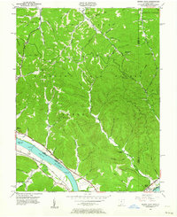
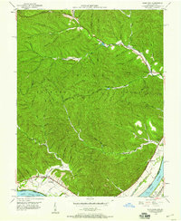 1949 Pond Run1960 Print · USGSThe rugged interior of Scioto County is captured here in the late 1940s, just as state forest management was maturing. Genealogists can locate family landmarks like McDermott Cem and Elmtree Sch, or trace the path of the Chesapeake and Ohio through Quincy.
 - 1949 Map of Vanceburg, 1960 Print
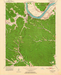
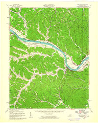 1949 Vanceburg1960 Print · USGSThe Ohio River valley and the rugged hills of Lewis County are captured here just after the war. Local historians can trace family roots through numerous country landmarks like Beasley Fork Chapel, Aills Cem, and the County Infirmary.
 - 1949 Map of Garrison, 1961 Print
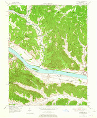
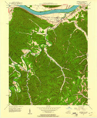 1949 Garrison1961 Print · USGSThe Ohio River valley and the interior hollows of Lewis County are captured here just after the war. Genealogists can trace family landmarks like the Waring Cem, Red Brush Sch, and several rural churches along Kinniconick Creek.5 unique versions available
 - 1949 Map of Friendship, 1962 Print
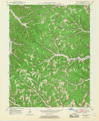
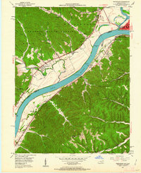 1949 Friendship1962 Print · USGSThe Ohio River valley near the turn of the mid-century reveals a landscape of industrial river transport and deep-hollow settlements. Researchers can trace the legacy of rural education and faith at Lower Carey Run Sch, Pine Grove Sch, and Nace Run Tabernacle.
 - 1949 Map of Buena Vista, 1964 Print
 1949 Buena Vista1964 Print · USGSThe Ohio River borderlands of the late 1940s reveal a landscape of river navigation and forest management. Researchers can trace riverside life at Rome (Stout PO), locate the Twin Creek Lookout Tower, and find rural congregations like Aills Chapel.
 - 1949 Map of Vanceburg, 1964 Print
 1949 Vanceburg1964 Print · USGSVanceburg and the surrounding hollows of Lewis County are captured here just after the war, showing the deep intersection of river, rail, and ridge life. Genealogists can locate family landmarks such as Holly Cem, the Lewis County Infirmary, and Holly Hill Ch.4 unique versions available
 - 1949 Map of Concord, 1965 Print
 1949 Concord1965 Print · USGSThe Ohio River valley in the late 1940s reveals a landscape of river-and-rail industry along the Lewis County border. Trace the vanished stops at Rome Sta and Chalkley Sta, or find rural landmarks like Beasley Fork Chapel and Martin (Queens PO).
 - 1949 Map of Brushart, 1968 Print
 1949 Brushart1968 Print · USGSThe Lewis and Greenup County border in the late 1940s is a landscape of high ridges and deep hollows. Researchers can trace rural life through numerous country schools like Zion Hill Sch and family landmarks such as Logan Cem or the settlement at Brushart.2 unique versions available
 - 1949 Map of Charters, 1969 Print
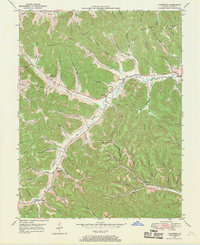 1949 Charters1969 Print · USGSLewis County hill country is captured here in the late 1940s, showing a landscape defined by deep hollows and high ridges. Researchers can trace family roots through several rural landmarks, including Liberty Grove Ch, Hackworth Cem, and the small settlement of Charters.3 unique versions available
End of results
Showing maps 1-9 of 9
Top cities of Lewis County
Frequently asked questions
- What are the different types of historical maps available for Lewis County?
- What is the oldest map of Lewis County?
- Where can I purchase historical maps of Lewis County for my home or office?
- Where can I download high-res historical maps of Lewis County?
- Are there historical topographic maps available for Lewis County?
- Is there historical aerial imagery available for Lewis County?
- Where are historical maps of Lewis County sourced from?