1950s Maps of Lewis County, Kentucky
Explore 20 historic maps of Lewis County from the 1950s. These maps offer a rare glimpse into what life looked like during the 1950s — showing old roads, neighborhoods, homes, and landmarks that have changed or disappeared over time.
Whether you're researching your family's past, planning a metal detecting trip, or studying how Lewis County's landscape evolved across the 1950s, these high-resolution maps are a powerful tool for exploring the history of this region.
- Focus on a specific era: All maps on this page are from the 1950s, giving you a focused view of this time period.
- See what’s changed: Compare century-old streets, trails, and buildings to today's modern landscape using overlays and satellite layers.
- Research with precision: Use these maps for genealogy, historical research, land use analysis, or educational projects.
- View, download, or print: Maps are fully viewable online in high resolution, and can be downloaded or printed for your own records.
Start exploring Lewis County's history through authentic maps from the 1950s. This is your window into the past.
Lewis County, KY maps
(20)- 1950 Map of Brushart
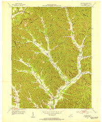
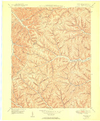 1950 Brushart1950 Print · USGSThe rural borderlands of Lewis and Greenup counties appear in the late 1940s as a landscape of isolated hollows and ridge-top crossings. Researchers can locate numerous local landmarks like Kenton-Furnace Sch, the Allen Cem, and the settlement of Whiteoak.
 - 1950 Map of Charters
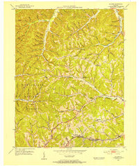
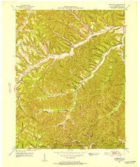
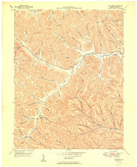 1950 Charters1950 Print · USGSLewis County hills and hollows are captured here at the mid-century, centered on the communities of Charters and Clarksburg. Genealogists can trace family landmarks and rural institutions like Liberty Grove Ch, Heselton School, and McCoy Cem.
 - 1950 Map of Head Of Grassy, 1952 Print
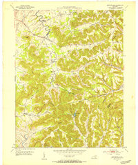
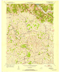
 1950 Head Of Grassy1952 Print · USGSLewis County's rugged ridge-and-hollow country is captured here at mid-century, showing the isolated communities of the Kentucky hills. Genealogists can trace family footprints through numerous rural landmarks like Blankenship Sch, Stone Cem, and the settlement of Head of Grassy.3 unique versions available
 - 1950 Map of Wesleyville, 1952 Print
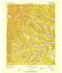 1950 Wesleyville1952 Print · USGSNortheastern Kentucky hill country at the start of the fifties reveals a landscape of isolated hollows and tightly-knit rural communities. Genealogists and hikers can trace old family burial grounds like Jordan Cem or locate the historic Wesleyville Post Office and Smith Creek Sch.
 - 1950 Map of Olive Hill, 1952 Print
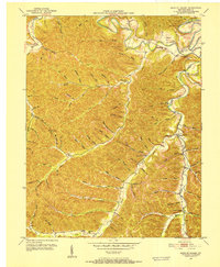
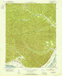
 1950 Olive Hill1952 Print · USGSMid-century Carter County comes alive in this survey of the Olive Hill area, where the river-and-rail economy of the Appalachians is on full display. Genealogists and historians can trace family-named ridges and hollows, locating old landmarks like Erie College, James Chapel, and the settlement of Soldier.
 - 1951 Map of Vanceburg
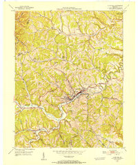
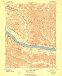
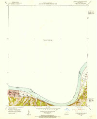
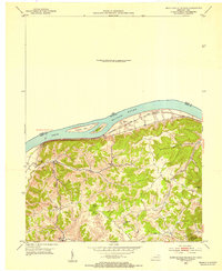
 1951 Vanceburg1951 Print · USGSVanceburg and the surrounding Lewis County hills are captured here in the early fifties, showing the river-and-rail economy along the Ohio River. Researchers can trace old family sites and rural infrastructure, from the Lewis County Infirmary to local landmarks like Evans Chapel and the Rock Run Sch.
 - 1951 Map of Buena Vista
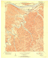
 1951 Buena Vista1951 Print · USGSThe Ohio River borderlands at the start of the 1950s show a landscape of deep timbered hollows and river navigation. Researchers can trace rural life through the locations of Dam No 32, the Twin Creek Mission, and the Rome (Stout PO) settlement.
 - 1951 Map of Garrison
 1951 Garrison1951 Print · USGSThe riverfront and rugged hollows of Lewis County are captured here just after the war, when the railroad still dominated the shoreline. Genealogists can locate family-named sites like Skidmore Cemetery and Tannery School along the winding Kinniconick Creek.
 - 1951 Map of Concord
 1951 Concord1951 Print · USGSThe riverfront communities of Lewis County and Adams County thrive along the Ohio during the early post-war era. Genealogists and local historians can trace family locations near Concord, identify the Stout Post Office, or find rural landmarks like Beasley Fork Chapel and the Carrs School.2 unique versions available
 - 1951 Map of Friendship
 1951 Friendship1951 Print · USGSThe Ohio River valley at the turn of the 1950s shows a landscape of river-dependent industry and hill-country settlements. Researchers can trace the legacy of family homesteads through features like Morris Hill Cem, Bethel Ch, and Upper Carey Run Sch.2 unique versions available
 - 1951 Map of Pond Run
 1951 Pond Run1951 Print · USGSSouthern Ohio and northern Kentucky met along the river in the early fifties, where the forest landscape was dotted with family hollows and small rail stops. Genealogists and hikers can trace old landmarks like the Pond Run Lookout Tower, McDermitt Cem, and the tracks of The Chesapeake and Ohio.
 - 1951 Map of Soldier, 1952 Print
 1951 Soldier1952 Print · USGSEastern Kentucky hills at the start of the 1950s show a landscape shaped by narrow creek valleys and the Chesapeake and Ohio railroad. Researchers can locate remote rural landmarks like the Bald Point School, Masters Cem, and the village of Bedford.2 unique versions available
 - 1951 Map of Cranston, 1953 Print
 1951 Cranston1953 Print · USGSRowan County in the early fifties shows a landscape of deep hollows and rural outposts within the Cumberland National Forest. Genealogists can trace family lines through sites like McRoberts Cem and schools such as Rock Fork Sch.2 unique versions available
 - 1951 Map of Stricklett, 1953 Print
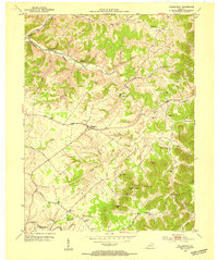
 1951 Stricklett1953 Print · USGSLewis County in the early fifties is mapped here as a network of creek-side communities and upland lookouts. Researchers can find old schools and churches like Kinniconick Sch, Thackers Chapel, and Union Ch along the winding Kinniconick Creek.4 unique versions available
 - 1951 Map of Burtonville, 1953 Print
 1951 Burtonville1953 Print · USGSThe Fleming and Lewis County borderlands in the early fifties were a network of ridge-top farms and deep creek-bottom settlements. Genealogists and local historians can trace family locations through Mays Cem, Pleasant Valley Ch, and the many hollows branching off Kinniconick Creek.3 unique versions available
 - 1952 Map of Maysville East, 1953 Print
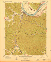
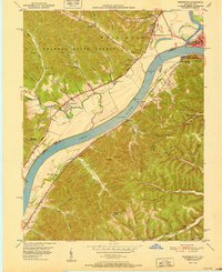
 1952 Maysville East1953 Print · USGSThe Ohio River valley near the Mason County line is captured here in the early fifties, showing the vital river-and-rail corridor. Researchers can trace the riverfront development of Maysville or locate landmarks near Sand Hill and the Chesapeake and Ohio railroad.
 - 1952 Map of Orangeburg, 1954 Print
 1952 Orangeburg1954 Print · USGSMason County hill country in the early fifties is mapped here, showing the rural life centered on the North Fork Licking River. Genealogists can locate family landmarks like Stone Lick Ch, Antioch Ch, and the hamlet of Orangeburg.3 unique versions available
 - 1952 Map of Manchester Islands, 1954 Print
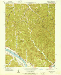
 1952 Manchester Islands1954 Print · USGSThe Ohio River shoreline and the timbered heights of Lewis County come alive in this early 1950s survey. Researchers can trace family-named landmarks and rural hubs like Trinity Station, Covedale, and the remote Sulphur Knob Lookout Tower.
 - 1953 Map of Tollesboro, 1954 Print
 1953 Tollesboro1954 Print · USGSLewis County hills and hollows are captured in the early fifties, showing a rural landscape defined by ridge-top farms and creek-side hamlets. Researchers can trace family roots through Tollesboro and locate landmarks like Canaan Sch and Eskalapia Mountain.2 unique versions available
 - 1957 Map of Huntington, 1966 Print
 1957 Huntington1966 Print · USGSThe industrial heart of the Ohio River valley is captured here in the mid-sixties, showing the growth of Huntington and Ashland. Researchers can trace the extensive rail networks of the Chesapeake and Ohio RR and locate sites like the Chief Cornstalk Hunting Ground.3 unique versions available
End of results
Showing maps 1-20 of 20
Top cities of Lewis County
Frequently asked questions
- What are the different types of historical maps available for Lewis County?
- What is the oldest map of Lewis County?
- Where can I purchase historical maps of Lewis County for my home or office?
- Where can I download high-res historical maps of Lewis County?
- Are there historical topographic maps available for Lewis County?
- Is there historical aerial imagery available for Lewis County?
- Where are historical maps of Lewis County sourced from?