Old Maps of Lewis County, Kentucky for Metal Detecting
Plan your next treasure hunt with 145 historic maps of Lewis County. Find old homesites, ghost towns, trails, and gathering spots that may be lost to time — perfect for identifying promising metal detecting locations.
- Locate forgotten sites: Uncover places like long-lost settlements, abandoned rail lines, or gathering spots.
- Plan better hunts: Use map overlays combined with LiDAR or satellite views to narrow in on historically rich areas.
- Made for detectorists: Thousands of hobbyists use these maps to discover relics, coins, and hidden history.
Use these historic maps to boost your research and find new opportunities beneath the surface of Lewis County.
Lewis County, KY maps
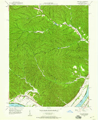
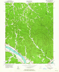
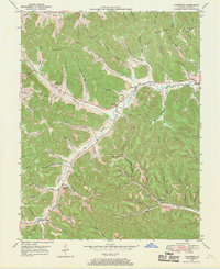
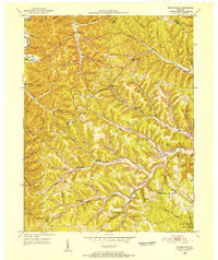
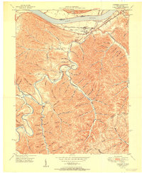
(145)- 1915 Map of Garrison, 1952 Print
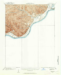 1915 Garrison1952 Print · USGSThe riverfront and uplands of the Ohio Valley come alive in this mid-century publication of a Great War-era survey. Genealogists and local historians can trace the many rural schoolhouses like Elmtree School and Leatherwood School or find the early footprint of Portsmouth.
 - 1918 Map of Garrison, 1932 Print
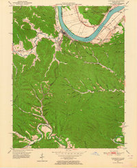
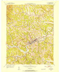
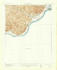 1918 Garrison1932 Print · USGSThe river valley at the Ohio and Kentucky border was a landscape of small schools and isolated runs during the mid-1910s. Researchers can trace the placement of local institutions like the Scioto County Infirmary and rural schools including Pond Run School and Carey Run School.
 - 1919 Map of Vanceburg, 1938 Print
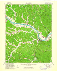
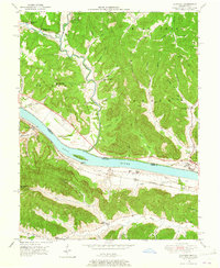
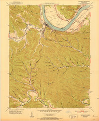
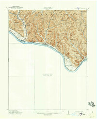 1919 Vanceburg1938 Print · USGSThe Ohio River shoreline at the close of the Great War was a landscape of small river towns and remote ridge-top schools. Genealogists can trace family footprints at Stout PO, Sandy Springs, and the Cedar College School in the rugged hills north of the river.2 unique versions available
 - 1929 Map of Springdale
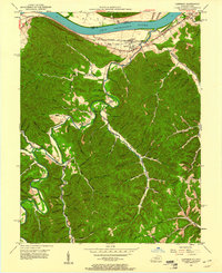
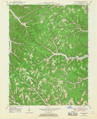
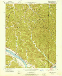
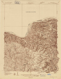 1929 Springdale1929 Print · USGSThe Ohio River valley and Kentucky's northern hills are captured here in the late twenties, showing a landscape defined by the Chesapeake and Ohio railroad. Genealogists can trace early homesteads and landmarks near Tollesboro, Ruggles Camp, and the many rural sites like Ebenezer Ch.2 unique versions available
 - 1935 Map of Springdale
 1935 Springdale1935 Print · USGSThe Ohio River valley at the height of the mid-1930s reveals a landscape shaped by river commerce and the Chesapeake and Ohio railroad. Researchers can locate numerous vanished country schools like Hamilton School, the infrastructure of Dam 33, and rural centers such as Tollesboro.
 - 1949 Map of Pond Run, 1960 Print
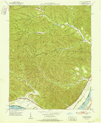
 1949 Pond Run1960 Print · USGSThe rugged interior of Scioto County is captured here in the late 1940s, just as state forest management was maturing. Genealogists can locate family landmarks like McDermott Cem and Elmtree Sch, or trace the path of the Chesapeake and Ohio through Quincy.
 - 1949 Map of Vanceburg, 1960 Print
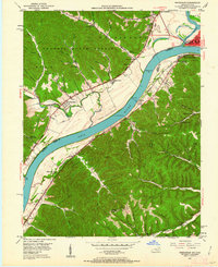
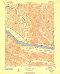
 1949 Vanceburg1960 Print · USGSThe Ohio River valley and the rugged hills of Lewis County are captured here just after the war. Local historians can trace family roots through numerous country landmarks like Beasley Fork Chapel, Aills Cem, and the County Infirmary.
 - 1949 Map of Garrison, 1961 Print
 1949 Garrison1961 Print · USGSThe Ohio River valley and the interior hollows of Lewis County are captured here just after the war. Genealogists can trace family landmarks like the Waring Cem, Red Brush Sch, and several rural churches along Kinniconick Creek.5 unique versions available
 - 1949 Map of Friendship, 1962 Print
 1949 Friendship1962 Print · USGSThe Ohio River valley near the turn of the mid-century reveals a landscape of industrial river transport and deep-hollow settlements. Researchers can trace the legacy of rural education and faith at Lower Carey Run Sch, Pine Grove Sch, and Nace Run Tabernacle.
 - 1949 Map of Buena Vista, 1964 Print
 1949 Buena Vista1964 Print · USGSThe Ohio River borderlands of the late 1940s reveal a landscape of river navigation and forest management. Researchers can trace riverside life at Rome (Stout PO), locate the Twin Creek Lookout Tower, and find rural congregations like Aills Chapel.
 - 1949 Map of Vanceburg, 1964 Print
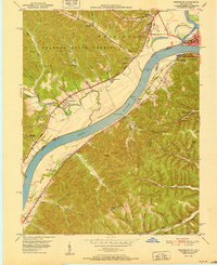
 1949 Vanceburg1964 Print · USGSVanceburg and the surrounding hollows of Lewis County are captured here just after the war, showing the deep intersection of river, rail, and ridge life. Genealogists can locate family landmarks such as Holly Cem, the Lewis County Infirmary, and Holly Hill Ch.4 unique versions available
 - 1949 Map of Concord, 1965 Print
 1949 Concord1965 Print · USGSThe Ohio River valley in the late 1940s reveals a landscape of river-and-rail industry along the Lewis County border. Trace the vanished stops at Rome Sta and Chalkley Sta, or find rural landmarks like Beasley Fork Chapel and Martin (Queens PO).
 - 1949 Map of Brushart, 1968 Print
 1949 Brushart1968 Print · USGSThe Lewis and Greenup County border in the late 1940s is a landscape of high ridges and deep hollows. Researchers can trace rural life through numerous country schools like Zion Hill Sch and family landmarks such as Logan Cem or the settlement at Brushart.2 unique versions available
 - 1949 Map of Charters, 1969 Print
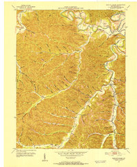
 1949 Charters1969 Print · USGSLewis County hill country is captured here in the late 1940s, showing a landscape defined by deep hollows and high ridges. Researchers can trace family roots through several rural landmarks, including Liberty Grove Ch, Hackworth Cem, and the small settlement of Charters.3 unique versions available
 - 1950 Map of Brushart
 1950 Brushart1950 Print · USGSThe rural borderlands of Lewis and Greenup counties appear in the late 1940s as a landscape of isolated hollows and ridge-top crossings. Researchers can locate numerous local landmarks like Kenton-Furnace Sch, the Allen Cem, and the settlement of Whiteoak.
 - 1950 Map of Charters
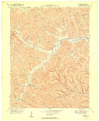 1950 Charters1950 Print · USGSLewis County hills and hollows are captured here at the mid-century, centered on the communities of Charters and Clarksburg. Genealogists can trace family landmarks and rural institutions like Liberty Grove Ch, Heselton School, and McCoy Cem.
 - 1950 Map of Head Of Grassy, 1952 Print
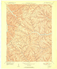
 1950 Head Of Grassy1952 Print · USGSLewis County's rugged ridge-and-hollow country is captured here at mid-century, showing the isolated communities of the Kentucky hills. Genealogists can trace family footprints through numerous rural landmarks like Blankenship Sch, Stone Cem, and the settlement of Head of Grassy.3 unique versions available
 - 1950 Map of Wesleyville, 1952 Print
 1950 Wesleyville1952 Print · USGSNortheastern Kentucky hill country at the start of the fifties reveals a landscape of isolated hollows and tightly-knit rural communities. Genealogists and hikers can trace old family burial grounds like Jordan Cem or locate the historic Wesleyville Post Office and Smith Creek Sch.
 - 1950 Map of Olive Hill, 1952 Print
 1950 Olive Hill1952 Print · USGSMid-century Carter County comes alive in this survey of the Olive Hill area, where the river-and-rail economy of the Appalachians is on full display. Genealogists and historians can trace family-named ridges and hollows, locating old landmarks like Erie College, James Chapel, and the settlement of Soldier.
 - 1951 Map of Vanceburg
 1951 Vanceburg1951 Print · USGSVanceburg and the surrounding Lewis County hills are captured here in the early fifties, showing the river-and-rail economy along the Ohio River. Researchers can trace old family sites and rural infrastructure, from the Lewis County Infirmary to local landmarks like Evans Chapel and the Rock Run Sch.
 - 1951 Map of Buena Vista
 1951 Buena Vista1951 Print · USGSThe Ohio River borderlands at the start of the 1950s show a landscape of deep timbered hollows and river navigation. Researchers can trace rural life through the locations of Dam No 32, the Twin Creek Mission, and the Rome (Stout PO) settlement.
 - 1951 Map of Garrison
 1951 Garrison1951 Print · USGSThe riverfront and rugged hollows of Lewis County are captured here just after the war, when the railroad still dominated the shoreline. Genealogists can locate family-named sites like Skidmore Cemetery and Tannery School along the winding Kinniconick Creek.
 - 1951 Map of Concord
 1951 Concord1951 Print · USGSThe riverfront communities of Lewis County and Adams County thrive along the Ohio during the early post-war era. Genealogists and local historians can trace family locations near Concord, identify the Stout Post Office, or find rural landmarks like Beasley Fork Chapel and the Carrs School.2 unique versions available
 - 1951 Map of Friendship
 1951 Friendship1951 Print · USGSThe Ohio River valley at the turn of the 1950s shows a landscape of river-dependent industry and hill-country settlements. Researchers can trace the legacy of family homesteads through features like Morris Hill Cem, Bethel Ch, and Upper Carey Run Sch.2 unique versions available
 - 1951 Map of Pond Run
 1951 Pond Run1951 Print · USGSSouthern Ohio and northern Kentucky met along the river in the early fifties, where the forest landscape was dotted with family hollows and small rail stops. Genealogists and hikers can trace old landmarks like the Pond Run Lookout Tower, McDermitt Cem, and the tracks of The Chesapeake and Ohio.
Showing maps 1-25 of 145
Top cities of Lewis County
Frequently asked questions
- What are the different types of historical maps available for Lewis County?
- What is the oldest map of Lewis County?
- Where can I purchase historical maps of Lewis County for my home or office?
- Where can I download high-res historical maps of Lewis County?
- Are there historical topographic maps available for Lewis County?
- Is there historical aerial imagery available for Lewis County?
- Where are historical maps of Lewis County sourced from?