1930s Maps of Meade County, Kentucky
Explore 3 historic maps of Meade County from the 1930s. These maps offer a rare glimpse into what life looked like during the 1930s — showing old roads, neighborhoods, homes, and landmarks that have changed or disappeared over time.
Whether you're researching your family's past, planning a metal detecting trip, or studying how Meade County's landscape evolved across the 1930s, these high-resolution maps are a powerful tool for exploring the history of this region.
- Focus on a specific era: All maps on this page are from the 1930s, giving you a focused view of this time period.
- See what’s changed: Compare century-old streets, trails, and buildings to today's modern landscape using overlays and satellite layers.
- Research with precision: Use these maps for genealogy, historical research, land use analysis, or educational projects.
- View, download, or print: Maps are fully viewable online in high resolution, and can be downloaded or printed for your own records.
Start exploring Meade County's history through authentic maps from the 1930s. This is your window into the past.
Meade County, KY maps
(3)- 1931 Map of Hardinsburg
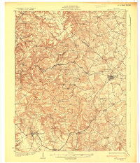 1931 Hardinsburg1931 Print · USGSBreckinridge and Meade Counties are shown in meticulous detail during the late Prohibition era, before modern highways bypassed many rural communities. Researchers can trace dozens of country schools and churches like Giltedge Sch or the Gar Rook Mine along the Louisville and Nashville line.3 unique versions available
 - 1931 Map of Corydon
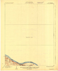 1931 Corydon1931 Print · USGSThe Kentucky-Indiana borderlands along the Ohio River are captured here during the late Prohibition era. Local researchers can trace the riverbank settlement of Brandenburg or locate landmarks like the Oak Grove Sch and Hamilton Hill.4 unique versions available
 - 1936 Map of Vine Grove
 1936 Vine Grove1936 Print · USGSHardin and Bullitt counties are shown here during a period of massive military expansion before the mid-century. Researchers can trace the development of Fort Knox alongside established communities like Vine Grove and old rural landmarks like Stovall Chapel or the Glenbeddis Sch.
End of results
Showing maps 1-3 of 3
Top cities of Meade County
Frequently asked questions
- What are the different types of historical maps available for Meade County?
- What is the oldest map of Meade County?
- Where can I purchase historical maps of Meade County for my home or office?
- Where can I download high-res historical maps of Meade County?
- Are there historical topographic maps available for Meade County?
- Is there historical aerial imagery available for Meade County?
- Where are historical maps of Meade County sourced from?