2020s Maps of Meade County, Kentucky
Explore 14 historic maps of Meade County from the 2020s. These maps offer a rare glimpse into what life looked like during the 2020s — showing old roads, neighborhoods, homes, and landmarks that have changed or disappeared over time.
Whether you're researching your family's past, planning a metal detecting trip, or studying how Meade County's landscape evolved across the 2020s, these high-resolution maps are a powerful tool for exploring the history of this region.
- Focus on a specific era: All maps on this page are from the 2020s, giving you a focused view of this time period.
- See what’s changed: Compare century-old streets, trails, and buildings to today's modern landscape using overlays and satellite layers.
- Research with precision: Use these maps for genealogy, historical research, land use analysis, or educational projects.
- View, download, or print: Maps are fully viewable online in high resolution, and can be downloaded or printed for your own records.
Start exploring Meade County's history through authentic maps from the 2020s. This is your window into the past.
Meade County, KY maps
(14)- 2022 Map of Alton, 2022 Print
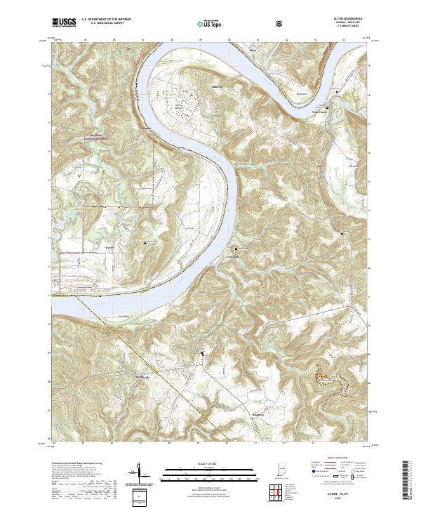 2022 Alton2022 Print · USGSThe Ohio River oxbow dominates this landscape at the Indiana-Kentucky border, where riverfront hamlets and upland forests meet. Researchers can trace family history through sites like Saint Theresa Cem and the Flannery Family Cem or explore the terrain of Jarbo Sinks and Little Bend.
 - 2022 Map of Beechwood, 2022 Print
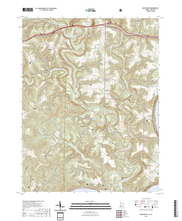 2022 Beechwood2022 Print · USGSCrawford County and the forest lands of southern Indiana are shown here just as the new decade began. Researchers can trace numerous family burial grounds like Bloom Riddle Cem and Wiseman Cem or locate the riverside settlement of Fredonia.
 - 2022 Map of Mauckport, 2022 Print
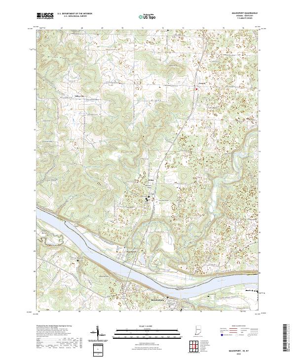 2022 Mauckport2022 Print · USGSThe Indiana-Kentucky borderlands along the Ohio River are shown here as they appeared in the early 2020s. Researchers can trace local lineage through sites like Old Mauckport Cemetery or locate the Meade County Courthouse in Brandenburg.
 - 2022 Map of New Amsterdam, 2022 Print
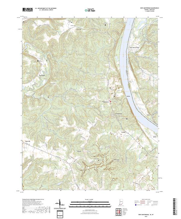 2022 New Amsterdam2022 Print · USGSThe Ohio River corridor comes to life in the early 2020s, showing the crossing between Indiana and Kentucky. Trace family roots through Crown Hill Cem or explore river-bluff settlements like New Amsterdam and Battletown.
 - 2022 Map of Laconia, 2022 Print
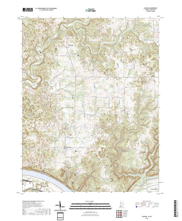 2022 Laconia2022 Print · USGSSouthern Harrison County rural life is captured here in the early 2020s, anchored by the settlement of Laconia and the Ohio River border. Genealogists can trace family heritage through numerous sites including Old Goshen Cem, King Cem, and Crown Hill Cem.
 - 2022 Map of Guston, 2022 Print
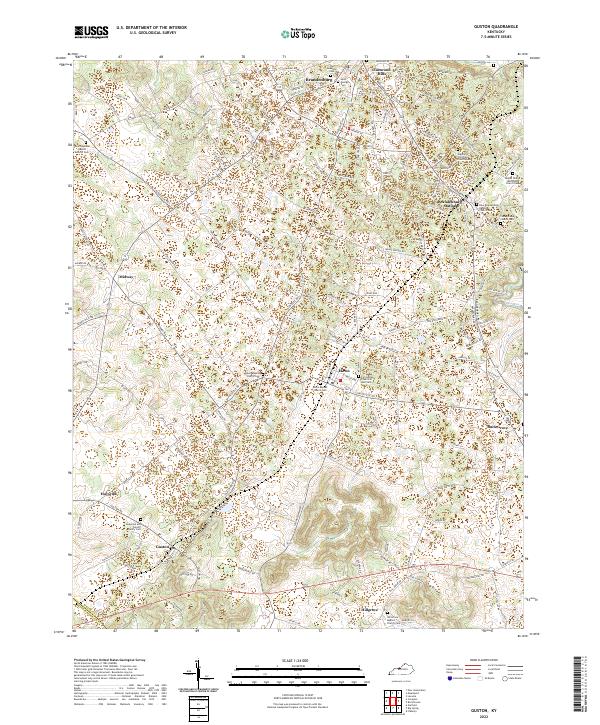 2022 Guston2022 Print · USGSMeade County, Kentucky, maintains its traditional character through a network of rural hamlets and historic church communities. Genealogists can trace family lines across several burial grounds, including the Anderson and Cundiff Family Cem and Hill Grove Baptist Church Cem.
 - 2022 Map of Flaherty, 2022 Print
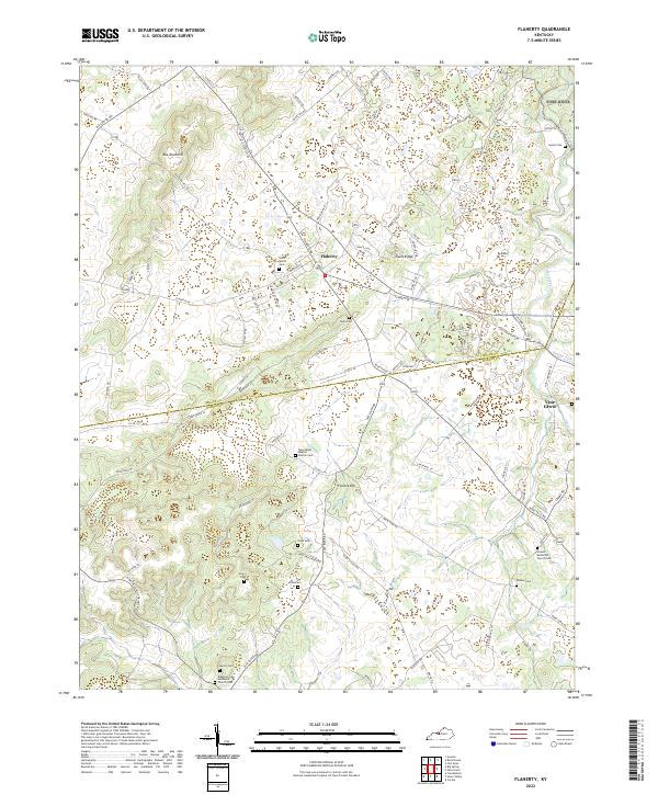 2022 Flaherty2022 Print · USGSThe border lands of Meade and Hardin counties are mapped here in the early twenty-first century, showcasing a rural landscape of family-run farms and country parishes. Genealogists can trace family names through numerous burial sites like Yates Cem and historic congregational centers such as Howell Methodist Church.
 - 2022 Map of Big Spring, 2022 Print
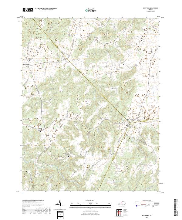 2022 Big Spring2022 Print · USGSBreckinridge County and its neighbors meet at the rural crossroads of Big Spring in this recent study of the Kentucky landscape. Genealogists can trace family footprints through numerous local sites including Bewleyville Cem, Hardaway Cem, and High Plains.
 - 2022 Map of Irvington, 2022 Print
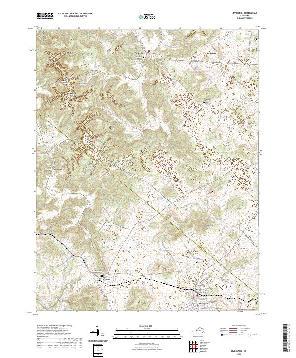 2022 Irvington2022 Print · USGSBreckinridge and Meade counties are shown here in the modern era, centering on the rural crossroads and small settlements that define the region. You can trace family history through numerous documented sites like Richardson Cem, Webster United Methodist Church Cem, and Sirocco.
 - 2022 Map of Lodiburg, 2022 Print
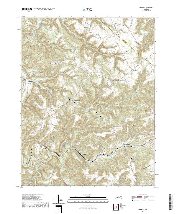 2022 Lodiburg2022 Print · USGSBreckinridge County settlements and family cemeteries are documented here in the early twenty-first century. Genealogists can trace family names at Jolly Cem, Shelman Cem, and Claycomb Cem near communities like Union Star and Lodiburg.
 - 2022 Map of Leavenworth, 2022 Print
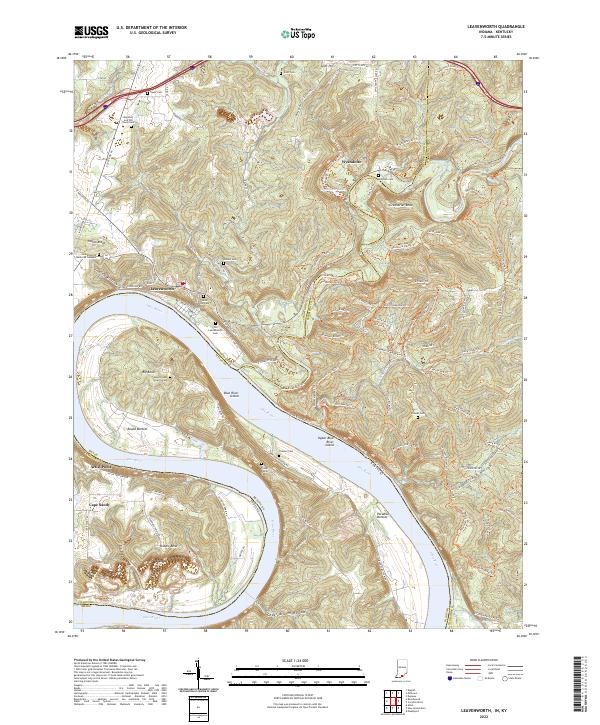 2022 Leavenworth2022 Print · USGSThe Indiana-Kentucky borderlands along the Ohio River come to life here during the early twenty-first century. Genealogists and local historians can trace family roots at the Foster Family Cemetery or explore the river bottoms of Round Bottom and Paradise Bottom.
 - 2022 Map of Rock Haven, 2022 Print
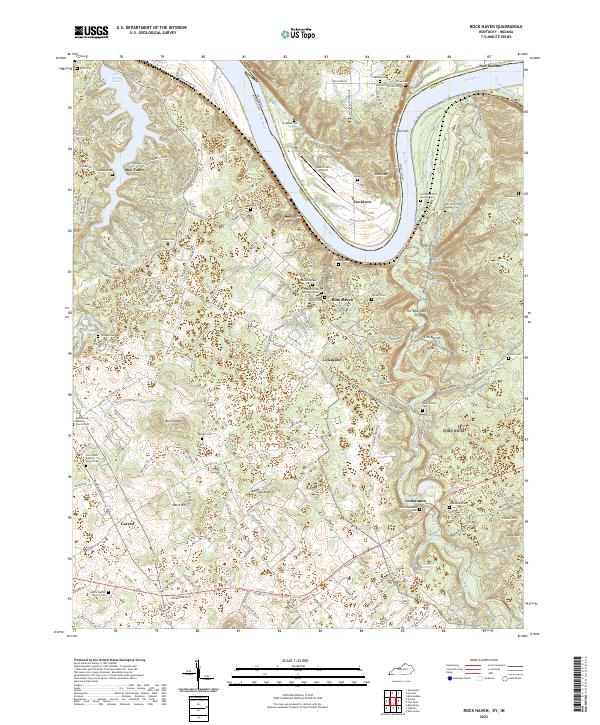 2022 Rock Haven2022 Print · USGSMeade County and the Indiana borderlands are captured here in a period of transition along the Ohio River. Genealogists and researchers can trace numerous family and community sites, from Garnettsville Cem to the old crossroads at Lickskillet and Garrett.
 - 2022 Map of Vine Grove, 2022 Print
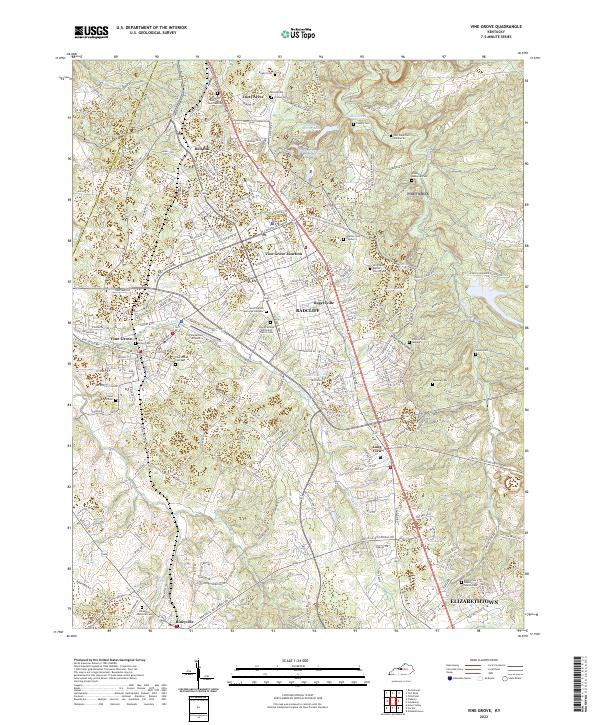 2022 Vine Grove2022 Print · USGSHardin County settlements and military history converge in this contemporary look at the Vine Grove area and the northern reaches of Elizabethtown. Researchers can locate numerous burial grounds and landmarks like Saint Brigid Cem, the Vine Grove Airport, and Fort Knox Cem Number 83.
 - 2022 Map of Fort Knox, 2022 Print
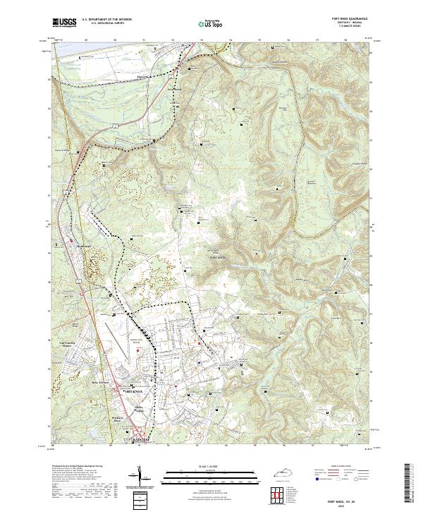 2022 Fort Knox2022 Print · USGSThe military landscape of Hardin County and the confluence of the Ohio and Salt Rivers are seen here in the early 2020s. Genealogists can locate family burial sites like Geoghegan Cem and the Fort Knox Post Cem alongside Godman Army Airfield.
End of results
Showing maps 1-14 of 14
Top cities of Meade County
Frequently asked questions
- What are the different types of historical maps available for Meade County?
- What is the oldest map of Meade County?
- Where can I purchase historical maps of Meade County for my home or office?
- Where can I download high-res historical maps of Meade County?
- Are there historical topographic maps available for Meade County?
- Is there historical aerial imagery available for Meade County?
- Where are historical maps of Meade County sourced from?