Old Maps of Meade County, Kentucky for Hiking & Exploration
Hike through history with 138 historic maps of Meade County. Explore old trails, ghost towns, and forgotten backroads — perfect for outdoor adventurers and local explorers.
- Rediscover forgotten places: Map out old mining camps, roads, and footpaths that no longer exist on modern maps.
- Layer with modern tools: Combine with LiDAR or satellite views to plan hikes through historical terrain.
- Made for exploration: Popular among hikers, overlanders, and local history lovers.
Use these maps to find adventure and explore the hidden past of Meade County.
Meade County, KY maps
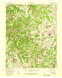
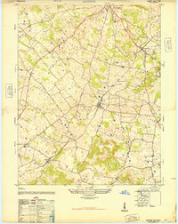
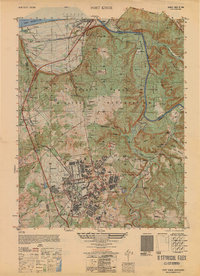
(138)- 1928 Map of Hardinsburg
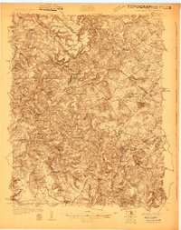 1928 Hardinsburg1928 Print · USGSBreckinridge and Meade counties are captured here in the late twenties as the railroad and the Dixie Highway shaped local commerce. Genealogists can trace family footprints through dozens of rural landmarks like Clifton Mills, Mt Merino Ch, and Argabright Sch.
 - 1931 Map of Hardinsburg
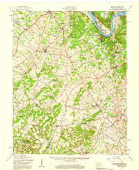
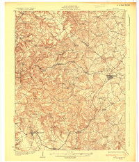 1931 Hardinsburg1931 Print · USGSBreckinridge and Meade Counties are shown in meticulous detail during the late Prohibition era, before modern highways bypassed many rural communities. Researchers can trace dozens of country schools and churches like Giltedge Sch or the Gar Rook Mine along the Louisville and Nashville line.3 unique versions available
 - 1931 Map of Corydon
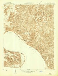
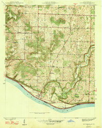
 1931 Corydon1931 Print · USGSThe Kentucky-Indiana borderlands along the Ohio River are captured here during the late Prohibition era. Local researchers can trace the riverbank settlement of Brandenburg or locate landmarks like the Oak Grove Sch and Hamilton Hill.4 unique versions available
 - 1936 Map of Vine Grove
 1936 Vine Grove1936 Print · USGSHardin and Bullitt counties are shown here during a period of massive military expansion before the mid-century. Researchers can trace the development of Fort Knox alongside established communities like Vine Grove and old rural landmarks like Stovall Chapel or the Glenbeddis Sch.
 - 1941 Map of Ekron
 1941 Ekron1941 Print · USGSNorthern Kentucky and the Ohio River shoreline are captured here in the early 1940s, showing the rural communities of Meade and Hardin Counties. Genealogists can trace family locations near Ekron, Shumate School, and the historic Sherman Landing.
 - 1943 Map of Vine Grove
 1943 Vine Grove1943 Print · USGSHardin and Meade Counties appear here during a period of massive mid-century growth at Fort Knox. Genealogists can trace family homesteads near landmarks like Stovall Chapel, Red Hill, and the many rural schools including Hays Sch and Deckard Sch.
 - 1946 Map of Rock Haven
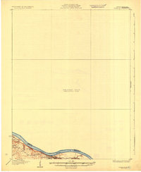
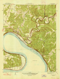
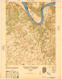 1946 Rock Haven1946 Print · USGSMeade County, Kentucky, is shown here in the immediate post-war era, where the Ohio River valley meets the expanding military footprint of the time. Genealogists and historians can trace the foundations of Garnettsville, locate Doe Run Mill, and find family landmarks like Buck Grove Ch or Rockridge Sch.
 - 1946 Map of Leavenworth
 1946 Leavenworth1946 Print · USGSThe Indiana-Kentucky borderlands come into focus in the mid-1940s as the river economy of the Ohio Valley transitions toward modern infrastructure. Trace family homesteads and local history through rural anchors like Blue River Chapel, Sunshine Sch, and the riverside community of Leavenworth.
 - 1946 Map of Fort Knox
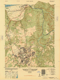 1946 Fort Knox1946 Print · USGSFort Knox and the surrounding Kentucky riverlands are captured just after the war as the military installation reached its modern maturity. Researchers can trace the layout of Godman Field, locate the famous Bullion Depository, and find family landmarks like Montgomery Cem or the town of West Point.
 - 1946 Map of Vine Grove
 1946 Vine Grove1946 Print · USGSHardin County settlements and the southern edge of Fort Knox are frozen in time just after the war. Researchers can locate family landmarks such as Lincoln Memorial Cem, the Illinois Central rail line, and the village of Vine Grove.
 - 1946 Map of Vine Grove, 1959 Print
 1946 Vine Grove1959 Print · USGSMid-century Hardin County is defined by the massive expansion of the Fort Knox Military Reservation and its surrounding rail-and-highway hubs. Researchers can trace dozens of family cemeteries and vanished landmarks like the Woolridge Ferry Bridge, Sherrard Sch, and the community of Pitts Point.
 - 1947 Map of Irvington
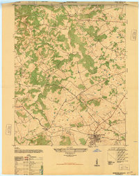 1947 Irvington1947 Print · USGSIn the post-war Kentucky countryside, this survey captures the rural landscape centered on the rail hub of Irvington. Genealogists and historians can trace local farm life and community ties through landmarks like Payneville School, Fairmont School, and Sirocco.
 - 1947 Map of Lodiburg
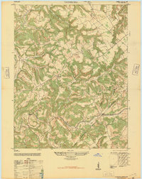 1947 Lodiburg1947 Print · USGSBreckinridge County settlements and winding ridgeline roads are captured here just after the war. Local historians can trace old homesteads and community sites like Union Star, Pleasant Valley School, and the Cem markers near Sample.
 - 1947 Map of Leavenworth
 1947 Leavenworth1947 Print · USGSSouthern Indiana and northern Kentucky are captured here in the late 1940s as the Ohio River trade still defined life in these border counties. Researchers can locate vanished landmarks like Schooner Point Landing and the rural Precinct Sch or explore the early environs of Wyandotte Cave.2 unique versions available
 - 1947 Map of Mauckport
 1947 Mauckport1947 Print · USGSHarrison County's riverfront and rural uplands are shown here in the years following the war, centered on the historic river town of Mauckport. Genealogists and historians can locate vanished local institutions like Hillgrove Sch, Wesley Chapel, and the landing at Morvins Landing.2 unique versions available
 - 1947 Map of Hardinsburg, 1959 Print
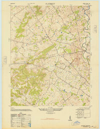
 1947 Hardinsburg1959 Print · USGSBreckinridge and Meade Counties are shown here during the late 1940s, a time when rural life centered on local crossroads and one-room schools. Genealogists can trace family connections to landmarks like Fate Chapel, Clifton Mills, or the Bunker Hill Sch.
 - 1947 Map of Ekron, 1959 Print
 1947 Ekron1959 Print · USGSMeade County and the riverfronts of the Ohio Valley come alive in this late 1940s survey. Genealogists and historians can trace the foundations of Garnettsville, locate rural landmarks like Doe Run Mill, or search for family connections at Cedar Farm Cem and St Martins Sch.
 - 1948 Map of Guston
 1948 Guston1948 Print · USGSMeade County's rural heartland is captured here just after the war, showing the railroad-centered life of the late 1940s. Genealogists can trace family footprints at the Meade County Farm, Smith School, and Salem Church Cemetery.
 - 1948 Map of Flaherty
 1948 Flaherty1948 Print · USGSMid-century Hardin County reveals a landscape of upland farms and rural schools shortly after the war. Genealogists can trace family roots at St Martins Church Cem and School, Salem Church and Cemetery, and the old Miller School.
 - 1948 Map of Big Spring
 1948 Big Spring1948 Print · USGSKentucky's rural interior comes into focus shortly after the war, showing the tight-knit network of country roads and family-named corners. Genealogists can trace property and community life near Bewleyville School, High Plains, and the prominent Big Spring crossing.
 - 1948 Map of Laconia, 1959 Print
 1948 Laconia1959 Print · USGSHarrison County, Indiana, sits along a winding stretch of the Ohio River in the late 1940s, serving as a vital borderland of small farms and river landings. Genealogists can locate over a dozen burial sites including Dunkard Cem and Brown Cem, alongside local hubs like Dogwood and St Michaels Ch.
 - 1950 Map of Fort Knox
 1950 Fort Knox1950 Print · USGSFort Knox and its surroundings in the years following the war show a landscape transformed by military necessity and river valley geography. Researchers can trace the layout of the US Bullion Depository and Godman Field alongside older communities like West Point and Goldville.
 - 1950 Map of Laconia
 1950 Laconia1950 Print · USGSHarrison County settlement patterns are preserved here in the mid-twentieth century, centered on the riverfront and the rural crossroads of Laconia. Researchers can trace dozens of family cemeteries like Ferree Cem and vanished landmarks like Rehoboth Sch or Tobacco Landing.2 unique versions available
 - 1950 Map of Beechwood, 1952 Print
 1950 Beechwood1952 Print · USGSThe Indiana-Kentucky borderlands along the Ohio River appear in high detail during the early fifties. Genealogists and hikers can trace remote landmarks like the Buzzard Roost Fire Tower, Old Union Ch, and the Wiseman Cem.3 unique versions available
 - 1950 Map of Leavenworth, 1954 Print
 1950 Leavenworth1954 Print · USGSThe Ohio River meanders through Crawford County in the mid-century, showcasing a landscape of dramatic river bends and timbered highlands. Genealogists and local historians can trace family locations near Mt Hope Ch, Peckenpaugh Sch, or the riverside settlement of Leavenworth.3 unique versions available
Showing maps 1-25 of 138
Top cities of Meade County
Frequently asked questions
- What are the different types of historical maps available for Meade County?
- What is the oldest map of Meade County?
- Where can I purchase historical maps of Meade County for my home or office?
- Where can I download high-res historical maps of Meade County?
- Are there historical topographic maps available for Meade County?
- Is there historical aerial imagery available for Meade County?
- Where are historical maps of Meade County sourced from?