1960s Maps of Meade County, Kentucky
Explore 9 historic maps of Meade County from the 1960s. These maps offer a rare glimpse into what life looked like during the 1960s — showing old roads, neighborhoods, homes, and landmarks that have changed or disappeared over time.
Whether you're researching your family's past, planning a metal detecting trip, or studying how Meade County's landscape evolved across the 1960s, these high-resolution maps are a powerful tool for exploring the history of this region.
- Focus on a specific era: All maps on this page are from the 1960s, giving you a focused view of this time period.
- See what’s changed: Compare century-old streets, trails, and buildings to today's modern landscape using overlays and satellite layers.
- Research with precision: Use these maps for genealogy, historical research, land use analysis, or educational projects.
- View, download, or print: Maps are fully viewable online in high resolution, and can be downloaded or printed for your own records.
Start exploring Meade County's history through authentic maps from the 1960s. This is your window into the past.
Meade County, KY maps
(9)- 1960 Map of Winchester
 1960 Winchester1960 Print · USGSCentral Kentucky's diverse landscape is shown here at mid-century, from the bluegrass plains to the rugged Pottsville Escarpment. Genealogists and historians can trace the rail-and-river network connecting towns like Bardstown and Stanford alongside landmarks like Lake Cumberland.
 - 1960 Map of Fort Knox, 1961 Print
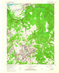 1960 Fort Knox1961 Print · USGSFort Knox and the surrounding river valleys are captured here during the height of the Cold War era. Researchers can trace the layout of the U S Bullion Depository and Godman Army Airfield or locate family plots like Boone Cem and McIntire Cem.3 unique versions available
 - 1960 Map of Vine Grove, 1961 Print
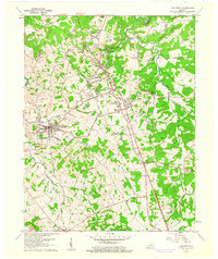 1960 Vine Grove1961 Print · USGSHardin County during the early sixties shows the interface between military growth and rural Kentucky life. Trace family roots at St Brigids Cem or follow the Illinois Central tracks through Vine Grove and Radcliff.5 unique versions available
 - 1960 Map of Rock Haven, 1961 Print
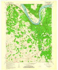 1960 Rock Haven1961 Print · USGSThe Ohio River borderlands of Kentucky and Indiana are captured here in the early sixties, showing the reach of the river-and-rail economy. Researchers can trace family history through sites like Doe Run Mill, the settlement of Davidson, and several country churches like Buck Grove Ch.3 unique versions available
 - 1960 Map of Flaherty, 1961 Print
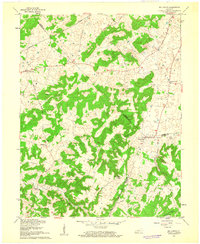
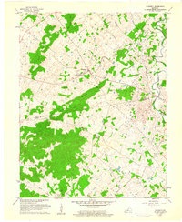 1960 Flaherty1961 Print · USGSMeade and Hardin counties in the early sixties are captured here at the edge of the military expansion. Genealogists can trace family names through rural landmarks like St Martins Ch, Hynes Cem, and the cluster of homes at Flaherty.3 unique versions available
 - 1961 Map of Evansville
 1961 Evansville1961 Print · USGSThe Ohio River valley and its surrounding coalfields are captured here during the late fifties and early sixties. Trace the industrial rail networks of the Illinois Central RR and explore regional landmarks like Mammoth Cave National Park and Angel Mounds State Memorial.2 unique versions available
 - 1961 Map of Big Spring, 1962 Print
 1961 Big Spring1962 Print · USGSThe three-way border of Meade, Breckinridge, and Hardin counties comes into focus in the early sixties, showing a landscape of small upland settlements and winding valleys. Researchers can trace family sites and local landmarks from Bewleyville and Big Spring to the rural crossroads at Maples Corner.2 unique versions available
 - 1961 Map of Guston, 1962 Print
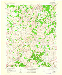 1961 Guston1962 Print · USGSMeade County during the early sixties shows a landscape of rural communities and karst topography just south of the Ohio River. Researchers can trace the legacy of local life through landmarks like Brandenburg Station, the County Fairground, and New Highland Ch.2 unique versions available
 - 1966 Map of Laconia, 1968 Print
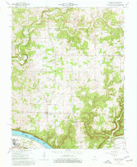 1966 Laconia1968 Print · USGSHarrison County's southern townships meet the Kentucky border along the Ohio River during the mid-1960s. Genealogists and local historians can trace family roots through Old Goshen Cemetery, locate the old South Central School, or explore the riverfront at Tobacco Landing.3 unique versions available
End of results
Showing maps 1-9 of 9
Top cities of Meade County
Frequently asked questions
- What are the different types of historical maps available for Meade County?
- What is the oldest map of Meade County?
- Where can I purchase historical maps of Meade County for my home or office?
- Where can I download high-res historical maps of Meade County?
- Are there historical topographic maps available for Meade County?
- Is there historical aerial imagery available for Meade County?
- Where are historical maps of Meade County sourced from?