Old Maps of Wayne County, Kentucky for Genealogy
Trace your family roots with 116 historic maps of Wayne County. These high-res maps reveal old neighborhoods, homesites, landmarks, and streets — helping you uncover where your ancestors lived and how the area evolved over time.
- Explore historic neighborhoods: Identify where your relatives may have lived in the 1800s or 1900s.
- Compare maps over time: Trace the changes in streets, buildings, and landmarks for multi-generational research.
- Perfect for genealogy & ancestry research: Used by family historians and researchers to map out lineage and migration.
These maps are an incredible resource for exploring your personal connection to Wayne County's past.
Wayne County, KY maps
(116)- 1911 Map of Monticello, 1952 Print
 1911 Monticello1952 Print · USGSWayne County and the southern loops of the Cumberland River are captured here in the early twentieth century before modern reservoirs changed the valley. Genealogists can locate dozens of country schools and churches, from Old Glory School to Union Church, alongside river landings like Rankin Landing.2 unique versions available
 - 1914 Map of Monticello
 1914 Monticello1914 Print · USGSWayne County life in the early twentieth century centered on the Cumberland River and the crossroads at Monticello. Genealogists and historians can trace numerous rural institutions like Old Glory School, Union Church, and the Ramsey Branch Stop PO.4 unique versions available
 - 1929 Map of Byrdstown
 1929 Byrdstown1929 Print · USGSThe Tennessee-Kentucky state line comes alive in the late twenties, showing a landscape defined by the winding Obey River before the era of modern dams. Researchers can trace ancestral roots through dozens of local sites like Davidson Cem, Franklin Ferry, and the Almshouse.2 unique versions available
 - 1932 Map of Burnside
 1932 Burnside1932 Print · USGSThe Cumberland River and its South Fork are captured here in the early 1930s, showing the intricate river-and-rail topography of southern Kentucky. Researchers can locate dozens of country landmarks like Roberts Mill, Lovells Chapel, and Pole Bridge Sch.2 unique versions available
 - 1934 Map of Barthell
 1934 Barthell1934 Print · USGSMcCreary County during the late 1920s reveals a landscape of industrial outposts and river-bound settlements at the edge of the Tennessee line. Researchers can trace the Kentucky and Tennessee Railway corridor or find family roots at Kidds Crossing, Cooperative, and Laurel Hill Ch.
 - 1934 Map of Pall Mall
 1934 Pall Mall1934 Print · USGSThe Kentucky-Tennessee borderlands appear in great detail during the late interwar period, showing a landscape of remote mountain hamlets and schools. Genealogists can locate family landmarks such as Edwards Chapel, Slickford, and the Parmley Sch among the cliffs and ridges.
 - 1953 Map of Frazer, 1955 Print
 1953 Frazer1955 Print · USGSWayne and Pulaski Counties appear here in the early fifties as the landscape was being reshaped by the waters of the newly created Lake Cumberland. Researchers can trace rural lineages through numerous country schools and churches like New Salem Ch, Turpin Sch, and Meadow Creek Sch.2 unique versions available
 - 1953 Map of Parnell, 1955 Print
 1953 Parnell1955 Print · USGSWayne County is captured here in the early fifties, just as the controlled inundation of Lake Cumberland began altering the traditional valley geography. Family researchers can locate long-standing community centers like the Old Glory Sch, Parnell Ch, and the rural settlement at Zula.2 unique versions available
 - 1953 Map of Monticello, 1955 Print
 1953 Monticello1955 Print · USGSThe Wayne County seat and its surrounding hollows are captured here in the early fifties as a landscape of valley farms and upland ridges. Genealogists can locate family landmarks like Elk Spring Cemetery and the many rural schools including Travis Sch and Missouri Sch.2 unique versions available
 - 1953 Map of Mill Springs, 1955 Print
 1953 Mill Springs1955 Print · USGSThe mid-century landscape of Wayne and Pulaski counties comes alive here, showing the region just as the rising waters of Lake Cumberland redefined the terrain. Genealogists and historians can trace family roots at Morrow Chapel, Simpson Spr, and the Mill Springs Battlefield.2 unique versions available
 - 1953 Map of Jamestown, 1955 Print
 1953 Jamestown1955 Print · USGSThe Russell County uplands meet the newly formed reservoir in the early fifties, showing a landscape reshaped by the water. Trace family roots in Freedom, Sewellton, and Rowena, or locate remote landmarks like Worldridge Sch and Belle Chapel.2 unique versions available
 - 1954 Map of Jabez, 1955 Print
 1954 Jabez1955 Print · USGSThe Russell and Wayne county borderland is captured here in the early fifties as the rising waters of Lake Cumberland reshaped the valley. Genealogists can trace family landmarks like Norfleet Cem, Jabez, and the Union Sch district.2 unique versions available
 - 1954 Map of Parmleysville, 1955 Print
 1954 Parmleysville1955 Print · USGSThe Wayne County highlands come into focus in the mid-1950s, showing a network of remote hollows and high knobs. Researchers can trace family history through the sites of Parmleysville Sch, Mt Pisgah, and dozens of Oil Wells dotting the ridges.2 unique versions available
 - 1954 Map of Coopersville, 1955 Print
 1954 Coopersville1955 Print · USGSSouthern Wayne County at the mid-century is captured here as a landscape of forest cliffs and river bends. Genealogists can trace family names across rural schoolhouses and churches like Big Sinking Sch, Shiloh Ch, and Kidds Crossing Cem.4 unique versions available
 - 1954 Map of Cumberland City, 1955 Print
 1954 Cumberland City1955 Print · USGSIn the mid-fifties, the newly formed shores of Lake Cumberland redefined these Clinton and Wayne County valleys. Genealogists and historians can trace the foundations of rural life through Cumberland City, Watauga Post Office, and many family burial grounds like McWhorter Cemetery.2 unique versions available
 - 1954 Map of Burnside, 1955 Print
 1954 Burnside1955 Print · USGSThe river loops and rugged ridges of Pulaski County are caught here in the mid-fifties, just as the Southern railroad served the timber and coal interests of the region. Researchers can locate vanished landmarks and family sites like Mt Union Sch, Owens Cem, and the old station at Sloans Valley.2 unique versions available
 - 1954 Map of Savage, 1955 Print
 1954 Savage1955 Print · USGSMid-century Clinton County, Kentucky, is shown here as a landscape of ridge-top schools and creek-bottom settlements. Genealogists and historians can trace the exact locations of Cannons Mill, Cooks Spring, and the Upper Oak Grove Sch.
 - 1954 Map of Nevelsville, 1955 Print
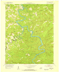 1954 Nevelsville1955 Print · USGSMcCreary and Wayne counties are shown in the mid-1950s, dominated by the winding South Fork Cumberland River. Genealogists can trace remote family sites like Jonesville, Freedom Chapel, and the Foster Sch among the bluffs and ridges.5 unique versions available
 - 1954 Map of Powersburg, 1955 Print
 1954 Powersburg1955 Print · USGSWayne County highlands in the mid-fifties reveal a network of isolated hollows and ridge-top settlements before modern development changed the rural character. Genealogists can trace family footprints through numerous rural landmarks like Keans Chapel, Sunnybrook Sch, and Dishman Cem.2 unique versions available
 - 1954 Map of Bell Farm, 1955 Print
 1954 Bell Farm1955 Print · USGSMcCreary and Wayne counties in the mid-1950s are depicted here as a landscape of isolated ridges and timber management. Genealogists can trace family homesteads near Barrier Cem, the Bell Hill Sch, or the remote settlement of Bell Farm.3 unique versions available
 - 1954 Map of Pall Mall, 1956 Print
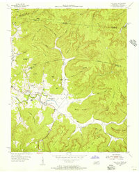 1954 Pall Mall1956 Print · USGSThe borderlands of Tennessee and Kentucky come alive in the mid-1950s, centered on the community of Pall Mall. Trace local history through the many rural landmarks of the Wolf River valley, including York Bible Sch, Travisville Ch, and the Alvin C York Highway.4 unique versions available
 - 1955 Map of Sharp Place, 1956 Print
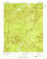 1955 Sharp Place1956 Print · USGSThe Tennessee-Kentucky borderlands come alive in the mid-fifties, showing a landscape shaped by national forests and small ridge-top communities. Genealogists can locate family sites like Akers Chapel, Sharp Place Cemetery, and the Langham School.5 unique versions available
 - 1956 Map of Corbin, 1966 Print
 1956 Corbin1966 Print · USGSThe Kentucky and Tennessee borderlands are captured here in the mid-fifties, showing the region's shift toward modern interstate travel and reservoir development. Genealogists and historians can trace old community lines near Albany and Monticello or locate early rail junctions along the Southern and Tennessee Central lines.3 unique versions available
 - 1958 Map of Corbin
 1958 Corbin1958 Print · USGSThe Upper Cumberland borderlands appear in the late 1950s as massive reservoirs and early atomic-era growth reshape the region. Trace family roots and vanished landmarks near Lake Cumberland, Oak Ridge, and the Cumberland National Forest.
 - 1965 Map of Burnside, 1967 Print
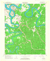 1965 Burnside1967 Print · USGSMid-century Pulaski County is defined by the winding waters of the Cumberland and South Fork rivers. Genealogists and hikers can locate family landmarks like Grave Hill Cemetery, the community at Sloans Valley, and the Alpine Recreation Area.3 unique versions available
Showing maps 1-25 of 116
Top cities of Wayne County
Frequently asked questions
- What are the different types of historical maps available for Wayne County?
- What is the oldest map of Wayne County?
- Where can I purchase historical maps of Wayne County for my home or office?
- Where can I download high-res historical maps of Wayne County?
- Are there historical topographic maps available for Wayne County?
- Is there historical aerial imagery available for Wayne County?
- Where are historical maps of Wayne County sourced from?