
1954 Map of Bell Farm
USGS Topo · Published 1955About this map
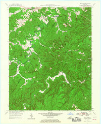
The South Fork Little Kentucky River and Little South Fork carve through the heavily forested terrain of the Cumberland National Forest on this mid-century survey. The landscape is defined by its verticality, featuring dramatic landmarks like The Pilot, Middle Cliff, and Chimney Rock. Small rural communities and family enclaves are scattered along the ridge tops and creek bottoms, evidenced by names like Rockybranch and Griffin. The map reveals a community-centered life in the 1950s, anchored by numerous country schools such as Slavans Sch and Wolf Sch, and churches like Green Ford Ch. Along the ridges, the Wolf Ridge Lookout and Skullbones Lookout Tower indicate a landscape managed for fire protection and timber, while clusters of Oil Wells near the center of the sheet point to the region's extractive history.
Find a feature on this map
73 named features on this map. Tap any name to fly to it.
Don’t see what you’re looking for? This feature index may not catch every label — zoom into the map to look around manually.
Map Details
Editions of this 1954 Bell Farm Map
3 editions found
Other maps of this area

1911 · Monticello
USGS Topo · 1:62,500

1914 · Monticello
USGS Topo · 1:62,500

1932 · Burnside
USGS Topo · 1:62,500

1934 · Barthell
USGS Topo · 1:62,500

1934 · Pall Mall
USGS Topo · 1:62,500

1953 · Monticello
USGS Topo · 1:24,000

1954 · Parmleysville
USGS Topo · 1:24,000

1954 · Coopersville
USGS Topo · 1:24,000
1954 · Nevelsville
USGS Topo · 1:24,000
1954 · Barthell
USGS Topo · 1:24,000