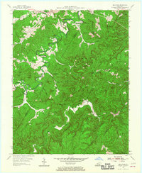
1954 Map of Bell Farm
USGS Topo · Published 1967About this map
The Cumberland National Forest defines the rugged border between Wayne and McCreary Counties, where the South Fork Cumberland River and Little South Fork Cumberland River carve deep through the plateau. This mid-century landscape is marked by isolated rural settlements and the infrastructure of early timber and resource extraction, including several scattered Oil Wells. High points like The Pilot and Stepping Rock Mountain overlook a network of creek-side communities characterized by small schools and country churches.
Find a feature on this map
60 named features on this map. Tap any name to fly to it.
Don’t see what you’re looking for? This feature index may not catch every label — zoom into the map to look around manually.
Map Details
Editions of this 1954 Bell Farm Map
3 editions found

Other maps of this area

1911 · Monticello
USGS Topo · 1:62,500

1914 · Monticello
USGS Topo · 1:62,500

1932 · Burnside
USGS Topo · 1:62,500

1934 · Barthell
USGS Topo · 1:62,500

1934 · Pall Mall
USGS Topo · 1:62,500

1953 · Monticello
USGS Topo · 1:24,000

1954 · Parmleysville
USGS Topo · 1:24,000

1954 · Coopersville
USGS Topo · 1:24,000
1954 · Nevelsville
USGS Topo · 1:24,000
1954 · Barthell
USGS Topo · 1:24,000