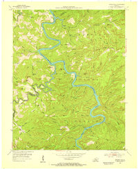
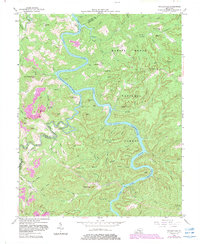
1954 Map of Nevelsville
USGS Topo · Published 1955About this map
The South Fork Cumberland River carves a winding path through the Cumberland National Forest in this mid-century topographic survey of McCreary and Wayne counties. The landscape is defined by the sharp descent from high ridges like Cotton Patch Ridge and Sellers Ridge to the river floor, where the water is marked as subject to controlled inundation to 760 feet. Local genealogy and community life are well-documented through scattered rural settlements such as Nevelsville and Jonesville, and landmarks like Green Grove Ch and the Lower Turkey Creek Sch. The terrain is famously steep, dotted with geological curiosities including the Natural Arch, Eureka Cave, and numerous riverfront cliffs like Hens Nest Cliff and Pound Cliff. This era shows the region before major modern developments, preserving the original locations of family sites like the Keith Cem Nevel and Jonesville Cem.
Find a feature on this map
107 named features on this map. Tap any name to fly to it.
Don’t see what you’re looking for? This feature index may not catch every label — zoom into the map to look around manually.
Map Details
Editions of this 1954 Nevelsville Map
5 editions found
Other maps of this area

1890 · Williamsburg
USGS Topo · 1:125,000

1894 · Williamsburg
USGS Topo · 1:125,000

1932 · Burnside
USGS Topo · 1:62,500

1934 · Barthell
USGS Topo · 1:62,500

1952 · Hail
USGS Topo · 1:24,000

1952 · Wiborg
USGS Topo · 1:24,000

1952 · Whitley City
USGS Topo · 1:24,000

1953 · Frazer
USGS Topo · 1:24,000

1954 · Coopersville
USGS Topo · 1:24,000

1954 · Burnside
USGS Topo · 1:24,000