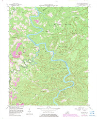
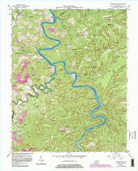
1954 Map of Nevelsville
USGS Topo · Published 1983About this map
South Fork Cumberland River carves a deep, winding path through the heart of the Daniel Boone National Forest, shaping a landscape defined by dramatic sandstone features like Pinnacle Rock and Natural Arch. The 1954 topography reveals a network of ridges and hollows where small communities and family farmsteads persisted along high ground, evidenced by scattered institutions such as Nevelsville and Cooper. The inclusion of photorevisions from 1981 illustrates the impact of the Lake Cumberland reservoir, showing how controlled inundation altered the low-lying reaches of the river and its tributaries.
Find a feature on this map
118 named features on this map. Tap any name to fly to it.
Don’t see what you’re looking for? This feature index may not catch every label — zoom into the map to look around manually.
Map Details
Editions of this 1954 Nevelsville Map
5 editions found
Other maps of this area

1890 · Williamsburg
USGS Topo · 1:125,000

1894 · Williamsburg
USGS Topo · 1:125,000

1932 · Burnside
USGS Topo · 1:62,500

1934 · Barthell
USGS Topo · 1:62,500

1952 · Hail
USGS Topo · 1:24,000

1952 · Wiborg
USGS Topo · 1:24,000

1952 · Whitley City
USGS Topo · 1:24,000

1953 · Frazer
USGS Topo · 1:24,000

1954 · Coopersville
USGS Topo · 1:24,000

1954 · Burnside
USGS Topo · 1:24,000