1900s (20th Century) Maps of Crowley, Louisiana
Explore 11 historic maps of Crowley from the 1900s (20th Century). These maps offer a rare glimpse into what life looked like during the 1900s — showing old roads, neighborhoods, homes, and landmarks that have changed or disappeared over time.
Whether you're researching your family's past, planning a metal detecting trip, or studying how Crowley's landscape evolved across the 1900s, these high-resolution maps are a powerful tool for exploring the history of this region.
- Focus on a specific era: All maps on this page are from the 1900s, giving you a focused view of this time period.
- See what’s changed: Compare century-old streets, trails, and buildings to today's modern landscape using overlays and satellite layers.
- Research with precision: Use these maps for genealogy, historical research, land use analysis, or educational projects.
- View, download, or print: Maps are fully viewable online in high resolution, and can be downloaded or printed for your own records.
Start exploring Crowley's history through authentic maps from the 1900s. This is your window into the past.
Crowley, LA maps
(11)- 1946 Map of Rayne
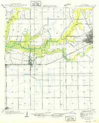
 1946 Rayne1946 Print · USGSAcadia Parish at the close of the Second World War shows a landscape shaped by rail lines and irrigation canals. Genealogists and local researchers can locate old community centers like Ebenezer Sch and Hebron Ch, or trace the winding parish boundaries along Bayou Queue De Tortue.
 - 1949 Map of Estherwood
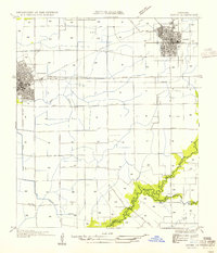
 1949 Estherwood1949 Print · USGSAcadia Parish in the late 1940s reveals a landscape defined by industrial rice farming and rail-line commerce. Genealogists and historians can trace the growth of Crowley, the Tartue Siding, and the irrigation network of Estherwood Canal.
 - 1952 Map of Lake Charles
 1952 Lake Charles1952 Print · USGSSouthwest Louisiana is captured here in the mid-fifties, showing a landscape defined by the rise of the petrochemical industry and deep-water navigation. Researchers can trace family roots through numerous small-town settlements and oil developments like Nibletts Bluff, the Lockport Oil Field, and Starks.
 - 1954 Map of Rayne
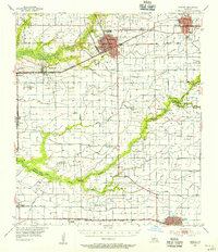
 1954 Rayne1954 Print · USGSAcadia Parish in the mid-fifties is captured here as a landscape of productive prairie and vital rail corridors. Genealogists and local historians can trace the rural layout of Ebenezer Sch and Hebron Ch, or follow the winding Bayou Queue de Tortue as it meanders past Faulk Bridge.
 - 1954 Map of Lake Charles, 1964 Print
 1954 Lake Charles1964 Print · USGSSouthwest Louisiana in the mid-fifties is defined by its massive petroleum industry and its complex network of bayous and rail lines. Researchers can trace the development of the Sulphur Mines Oil Field or locate historic settlements like Longville and De Quincy.3 unique versions available
 - 1955 Map of Crowley, 1956 Print
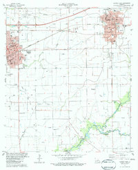
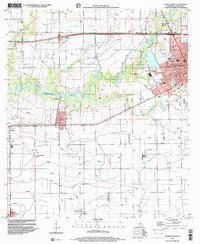
 1955 Crowley1956 Print · USGSAcadia Parish and the northern edge of Vermilion Parish are shown in the mid-fifties, during a period of agricultural and industrial expansion. Researchers can trace family history through numerous rural landmarks like Hebron Ch, Woodlawn Cem, and Simon Cem.4 unique versions available
 - 1983 Map of Crowley East
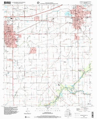
 1983 Crowley East1983 Print · USGSAcadia Parish at the start of the 1980s shows a landscape defined by the intersection of rail commerce and intensive agricultural irrigation. Researchers can trace historical family sites through St Joseph Cem and Notre Dame High Sch, or follow the industrial path of the Southern Pacific line.
 - 1983 Map of Crowley West
 1983 Crowley West1983 Print · USGSAcadia Parish in the early 1980s reveals a sophisticated network of canals and flumes supporting the prairie rice country. Researchers can trace family history at Leger Cem or explore the rail-based growth of Estherwood, Midland, and the western edge of Crowley.2 unique versions available
 - 1985 Map of Crowley, 1986 Print
 1985 Crowley1986 Print · USGSCoastal prairie and bayou country are captured in the mid-eighties as the rice-and-rail economy defined South Louisiana life. Genealogists and researchers can trace family lands and rural hubs from Crowley to Jennings, following the paths of the Southern Pacific Railroad and the winding Mermentau River.2 unique versions available
 - 1998 Map of Crowley East, 2000 Print
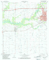
 1998 Crowley East2000 Print · USGSAcadia Parish in the late 1990s displays a landscape of growing towns and established rural traditions. Genealogists can trace family footprints across Woodlawn Cem, Leger Cem, and parish schools like Redemptorist Sch or South Sch.
 - 1998 Map of Crowley West, 2000 Print
 1998 Crowley West2000 Print · USGSAcadia Parish at the end of the nineties shows a landscape deeply tied to water management and aviation. Genealogists and historians can trace the irrigation networks and find family landmarks like Leger Cem, Estherwood, and the Ross Sch.
End of results
Showing maps 1-11 of 11
Top cities near Crowley
- Abbeville historical maps
- Rayne historical maps
- Kaplan historical maps
- Church Point historical maps
- Duson historical maps
- Gueydan historical maps
See more
Frequently asked questions
- What are the different types of historical maps available for Crowley?
- What is the oldest map of Crowley?
- Where can I purchase historical maps of Crowley for my home or office?
- Where can I download high-res historical maps of Crowley?
- Are there historical topographic maps available for Crowley?
- Is there historical aerial imagery available for Crowley?
- Where are historical maps of Crowley sourced from?