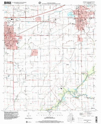
1998 Map of Crowley East
USGS Topo · Published 2000About this map
The agricultural and urban landscape of the Acadiana region is defined here by the meeting of three parishes—Acadia Parish, Lafayette Parish, and Vermilion Parish. This late 20th-century survey shows the dense network of schools and parishes in Crowley and Rayne, including Notre Dame High Sch and St. Michael Sch. The southern half of the map transitions into the intricate wetlands and drainage patterns of Bayou Queue de Tortue and Indian Bayou. The settlement of Ebenezer serves as a rural anchor among the fields, marked by Ebenezer Ch. Significant genealogical data is present through numerous burial grounds like Woodlawn Cem and the IOOF Cem, reflecting the deep-seated community roots of this prairie and bayou country.
Find a feature on this map
32 named features on this map. Tap any name to fly to it.
Don’t see what you’re looking for? This feature index may not catch every label — zoom into the map to look around manually.
Map Details
Editions of this 1998 Crowley East Map
This is the sole edition of this map. No revisions or reprints were ever made.
Other maps of this area

1934 · Duson
USGS Topo · 1:31,680

1935 · Branch
USGS Topo · 1:31,680

1946 · Morse
USGS Topo · 1:31,680

1946 · Leroy
USGS Topo · 1:31,680

1946 · Kaplan
USGS Topo · 1:31,680

1946 · Rayne
USGS Topo · 1:31,680

1947 · Branch
USGS Topo · 1:31,680

1947 · Iota
USGS Topo · 1:31,680

1949 · Estherwood
USGS Topo · 1:31,680

1952 · Lake Charles
USGS Topo · 1:250,000