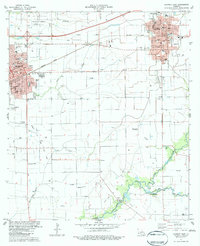
1983 Map of Crowley East
USGS Topo · Published 1983About this map
The Louisiana State University Experimental Station anchors the northern landscape of this Acadia Parish region, reflecting the area's deep ties to agricultural research during the early 1980s. The cities of Crowley and Rayne serve as the primary population centers, connected by the industrial corridor of the Southern Pacific railroad. The mapping reveals a complex network of water management essential to the local economy, including numerous siphons and flumes that crisscross the terrain between Bayou Blanc and the winding course of Bayou de Tortue. Genealogists and local historians can locate several burial grounds, such as Gossen Memorial Park Cem and Leger Cem, alongside community landmarks like Ebenezer Ch and the Crowley-Hains Landing Strip. The confluence of Acadia Parish, Lafayette Parish, and Vermilion Parish at the southern edge highlights the administrative and geographical intersections of these prairie-and-bayou districts.
Find a feature on this map
31 named features on this map. Tap any name to fly to it.
Don’t see what you’re looking for? This feature index may not catch every label — zoom into the map to look around manually.
Map Details
Editions of this 1983 Crowley East Map
This is the sole edition of this map. No revisions or reprints were ever made.
Other maps of this area

1934 · Duson
USGS Topo · 1:31,680

1935 · Branch
USGS Topo · 1:31,680

1946 · Morse
USGS Topo · 1:31,680

1946 · Leroy
USGS Topo · 1:31,680

1946 · Kaplan
USGS Topo · 1:31,680

1946 · Rayne
USGS Topo · 1:31,680

1947 · Branch
USGS Topo · 1:31,680

1947 · Iota
USGS Topo · 1:31,680

1949 · Estherwood
USGS Topo · 1:31,680

1952 · Lake Charles
USGS Topo · 1:250,000