1940s Maps of Bienville Parish, Louisiana
Explore 11 historic maps of Bienville Parish from the 1940s. These maps offer a rare glimpse into what life looked like during the 1940s — showing old roads, neighborhoods, homes, and landmarks that have changed or disappeared over time.
Whether you're researching your family's past, planning a metal detecting trip, or studying how Bienville Parish's landscape evolved across the 1940s, these high-resolution maps are a powerful tool for exploring the history of this region.
- Focus on a specific era: All maps on this page are from the 1940s, giving you a focused view of this time period.
- See what’s changed: Compare century-old streets, trails, and buildings to today's modern landscape using overlays and satellite layers.
- Research with precision: Use these maps for genealogy, historical research, land use analysis, or educational projects.
- View, download, or print: Maps are fully viewable online in high resolution, and can be downloaded or printed for your own records.
Start exploring Bienville Parish's history through authentic maps from the 1940s. This is your window into the past.
Bienville Parish, LA maps
(11)- 1941 Map of East Point
 1941 East Point1941 Print · USGSThe Red River Valley bottomlands are captured here in the late 1930s, showing a network of riverfront settlements and rural parish life. Researchers can trace family history through numerous landmarks like Elizabeth Church, Crichton School, and the St Marks Cemetery near the Bayou Toulon.
 - 1941 Map of Bossier Point
 1941 Bossier Point1941 Print · USGSThe marshlands and bottomlands of Bossier Parish come alive in the early 1940s, showing a landscape defined by the shifting waters of Lake Bistineau. Genealogists can trace family footprints at Fairview Cem or locate rural landmarks like Bear Island Sch and the Burkett Bridge.
 - 1947 Map of Ringgold
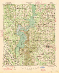 1947 Ringgold1947 Print · USGSNorthwestern Louisiana comes to life in the 1940s, centered on the growing town of Ringgold and the expansive waters of LAKE BISTINEAU. Trace local roots through rural landmarks like the NEW SALT WORKS, St Johns Ch, and the Ogden Spur railroad line.
 - 1947 Map of Goldonna
 1947 Goldonna1947 Print · USGSNorth Louisiana's timber and rail country is captured here just after the war, showing the rural communities of Natchitoches and Bienville Parishes. Researchers can locate local landmarks like Blooms Mill, trace the Louisiana and Arkansas Railroad, or find old school sites like Readhimer Sch.
 - 1947 Map of Ashland
 1947 Ashland1947 Print · USGSNorth Louisiana's parish boundaries converge in this mid-century landscape where timber and rail lines defined daily life. Genealogists can locate numerous rural landmarks like St Mathews Ch, Old Saline Cem, and the old rail stop at Ashland.
 - 1947 Map of Bienville, 1963 Print
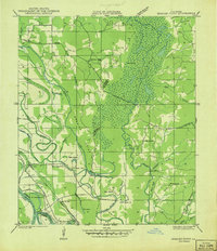
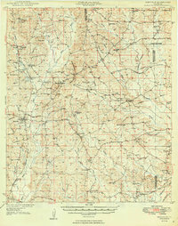
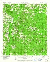 1947 Bienville1963 Print · USGSNorth central Louisiana is shown here in the mid-forties, characterized by a mix of timber, rail, and early gas exploration. Researchers can find numerous rural landmarks like Raspberry School, the Louisiana and Arkansas Railroad, and Driskill Mountain.2 unique versions available
 - 1948 Map of Coushatta
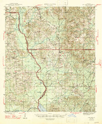
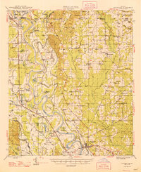 1948 Coushatta1948 Print · USGSRed River Parish and the surrounding hill country are captured here just after the war, showing the intricate river-and-rail network. Genealogists can trace family names through dozens of landmarks like Elizabeth Sch, St Pauls Cem, and Hall Summit.
 - 1948 Map of Jamestown, 1960 Print
 1948 Jamestown1960 Print · USGSNorthwest Louisiana's timber and oil lands appear here in the late 1940s, just as modern infrastructure began to weave through the piney woods. Genealogists can locate family sites near S Gamel Cemetery, Galilee School, and Rosenwald School.3 unique versions available
 - 1949 Map of Jamestown
 1949 Jamestown1949 Print · USGSNorthwestern Louisiana at mid-century reveals a landscape of rural communities and timbered bottoms along the parish lines. Genealogists can trace family roots at Little Hope Cem or Gamel Cem, while locating vanished schools like Baltimore Sch and Madden Sch.
 - 1949 Map of Bienville
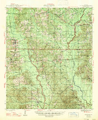
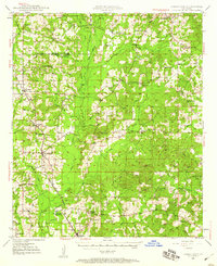
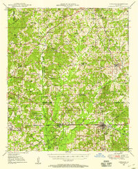
 1949 Bienville1949 Print · USGSNorthern Louisiana hill country is documented here in the late 1940s, showing the rural communities of Bienville Parish and its neighbors. Researchers can locate dozens of country churches and schools, including Raspberry School and Mt Villa Ch Cem, or trace the Louisiana and North West Railroad.2 unique versions available
 - 1949 Map of Gibsland, 1958 Print
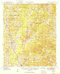
 1949 Gibsland1958 Print · USGSGibsland and the surrounding hill country are captured here at the height of the mid-century energy boom. Researchers can trace historic family connections at Germantown Church, locate the Athens Lookout Tower, and see the rail junction of the Illinois Central.2 unique versions available
End of results
Showing maps 1-11 of 11
Top cities of Bienville Parish
- Arcadia historical maps
- Ringgold historical maps
- Gibsland historical maps
- Saline historical maps
- Bienville historical maps
- Lucky historical maps
See more
Frequently asked questions
- What are the different types of historical maps available for Bienville Parish?
- What is the oldest map of Bienville Parish?
- Where can I purchase historical maps of Bienville Parish for my home or office?
- Where can I download high-res historical maps of Bienville Parish?
- Are there historical topographic maps available for Bienville Parish?
- Is there historical aerial imagery available for Bienville Parish?
- Where are historical maps of Bienville Parish sourced from?