Old Maps of Haughton, Louisiana for Academic Research
Study the evolution of Haughton with 43 high-resolution historic maps. Whether you're teaching, researching, or modeling changes in land use, these maps provide essential visual documentation of urban, environmental, and geographic change.
- Analyze long-term change: Track patterns in development, transportation, and natural features.
- Ideal for environmental or urban studies: Support academic projects with primary historical map data.
- Use in the classroom or lab: Educators and researchers rely on these maps to bring historical context to life.
These maps are a powerful tool for teaching, research, and visualizing how Haughton has changed over the decades.
Haughton, LA maps
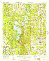
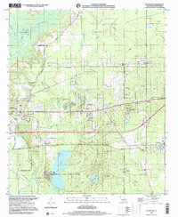
(43)- 1932 Map of Bossier SE
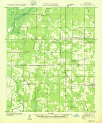 1932 Bossier SE1932 Print · USGSBossier Parish in the early 1930s is a landscape of growing military tracts and rural crossroads settlements. Genealogists can trace family footprints through numerous local landmarks, including Cedar Grove Sch, Rocky Mount Ch, and the Harper cemetery.
 - 1938 Map of Arnsberg
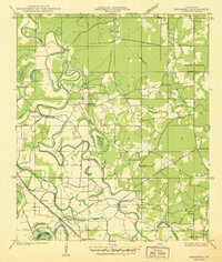 1938 Arnsberg1938 Print · USGSBossier Parish at the end of the 1930s reveals a landscape of dense river meanders and rail-side settlements. Trace family roots and vanished landmarks like Arnsberg, Taylortown, and rural schools such as Marshall Hill Sch or Indian Hill Sch.
 - 1947 Map of Ringgold
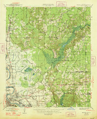
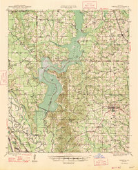 1947 Ringgold1947 Print · USGSNorthwestern Louisiana comes to life in the 1940s, centered on the growing town of Ringgold and the expansive waters of LAKE BISTINEAU. Trace local roots through rural landmarks like the NEW SALT WORKS, St Johns Ch, and the Ogden Spur railroad line.
 - 1947 Map of Minden, 1964 Print
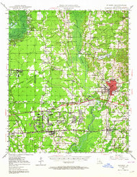 1947 Minden1964 Print · USGSMinden and the surrounding Webster Parish countryside are captured here in the mid-1940s, during a period of significant industrialization. Genealogists and local historians can trace family-named sites and rural centers like the Louisiana Ordnance Plant, Doyline, and Shady Grove Cem.2 unique versions available
 - 1948 Map of Bossier City
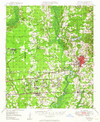
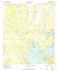
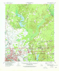
 1948 Bossier City1948 Print · USGSNorthwestern Louisiana during the late 1940s reveals a landscape shaped by the Red River and the expansion of the Bossier City area. Researchers can trace rural family sites near Benton or locate historical landmarks like Barksdale Field and Red River Ch.
 - 1948 Map of Caspiana
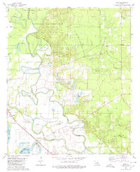
 1948 Caspiana1948 Print · USGSNorthwest Louisiana south of Shreveport is captured here in the late 1940s as the river-and-rail economy shaped the Red River Valley. Genealogists can trace family footprints across dozens of rural landmarks like Blenheim Sch, Robinson Chapel, and Evergreen Cem.
 - 1949 Map of Minden
 1949 Minden1949 Print · USGSNorthwest Louisiana's hill country and bayous are caught at a point of industrial transition just after the war. Researchers can trace the massive Louisiana Ordnance Plant, the bustling junction at Sibley, and local burial sites like Ratcliff Cemetery.
 - 1955 Map of Shreveport
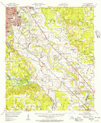
 1955 Shreveport1955 Print · USGSNorthern Louisiana in the mid-fifties is captured here as a landscape of military bases, vast oil fields, and burgeoning college towns. Genealogists and historians can trace the rail-and-river economy through the Monroe Gas Field, Grambling College, and Barksdale Air Force Base.3 unique versions available
 - 1955 Map of Caspiana, 1956 Print
 1955 Caspiana1956 Print · USGSShreveport and the Red River valley are captured here in the mid-fifties, just as the region's military and agricultural footprint was expanding. Researchers can trace the boundaries of Barksdale Air Force Base or locate rural landmarks like Daisy Grove Sch and Oakland Cem.3 unique versions available
 - 1955 Map of Bossier City, 1956 Print
 1955 Bossier City1956 Print · USGSBossier Parish at the height of the post-war era shows a landscape balancing military aviation and the oil industry with traditional rural settlements. Researchers can trace family roots at Macanesea Cem, locate the Benton Oil and Gas Field, or find the Pleasant Hill Sch (Abandoned).2 unique versions available
 - 1956 Map of Shreveport
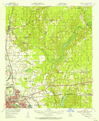
 1956 Shreveport1956 Print · USGSNorthern Louisiana during the mid-fifties presents a complex landscape of booming oil fields and strategic military installations. Genealogists and historians can trace the infrastructure of the Monroe Gas Field and family-named locales from Cotton Valley to Jonesboro.
 - 1956 Map of Ringgold, 1957 Print
 1956 Ringgold1957 Print · USGSThe Lake Bistineau region of northern Louisiana flourished in the mid-fifties as a hub of timber, gas extraction, and lakeside recreation. Genealogists and local historians can trace family-named landmarks such as Peggys Island, St Pauls Cem & Ch, and the settlement of Woodardville.2 unique versions available
 - 1972 Map of Koran, 1973 Print
 1972 Koran1973 Print · USGSNorthwest Louisiana in the early seventies shows a landscape where parish boundaries meet among the bayous and the expanding Lake Bistineau. Researchers can trace rural lineages through sites like Jerusalem Cem, Suggs Cem, and the community of Koran.2 unique versions available
 - 1972 Map of Ringgold, 1974 Print
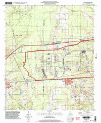
 1972 Ringgold1974 Print · USGSThe Louisiana parishes of Bossier, Webster, and Bienville are shown here in the early 1970s as industrial gas fields and lakeside recreation shaped the land. Genealogists can locate several local burial sites including Tooke Cem and Gilmer Cem, or trace the rail lines of the Kansas City Southern.
 - 1975 Map of Eastwood, 1978 Print
 1975 Eastwood1978 Print · USGSBossier Parish in the mid-seventies reveals a landscape transitioning from rural bayous to active military and industrial zones. Researchers can trace the massive Barksdale Air Force Base, old local landmarks like Pease Chapel, and the developing streets of Eastwood.
 - 1978 Map of Bossier City
 1978 Bossier City1978 Print · USGSBossier City and its surrounding parishes are shown during a period of rapid development and infrastructure growth in the late seventies. Genealogists and local historians can trace family locations near Hillcrest Memorial Park Cem, the historic settlement of Bellevue, or the rural Macedonia Cem.2 unique versions available
 - 1980 Map of Sligo
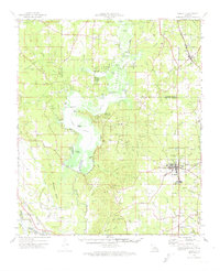
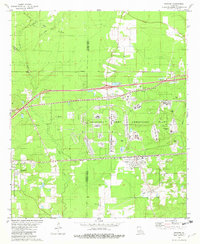
 1980 Sligo1980 Print · USGSThe Red River floodplain southeast of Bossier City comes into focus during the late 1970s as a landscape of military reserves and active oil fields. You can trace family roots at Oakland Cem and Mayflower Cem, or locate landmarks in Sligo and Taylortown.
 - 1981 Map of Doyline, 1982 Print
 1981 Doyline1982 Print · USGSNorthwest Louisiana at the start of the eighties reveals a complex landscape of military industry and rural settlement. Genealogists and historians can trace family locations near the Louisiana Army Ammunition Plant and old burying grounds like Allen Town Cem and Raine Cem.2 unique versions available
 - 1984 Map of Shreveport
 1984 Shreveport1984 Print · USGSNorthern Louisiana at the peak of the 1980s reveals a landscape of massive water management projects and Cold War military hubs. Trace the rail lines of the Kansas City Southern Ry past Barksdale Air Force Base and the high ground of Driskill Mountain.2 unique versions available
 - 1985 Map of Shreveport South
 1985 Shreveport South1985 Print · USGSNorthwest Louisiana in the mid-eighties shows a landscape defined by the Red River and a transition from urban centers to deep timberland. Researchers can trace the rail-and-river economy through landmarks like Barksdale Air Force Base, the Sligo Oil and Gas Field, and Lake Bistineau.2 unique versions available
 - 1986 Map of Shreveport North
 1986 Shreveport North1986 Print · USGSNorthern Louisiana in the mid-eighties shows a landscape of expansive river bottoms and growing suburban centers. Genealogists and historians can trace the development of Shreveport, the infrastructure of Barksdale Air Force Base, and rural life in Rocky Mount.2 unique versions available
 - 1998 Map of Doyline, 2004 Print
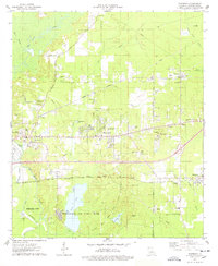
 1998 Doyline2004 Print · USGSNorth Louisiana’s industrial and rural landscapes meet in the late nineties, showcasing the intersection of military infrastructure and small-town life. Researchers can locate family landmarks like Jim Davis Cem and Allen Town Cem or trace the vast Louisiana Army Ammunition Plant.
 - 1999 Map of Eastwood, 2000 Print
 1999 Eastwood2000 Print · USGSBossier Parish at the close of the century shows a unique landscape where military aviation and bayou country meet. Researchers can trace family history through numerous rural landmarks like St Johns Ch, Fillmore Cem, and the sprawling grounds of Barksdale Air Force Base.
 - 2012 Map of Sligo, 2012 Print
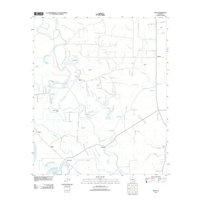 2012 Sligo2012 Print · USGSCovers Haughton, including Bossier City, Sligo, and other nearby areas
 - 2012 Map of Doyline, 2012 Print
 2012 Doyline2012 Print · USGSCovers Haughton, including Doyline, Goodwill, and other nearby areas
Showing maps 1-25 of 43
Top cities near Haughton
- Shreveport historical maps
- Bossier City historical maps
- Minden historical maps
- Benton historical maps
- Ringgold historical maps
- Sibley historical maps
See more
Frequently asked questions
- What are the different types of historical maps available for Haughton?
- What is the oldest map of Haughton?
- Where can I purchase historical maps of Haughton for my home or office?
- Where can I download high-res historical maps of Haughton?
- Are there historical topographic maps available for Haughton?
- Is there historical aerial imagery available for Haughton?
- Where are historical maps of Haughton sourced from?