1930s Maps of Lake Charles, Louisiana
Explore 3 historic maps of Lake Charles from the 1930s. These maps offer a rare glimpse into what life looked like during the 1930s — showing old roads, neighborhoods, homes, and landmarks that have changed or disappeared over time.
Whether you're researching your family's past, planning a metal detecting trip, or studying how Lake Charles's landscape evolved across the 1930s, these high-resolution maps are a powerful tool for exploring the history of this region.
- Focus on a specific era: All maps on this page are from the 1930s, giving you a focused view of this time period.
- See what’s changed: Compare century-old streets, trails, and buildings to today's modern landscape using overlays and satellite layers.
- Research with precision: Use these maps for genealogy, historical research, land use analysis, or educational projects.
- View, download, or print: Maps are fully viewable online in high resolution, and can be downloaded or printed for your own records.
Start exploring Lake Charles's history through authentic maps from the 1930s. This is your window into the past.
Lake Charles, LA maps
(3)- 1932 Map of Moss Lake
 1932 Moss Lake1932 Print · USGSCoastal Calcasieu Parish comes to life in the early 1930s as the Intracoastal Waterway begins to reshape the landscape. Researchers can trace family roots at Hackberry or locate the historic Dutch Cove Cemetery and Ellender Ferry crossings.
 - 1932 Map of Lake Charles NW
 1932 Lake Charles NW1932 Print · USGSLake Charles and Calcasieu Parish are shown here in the early thirties as the region’s rail and water networks supported a growing coastal economy. Genealogists can locate family landmarks like La Grange High Sch, Davies, and the Lake Charles Landing Field.
 - 1935 Map of Moss Bluff
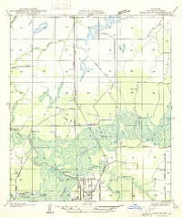 1935 Moss Bluff1935 Print · USGSCalcasieu Parish at the midpoint of the thirties reveals a river-driven landscape being reshaped by the Southern Pacific railroad. Genealogists and historians can locate family landmarks like Ritchie Cem, the old Moser Mill, and river crossings at Goss Ferry.
End of results
Showing maps 1-3 of 3
Top cities near Lake Charles
Top neighborhoods of Lake Charles
- Goosport historical maps
- Greinwich Village historical maps
- Pine Acres Trailer Park historical maps
- University Place historical maps
- The Ihles Townhomes historical maps
Frequently asked questions
- What are the different types of historical maps available for Lake Charles?
- What is the oldest map of Lake Charles?
- Where can I purchase historical maps of Lake Charles for my home or office?
- Where can I download high-res historical maps of Lake Charles?
- Are there historical topographic maps available for Lake Charles?
- Is there historical aerial imagery available for Lake Charles?
- Where are historical maps of Lake Charles sourced from?