1980s Maps of Lucas, Louisiana
Explore 2 historic maps of Lucas from the 1980s. These maps offer a rare glimpse into what life looked like during the 1980s — showing old roads, neighborhoods, homes, and landmarks that have changed or disappeared over time.
Whether you're researching your family's past, planning a metal detecting trip, or studying how Lucas's landscape evolved across the 1980s, these high-resolution maps are a powerful tool for exploring the history of this region.
- Focus on a specific era: All maps on this page are from the 1980s, giving you a focused view of this time period.
- See what’s changed: Compare century-old streets, trails, and buildings to today's modern landscape using overlays and satellite layers.
- Research with precision: Use these maps for genealogy, historical research, land use analysis, or educational projects.
- View, download, or print: Maps are fully viewable online in high resolution, and can be downloaded or printed for your own records.
Start exploring Lucas's history through authentic maps from the 1980s. This is your window into the past.
Lucas, LA maps
(2)- 1982 Map of Lunita, 1983 Print
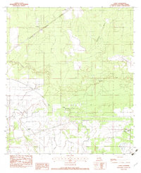 1982 Lunita1983 Print · USGSCalcasieu Parish in the early eighties shows a transition from rural timberland to managed water systems. Genealogists can locate family landmarks like Benevolent Cemetery and the settlements of Lunita and Big Woods.
 - 1986 Map of Lake Charles
 1986 Lake Charles1986 Print · USGSThe Louisiana-Texas borderlands are captured here in the mid-1980s, showcasing the industrial growth of the Lake Charles region and its rail-linked satellite towns. Trace the evolution of coastal settlements and family landmarks from Sulphur to the Highland Cem.2 unique versions available
End of results
Showing maps 1-2 of 2
Top cities near Lucas
Frequently asked questions
- What are the different types of historical maps available for Lucas?
- What is the oldest map of Lucas?
- Where can I purchase historical maps of Lucas for my home or office?
- Where can I download high-res historical maps of Lucas?
- Are there historical topographic maps available for Lucas?
- Is there historical aerial imagery available for Lucas?
- Where are historical maps of Lucas sourced from?