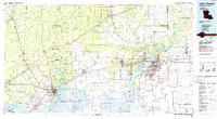
1986 Map of Lake Charles
USGS Topo · Published 1986About this map
The Calasieu River and Sabine River systems dominate this mid-1980s landscape, illustrating the industrial and residential growth across the Texas-Louisiana border. The hub of Lake Charles is shown alongside industrial neighbors like Westlake, Sulphur, and Goosport, while the northern reaches transition into the pine-wooded expanses near De Quincy. This planimetric study documents the mid-century expansion of transit networks, notably the Kansas City Southern and Southern Pacific railroads which intersect the region's diverse terrain. From the protected grounds of Sam Houston Jones State Park to the small-town life in Iowa and Vidor, the map records a specific moment of coastal-plain development. Researchers can trace family history through sites like Highland Cem or observe the intricate waterways of Choupique Island and Turner Island.
Find a feature on this map
87 named features on this map. Tap any name to fly to it.
Don’t see what you’re looking for? This feature index may not catch every label — zoom into the map to look around manually.
Map Details
Editions of this 1986 Lake Charles Map
2 editions found
Other maps of this area

1926 · Terry
USGS Topo · 1:24,000

1926 · Lakeview
USGS Topo · 1:24,000

1926 · Vidor
USGS Topo · 1:24,000

1926 · Texla
USGS Topo · 1:24,000

1926 · Mauriceville
USGS Topo · 1:24,000

1932 · Lake Charles NE
USGS Topo · 1:31,680

1932 · Moss Lake
USGS Topo · 1:31,680

1932 · Beaumont
USGS Topo · 1:62,500

1932 · Lake Charles NW
USGS Topo · 1:31,680

1932 · Orange
USGS Topo · 1:62,500