Old Maps of Ferriday, Louisiana for Academic Research
Study the evolution of Ferriday with 23 high-resolution historic maps. Whether you're teaching, researching, or modeling changes in land use, these maps provide essential visual documentation of urban, environmental, and geographic change.
- Analyze long-term change: Track patterns in development, transportation, and natural features.
- Ideal for environmental or urban studies: Support academic projects with primary historical map data.
- Use in the classroom or lab: Educators and researchers rely on these maps to bring historical context to life.
These maps are a powerful tool for teaching, research, and visualizing how Ferriday has changed over the decades.
Ferriday, LA maps
(23)- 1909 Map of Sycamore Landing
 1909 Sycamore Landing1909 Print · USGSThe riverfront of Concordia Parish comes alive in the early twentieth century as plantations and rail lines intersect along the Mississippi. Genealogists and historians can trace family roots at Lucerna Plantation or locate community centers like Rufus Baptist Church and Morville.
 - 1939 Map of Red Gum, 1941 Print
 1939 Red Gum1941 Print · USGSConcordia Parish sits at a vital rail and river junction during the late thirties. Researchers can locate numerous historic landings and community pillars like the Rosenwald Sch, New St John Ch, and the crossroads at Ferriday.2 unique versions available
 - 1953 Map of Natchez, 1966 Print
 1953 Natchez1966 Print · USGSSouthwest Mississippi and the Louisiana border country come alive in this mid-century survey of the river valley and forest lands. Researchers can trace the rail lines of the Illinois Central RR and locate rural hubs like Gloster and Ferriday.3 unique versions available
 - 1956 Map of Natchez
 1956 Natchez1956 Print · USGSThe Mississippi River borderlands and the Pine Hills come alive in this mid-fifties study of the Natchez region. Genealogists and historians can trace rail-era towns along the Illinois Central RR and explore the oxbows of Lake Bruin and Lake Concordia.
 - 1959 Map of Natchez
 1959 Natchez1959 Print · USGSSouthwestern Mississippi and eastern Louisiana are captured in the late fifties, showing a landscape defined by the winding Mississippi River and the timbered Homochitto National Forest. Researchers can trace the sprawling Illinois Central RR and find rural landmarks like Union Church and Camp Van Dorn (Abandoned).
 - 1961 Map of Ferriday, 1962 Print
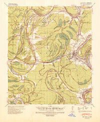
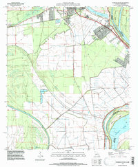
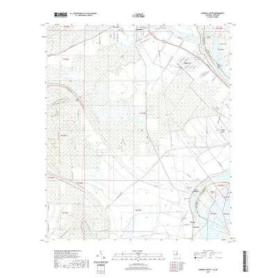
 1961 Ferriday1962 Print · USGSConcordia Parish and the Mississippi River bottomlands are captured here in the early sixties, showing a landscape of bayous and rail towns. Researchers can locate many rural landmarks including St Peters Ch, Sevier High Sch, and family sites near Clayton and Frogmore.2 unique versions available
 - 1983 Map of Ferriday South, 1984 Print
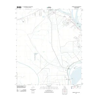
 1983 Ferriday South1984 Print · USGSThe alluvial plains of Concordia Parish and Adams County are captured here in the early 1980s. Genealogists can locate family landmarks like Lambert Cem and Sawyer Cem or churches including Shady Acres Ch and St Thomas Ch.
 - 1983 Map of Ferriday North, 1984 Print
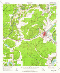
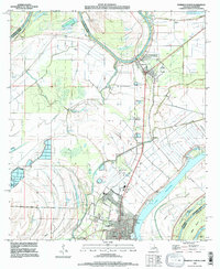
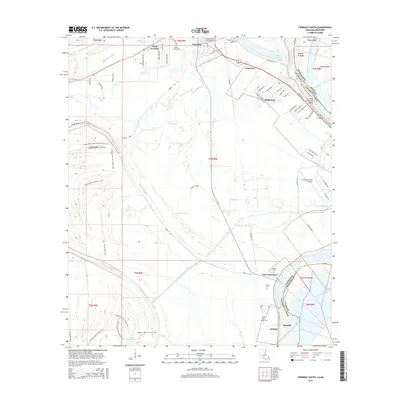
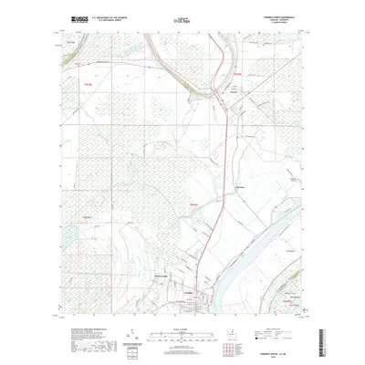
 1983 Ferriday North1984 Print · USGSThe delta country of Concordia Parish is captured here in the early 1980s as the river economy and rail lines shaped local life. Researchers can trace family history through sites like Hill Memorial Ch, Rogers Cem, and the neighborhoods of Ferriday.2 unique versions available
 - 1984 Map of Natchez
 1984 Natchez1984 Print · USGSThe Mississippi-Louisiana borderlands in the mid-eighties show a landscape defined by the winding Mississippi River and its rail networks. Trace family history at the Natchez National Cemetery or explore the river towns of Vidalia and Ferriday.
 - 1991 Map of Natchez, 1992 Print
 1991 Natchez1992 Print · USGSThe Mississippi River valley at the turn of the nineties reveals a landscape of oxbow lakes, river landings, and bustling bluff-top towns. Genealogists and historians can trace the rail corridors of the Illinois Central Gulf Railroad through Fayette or locate family roots in riverside settlements like Waterproof and St Joseph.
 - 1995 Map of Ferriday South, 1997 Print
 1995 Ferriday South1997 Print · USGSConcordia Parish sits along a dynamic stretch of the Mississippi during the 1990s, where river chutes and bayous shape the land. Researchers can find precise locations for St James Cem, Ridgecrest street layouts, and family-named landmarks like Sawyer Cem.
 - 1995 Map of Ferriday North, 1997 Print
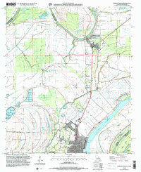
 1995 Ferriday North1997 Print · USGSConcordia Parish in the mid-nineties is defined by its intricate delta waterways and the protective reach of the river levees. Genealogists and researchers can trace the neighborhoods of Ferriday or locate rural landmarks like Calhoun Cem and Red Gum.
 - 1999 Map of Ferriday North, 2000 Print
 1999 Ferriday North2000 Print · USGSThe Louisiana-Mississippi borderlands come into focus at the end of the century, showing the intricate wetlands of the Mississippi floodplain. Genealogists and researchers can trace family landmarks like Rogers Cem and the riverfront streets of Ferriday.
 - 2012 Map of Ferriday North, 2012 Print
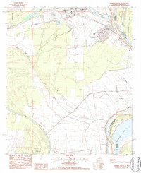
 2012 Ferriday North2012 Print · USGSCovers Ferriday, including Clayton, West Ferriday, and other nearby areas
 - 2012 Map of Ferriday South, 2012 Print
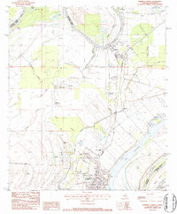
 2012 Ferriday South2012 Print · USGSCovers Ferriday, including Ridgecrest, Sycamore, and other nearby areas
 - 2015 Map of Ferriday North, 2015 Print
 2015 Ferriday North2015 Print · USGSCovers Ferriday, including Clayton, West Ferriday, and other nearby areas
 - 2015 Map of Ferriday South, 2015 Print
 2015 Ferriday South2015 Print · USGSCovers Ferriday, including Ridgecrest, Sycamore, and other nearby areas
 - 2018 Map of Ferriday North, 2018 Print
 2018 Ferriday North2018 Print · USGSCovers Ferriday, including Clayton, West Ferriday, and other nearby areas
 - 2018 Map of Ferriday South, 2018 Print
 2018 Ferriday South2018 Print · USGSCovers Ferriday, including Ridgecrest, Sycamore, and other nearby areas
 - 2020 Map of Ferriday South, 2020 Print
 2020 Ferriday South2020 Print · USGSCovers Ferriday, including Ridgecrest, Sycamore, and other nearby areas
 - 2020 Map of Ferriday North, 2020 Print
 2020 Ferriday North2020 Print · USGSCovers Ferriday, including Clayton, West Ferriday, and other nearby areas
 - 2024 Map of Ferriday South, 2024 Print
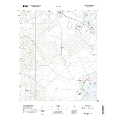
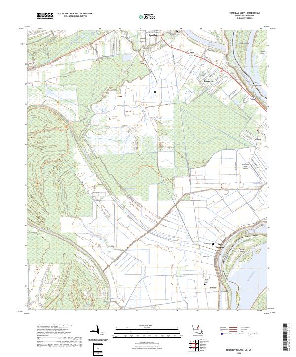 2024 Ferriday South2024 Print · USGSThe Louisiana bottomlands south of Ferriday come to life in this recent study of the Mississippi River floodplain. Genealogists and historians can trace the locations of Turner Acres Cem and Sawyer Cem or explore the riverfront settlements of Morville and Willetts.
 - 2024 Map of Ferriday North, 2024 Print
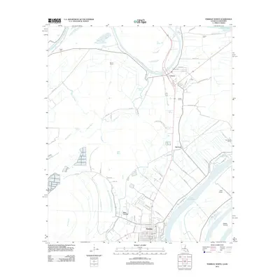
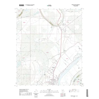
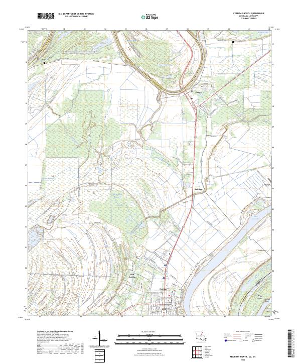 2024 Ferriday North2024 Print · USGSUpper Concordia Parish in the 2020s shows a landscape of river-bend settlements and complex bayou systems. Genealogists and local historians can trace the streets of Ferriday and Clayton, or locate family sites near Calhoun Cem and Rogers Cem.
End of results
Showing maps 1-23 of 23
Top cities near Ferriday
- Natchez historical maps
- Vidalia historical maps
- Ridgecrest historical maps
- Clayton historical maps
- Waterproof historical maps
- Sicily Island historical maps
Frequently asked questions
- What are the different types of historical maps available for Ferriday?
- What is the oldest map of Ferriday?
- Where can I purchase historical maps of Ferriday for my home or office?
- Where can I download high-res historical maps of Ferriday?
- Are there historical topographic maps available for Ferriday?
- Is there historical aerial imagery available for Ferriday?
- Where are historical maps of Ferriday sourced from?