Old Maps of Baton Rouge, Louisiana for Hiking & Exploration
Hike through history with 79 historic maps of Baton Rouge. Explore old trails, ghost towns, and forgotten backroads — perfect for outdoor adventurers and local explorers.
- Rediscover forgotten places: Map out old mining camps, roads, and footpaths that no longer exist on modern maps.
- Layer with modern tools: Combine with LiDAR or satellite views to plan hikes through historical terrain.
- Made for exploration: Popular among hikers, overlanders, and local history lovers.
Use these maps to find adventure and explore the hidden past of Baton Rouge.
Baton Rouge, LA maps
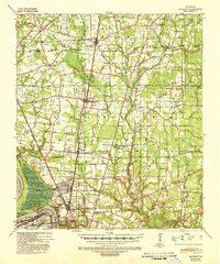
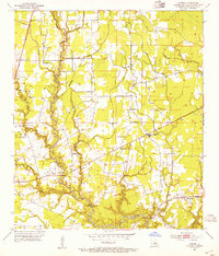
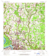
(79)- 1906 Map of Bayou Sara
 1906 Bayou Sara1906 Print · USGSThe Feliciana parishes and the Mississippi River bottomlands come to life in this early twentieth-century survey. Genealogists can trace family footprints through river-town settlements like St Francisville or find early rail stops such as Gayden Sta (Gurley P.O.) and Slaughter.3 unique versions available
 - 1908 Map of Baton Rouge, 1921 Print
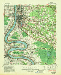
 1908 Baton Rouge1921 Print · USGSBaton Rouge and the surrounding river parishes are captured here at the dawn of the twentieth century, as the railroad network began to rival the river. Genealogists can locate family landmarks like Harelsons Store, Morning Star Church, and the community of Benton's.2 unique versions available
 - 1934 Map of Denham Springs
 1934 Denham Springs1934 Print · USGSLouisiana's river parishes come to life in the early 1930s as settlement spreads from the railroads into the bayous. Genealogists can trace family names at Broussard Grove Ch, locate the Rosenwald Sch, or find the old French Settlement Ferry crossing.2 unique versions available
 - 1939 Map of Zachary, 1941 Print
 1939 Zachary1941 Print · USGSEast Baton Rouge and East Feliciana parishes are documented here in the late 1930s, showing the vital rail-and-river economy before modern suburbanization. Genealogists can trace early landmarks like Leland College, Goodhope Ch, and the many cemeteries along White Bayou.2 unique versions available
 - 1939 Map of Denham Springs, 1942 Print
 1939 Denham Springs1942 Print · USGSLouisiana's river country comes alive in this pre-war survey of the Amite River basin during its transition to the modern highway era. Researchers can locate family roots at St Josephs Ch & Cem, track the old French Settlement Ferry, or find the Hoo Shoo Too Club.2 unique versions available
 - 1939 Map of Baton Rouge, 1947 Print
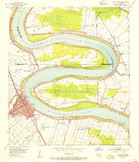
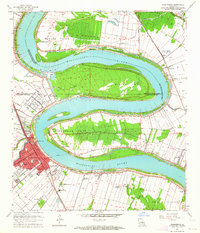
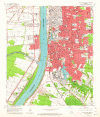
 1939 Baton Rouge1947 Print · USGSBaton Rouge and the Mississippi River transition from a plantation-based economy to a burgeoning rail hub just before World War II. Genealogists and historians can trace the foundations of local communities through landmarks like Poplar Grove Plantation, Rose Hill Ch Sch & Cem, and the riverfront at Port Allen.4 unique versions available
 - 1953 Map of Baton Rouge West, 1954 Print
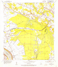
 1953 Baton Rouge West1954 Print · USGSBaton Rouge and its riverfront were entering a period of significant post-war expansion in the early fifties. Genealogists can trace family roots through numerous parish landmarks like Poplar Grove Plantation, Cinclare, and the St John Cem.
 - 1953 Map of Plaquemine, 1954 Print
 1953 Plaquemine1954 Print · USGSThe river bends and plantation lands of Iberville Parish are shown here in the mid-1950s, highlighting the transition between water and rail transport. Researchers can trace historic family lands like St Louis Plantation or locate the Plaquemine Lock and Conrad Cem.
 - 1953 Map of St. Gabriel, 1954 Print
 1953 St. Gabriel1954 Print · USGSThe river parishes of Louisiana come into focus in the 1950s, showing a landscape of rail lines and bayous at the edge of the Mississippi. Researchers can locate the Louisiana Prison Farm Camp "M" or trace family sites near St Gabriel, Sunshine, and Mt Carmel Ch.
 - 1953 Map of Baton Rouge East, 1954 Print
 1953 Baton Rouge East1954 Print · USGSEast Baton Rouge Parish at the height of the early fifties growth spurt shows a landscape transitioning from rural parishes to suburban hubs. Genealogists and historians can locate family landmarks such as Kleinpeter Cem or rural centers like St George Ch and the Baton Rouge Engineer Depot.
 - 1953 Map of Comite, 1954 Print
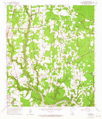
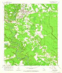
 1953 Comite1954 Print · USGSEast Baton Rouge Parish comes into focus during the early fifties, showing the rural communities and bayous north of the city. Genealogists and local historians can locate Central High Sch, the Odom Cem, and early settlements like Zion City.2 unique versions available
 - 1953 Map of Denham Springs, 1954 Print
 1953 Denham Springs1954 Print · USGSDenham Springs and the surrounding parishes are captured here in the early fifties, showing a landscape defined by river bends and rail lines. Researchers can trace family history through sites like Palmetto Cem, Eden Ch, and the 7th Ward Sch.2 unique versions available
 - 1954 Map of Scotlandville, 1955 Print
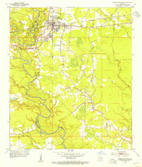
 1954 Scotlandville1955 Print · USGSNorth of Baton Rouge in the mid-fifties, the Mississippi River bluffs supported a mix of academic institutions and river-dependent industry. Genealogists and historians can trace the campuses of Southern University and Leland College, as well as Free Negro Point and Nickwack Cem.
 - 1954 Map of Baton Rouge, 1974 Print
 1954 Baton Rouge1974 Print · USGSSoutheast Louisiana in the mid-fifties is captured here during a period of transition for its river and rail economies. Researchers can trace the path of the Mississippi River and find landmarks like the Bonnet Carre Spillway and Bayou Plaquemine.2 unique versions available
 - 1956 Map of Baton Rouge
 1956 Baton Rouge1956 Print · USGSSouth Louisiana at the height of the mid-century oil boom shows a landscape of river oxbows and rising industry. Researchers can trace family roots through river towns like Scotlandville or locate early industrial sites and Oil wells near Lake Maurepas.
 - 1961 Map of Baton Rouge, 1966 Print
 1961 Baton Rouge1966 Print · USGSSoutheastern Louisiana in the early sixties remains a landscape of deep river bends and sprawling coastal lakes. Genealogists and historians can trace the rail-and-river economy through landmarks like Free-Nigger Point, Donaldsonville, and the Illinois Central Railroad.
 - 1962 Map of Baton Rouge
 1962 Baton Rouge1962 Print · USGSSouth Louisiana in the early sixties reveals a landscape of river-bend parishes and emerging interstate corridors. Genealogists and historians can trace family roots through historic river towns like Donaldsonville and Plaquemine, or follow the path of the Illinois Central Railroad through the swamp basins.
 - 1962 Map of Comite, 1964 Print
 1962 Comite1964 Print · USGSEast Baton Rouge Parish in the early sixties shows a landscape of bayous and new subdivisions emerging from older farmsteads. Genealogists can trace family names through landmarks like Odom Cem, Sharks Cem, and the rural Zoar Ch near the river.5 unique versions available
 - 1963 Map of Plaquemine, 1964 Print
 1963 Plaquemine1964 Print · USGSIberville Parish and the Mississippi River loops are captured here in the early sixties as the sugar and rail economies remained central to the landscape. Genealogists can trace family roots through named estates like St Louis Plantation and settlements such as Morrisonville and Seymourville.5 unique versions available
 - 1963 Map of Baton Rouge East, 1964 Print
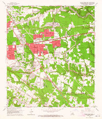 1963 Baton Rouge East1964 Print · USGSBaton Rouge’s eastern expansion is in full swing during the early sixties as residential subdivisions begin to replace old farmland. Genealogists and local historians can trace the development of Broadmoor, the Kleinpeter Cem, and the Downtown Airport.5 unique versions available
 - 1963 Map of Scotlandville, 1964 Print
 1963 Scotlandville1964 Print · USGSThe northern reaches of Baton Rouge during the early sixties show a landscape balancing institutional growth with the industrial riverfront. Researchers can trace the footprints of Southern University, Leland College, and local landmarks like Free Negro Point.5 unique versions available
 - 1963 Map of St. Gabriel, 1964 Print
 1963 St. Gabriel1964 Print · USGSJust south of Baton Rouge in the early sixties, this area shows a landscape of riverfront parishes and rising energy production. Trace family roots and land use near St Gabriel, St Raphael Cem, and the Burtville Oil Field.6 unique versions available
 - 1963 Map of Denham Springs, 1964 Print
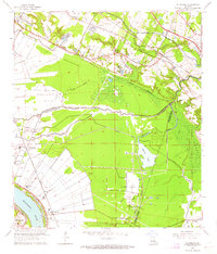
 1963 Denham Springs1964 Print · USGSDenham Springs and the surrounding river country are captured here in the early sixties as the suburban landscape began to expand. Genealogists and local historians can trace family roots through sites like Palmetto Cem, Hebron Ch, and the old 7th Ward Sch.3 unique versions available
 - 1963 Map of Baton Rouge West, 1964 Print
 1963 Baton Rouge West1964 Print · USGSBaton Rouge and the river parishes are captured in the early sixties as industrial expansion meets established plantation history. Trace the development of LSU, the busy Port Allen waterfront, and historic sites like Poplar Grove Plantation.5 unique versions available
 - 1963 Map of Zachary, 1967 Print
 1963 Zachary1967 Print · USGSThe northern corridor of East Baton Rouge Parish shows a blend of river industry and growing suburban centers in the early sixties. Genealogists can locate dozens of church-linked burial sites like Azalea Rest Cem and schools such as Leland College or Southern University.2 unique versions available
Showing maps 1-25 of 79
Top cities near Baton Rouge
- St. George historical maps
- Saint George historical maps
- Prairieville historical maps
- Central historical maps
- Baker historical maps
- Zachary historical maps
See more
Top neighborhoods of Baton Rouge
- Camelot historical maps
- Carmen Terrace historical maps
- Ashley historical maps
- East Sherwood Forest historical maps
- Green Back Forest historical maps
- Eastgate historical maps
See more
Frequently asked questions
- What are the different types of historical maps available for Baton Rouge?
- What is the oldest map of Baton Rouge?
- Where can I purchase historical maps of Baton Rouge for my home or office?
- Where can I download high-res historical maps of Baton Rouge?
- Are there historical topographic maps available for Baton Rouge?
- Is there historical aerial imagery available for Baton Rouge?
- Where are historical maps of Baton Rouge sourced from?