2020s Maps of Welsh, Louisiana
Explore 4 historic maps of Welsh from the 2020s. These maps offer a rare glimpse into what life looked like during the 2020s — showing old roads, neighborhoods, homes, and landmarks that have changed or disappeared over time.
Whether you're researching your family's past, planning a metal detecting trip, or studying how Welsh's landscape evolved across the 2020s, these high-resolution maps are a powerful tool for exploring the history of this region.
- Focus on a specific era: All maps on this page are from the 2020s, giving you a focused view of this time period.
- See what’s changed: Compare century-old streets, trails, and buildings to today's modern landscape using overlays and satellite layers.
- Research with precision: Use these maps for genealogy, historical research, land use analysis, or educational projects.
- View, download, or print: Maps are fully viewable online in high resolution, and can be downloaded or printed for your own records.
Start exploring Welsh's history through authentic maps from the 2020s. This is your window into the past.
Welsh, LA maps
(4)- 2020 Map of Welsh South, 2020 Print
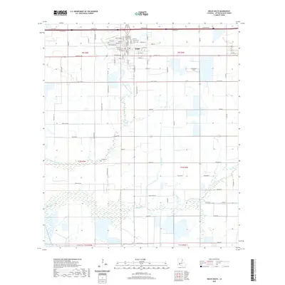 2020 Welsh South2020 Print · USGSCovers Welsh, including Jefferson Davis Parish, United States, and other nearby areas
 - 2020 Map of Welsh North, 2020 Print
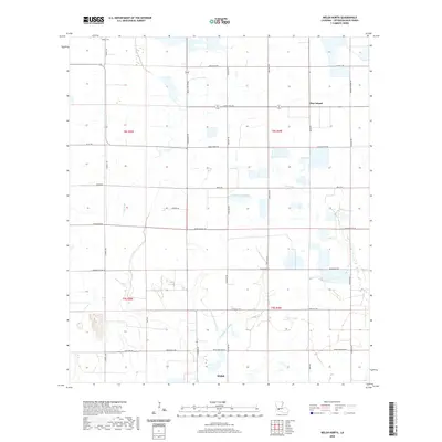 2020 Welsh North2020 Print · USGSCovers Welsh, including Pine Island, Jefferson Davis Parish, and other nearby areas
 - 2024 Map of Welsh North, 2024 Print
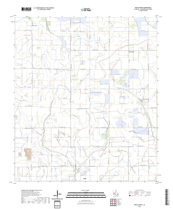 2024 Welsh North2024 Print · USGSJefferson Davis Parish comes into sharp focus in this recent survey of the Louisiana wetlands. Genealogists and local historians can locate the historic LeBleu Cem, trace the waters of East Bayou Lacassine, and explore the rural settlement at Pine Island.
 - 2024 Map of Welsh South, 2024 Print
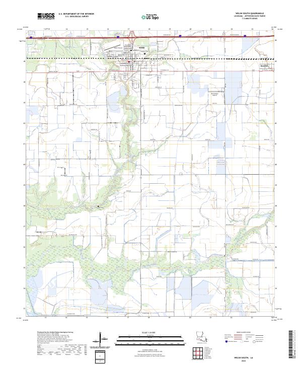 2024 Welsh South2024 Print · USGSSouthern Jefferson Davis Parish is seen here in recent years, centered on the agricultural town of Welsh. Researchers can trace local heritage through landmarks like Our Lady of Seven Dolors Catholic Cem and the waters of East Bayou Lacassine.
End of results
Showing maps 1-4 of 4
Top cities near Welsh
- Jennings historical maps
- Lake Arthur historical maps
- Iowa historical maps
- Hayes historical maps
- Mermentau historical maps
- Roanoke historical maps
See more
Frequently asked questions
- What are the different types of historical maps available for Welsh?
- What is the oldest map of Welsh?
- Where can I purchase historical maps of Welsh for my home or office?
- Where can I download high-res historical maps of Welsh?
- Are there historical topographic maps available for Welsh?
- Is there historical aerial imagery available for Welsh?
- Where are historical maps of Welsh sourced from?