Old Maps of Elmer, Louisiana for Hiking & Exploration
Hike through history with 17 historic maps of Elmer. Explore old trails, ghost towns, and forgotten backroads — perfect for outdoor adventurers and local explorers.
- Rediscover forgotten places: Map out old mining camps, roads, and footpaths that no longer exist on modern maps.
- Layer with modern tools: Combine with LiDAR or satellite views to plan hikes through historical terrain.
- Made for exploration: Popular among hikers, overlanders, and local history lovers.
Use these maps to find adventure and explore the hidden past of Elmer.
Elmer, LA maps
(17)- 1892 Map of Thibodaux, 1898 Print
 1892 Thibodaux1898 Print · USGSCajun country at the end of the nineteenth century is defined here by the winding course of Bayou Lafourche and its riverside communities. Genealogists and local historians can trace the early footprints of Thibodeaux and Labadieville alongside rail lines like the Southern Pacific Railroad.3 unique versions available
 - 1932 Map of Thibodaux SE
 1932 Thibodaux SE1932 Print · USGSLafourche Parish is captured in the early 1930s, revealing a landscape of historic bayou settlements and extensive sugar plantations. Genealogists can trace family lands and community landmarks from Laurel Valley Plantation to Blue Lily Cem and the Choupic Sch.
 - 1938 Map of Lafourche
 1938 Lafourche1938 Print · USGSThe Bayou Lafourche corridor is captured here in the late 1930s, showing a landscape defined by its historic sugar plantations and railway junctions. Genealogists and researchers can trace family lands and rural landmarks such as Morningstar Ch, Greenwood Plantation, and the settlement of Naquin.
 - 1940 Map of Lafourche
 1940 Lafourche1940 Print · USGSLouisiana's bayou country in the late 1930s is mapped here in detail, showcasing the agricultural and rail heart of the region. Researchers can trace historic family lands like Rienzi Plantation and find local landmarks such as Morningstar Ch and Thibodaux Junction.
 - 1945 Map of New Orleans
 1945 New Orleans1945 Print · USGSCoastal Louisiana and the Mississippi delta are captured here just after the war, showing the region's transition into a modern industrial and transit hub. Genealogists can trace family settlements along Bayou Teche or identify rail stops for the Illinois Central and Texas & Pacific lines.
 - 1955 Map of Thibodaux
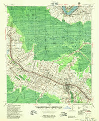 1955 Thibodaux1955 Print · USGSCoastal Louisiana in the mid-fifties is defined by the winding Bayou Lafourche and the massive Mississippi River. Genealogists and historians can trace numerous family-named sites and plantation tracts, including Laurel Valley Plantation, the New Belmont Ch, Sch & Cem, and the river landing at Moonshine.
 - 1962 Map of Thibodaux, 1963 Print
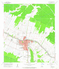 1962 Thibodaux1963 Print · USGSThibodaux and the surrounding bayou country are shown here in the early sixties, a landscape of historic sugar plantations and expanding oil fields. Genealogists and researchers can trace local landmarks like Rienzi Plantation, Thibodaux College, and the rail lines at Thibodaux Junction.4 unique versions available
 - 1962 Map of Thibodaux, 1966 Print
 1962 Thibodaux1966 Print · USGSCoastal Louisiana's river parishes are captured here in the early sixties, showing the complex overlap of plantation estates and the emerging oil industry. Researchers can trace historic family lands like Oak Alley and Madewood or locate community centers such as Labadieville and St James.
 - 1963 Map of New Orleans
 1963 New Orleans1963 Print · USGSCoastal Louisiana in the mid-twentieth century reveals a complex world of bayou settlements, expanding oil fields, and vital rail networks. Genealogists and historians can trace family roots through river towns like Thibodaux or follow the Southern Pacific line through Franklin and Patterson.4 unique versions available
 - 1966 Map of New Orleans
 1966 New Orleans1966 Print · USGSCoastal Louisiana in the mid-1960s reveals a transition from traditional bayou life to an intensive offshore oil and gas economy. Researchers can trace the rail lines of the Southern Pacific RR through Morgan City or locate the Eugene Island Lighthouse among the delta's shifting marshes.
 - 1983 Map of New Orleans
 1983 New Orleans1983 Print · USGSSoutheast Louisiana in the early eighties reveals a landscape where the urban density of New Orleans meets the vast wetlands of the Salvador State Wildlife Management Area. Genealogists and historians can trace the traditional bayou settlements of Houma and Thibodaux alongside major rail lines like the Southern Pacific.2 unique versions available
 - 1998 Map of Thibodaux, 2000 Print
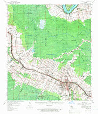
 1998 Thibodaux2000 Print · USGSThibodaux and its surrounding sugar country are captured here at the end of the millennium as the area transitioned from its plantation roots. Genealogists and historians can trace family-named estates like Greenwood Plantation or locate historic institutions like Thibodaux College.
 - 2012 Map of Thibodaux, 2012 Print
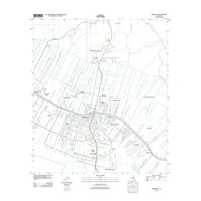 2012 Thibodaux2012 Print · USGSCovers Elmer, including Thibodaux, Johnson Ridge, and other nearby areas
 - 2015 Map of Thibodaux, 2015 Print
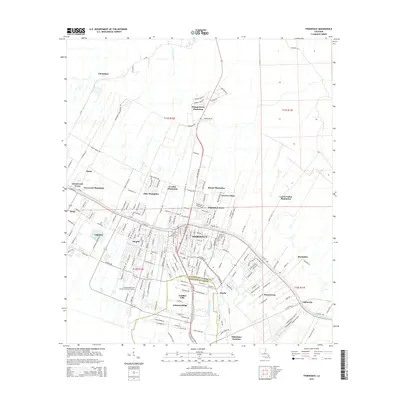 2015 Thibodaux2015 Print · USGSCovers Elmer, including Thibodaux, Johnson Ridge, and other nearby areas
 - 2018 Map of Thibodaux, 2018 Print
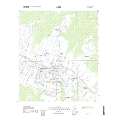 2018 Thibodaux2018 Print · USGSCovers Elmer, including Thibodaux, Johnson Ridge, and other nearby areas
 - 2020 Map of Thibodaux, 2020 Print
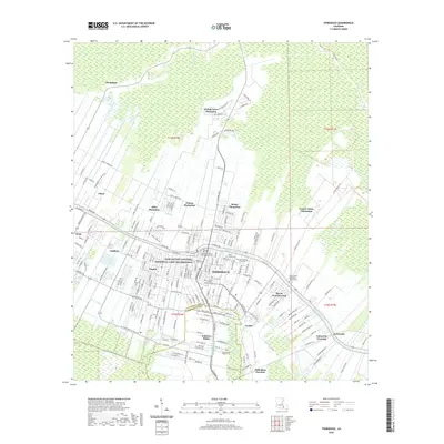 2020 Thibodaux2020 Print · USGSCovers Elmer, including Thibodaux, Johnson Ridge, and other nearby areas
 - 2024 Map of Thibodaux, 2024 Print
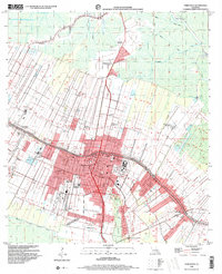
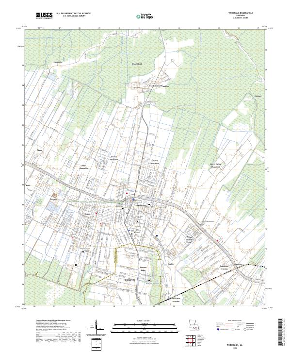 2024 Thibodaux2024 Print · USGSThibodaux and the surrounding bayou country appear here in the early twenty-first century, showing a landscape still defined by its plantation heritage. Genealogists can trace family roots through numerous sites like Saint Joseph Cem or the Coulon Plantation.
End of results
Showing maps 1-17 of 17
Top cities near Elmer
- Houma historical maps
- Thibodaux historical maps
- Lutcher historical maps
- Gramercy historical maps
- Convent historical maps
- Napoleonville historical maps
Frequently asked questions
- What are the different types of historical maps available for Elmer?
- What is the oldest map of Elmer?
- Where can I purchase historical maps of Elmer for my home or office?
- Where can I download high-res historical maps of Elmer?
- Are there historical topographic maps available for Elmer?
- Is there historical aerial imagery available for Elmer?
- Where are historical maps of Elmer sourced from?