Old Maps of Delta, Louisiana for Hiking & Exploration
Hike through history with 26 historic maps of Delta. Explore old trails, ghost towns, and forgotten backroads — perfect for outdoor adventurers and local explorers.
- Rediscover forgotten places: Map out old mining camps, roads, and footpaths that no longer exist on modern maps.
- Layer with modern tools: Combine with LiDAR or satellite views to plan hikes through historical terrain.
- Made for exploration: Popular among hikers, overlanders, and local history lovers.
Use these maps to find adventure and explore the hidden past of Delta.
Delta, LA maps
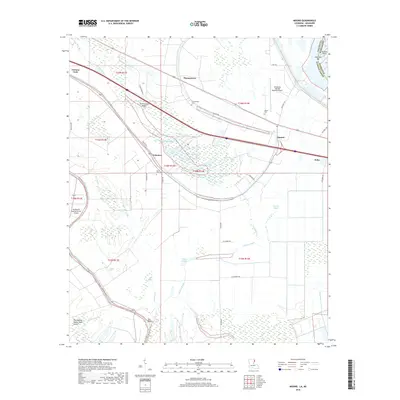
(26)- 1909 Map of Mound
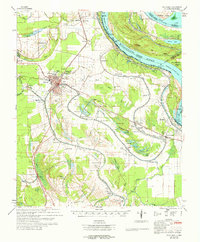
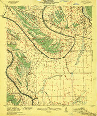 1909 Mound1909 Print · USGSMadison Parish plantations and bayous are meticulously detailed in this 1909 survey as they appeared at the dawn of the twentieth century. Researchers can trace the legacy of the Vicksburg Shreveport and Pacific Railroad and locate ancestral sites like Solomon Temple Church or Mound.2 unique versions available
 - 1910 Map of Mound
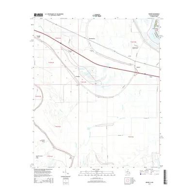
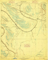 1910 Mound1910 Print · USGSMadison Parish in the early 1900s shows a landscape of productive riverbottom plantations and railroad commerce. Genealogists can trace family holdings and rural landmarks like California Plantation, Thomastown, and the Indian Mounds near the local rail siding.2 unique versions available
 - 1918 Map of Vicksburg
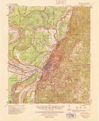
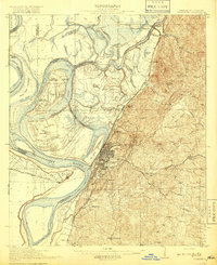 1918 Vicksburg1918 Print · USGSVicksburg and the Mississippi River bluffs are shown in great detail during the early twentieth century. Researchers can locate Civil War landmarks like Grants Canal and Vicksburg National Military Park or trace family roots near Blakeley and Cedars.4 unique versions available
 - 1939 Map of Talla Bena, 1941 Print
 1939 Talla Bena1941 Print · USGSMadison Parish and the Mississippi River bank appear here just before the war, when the river was undergoing significant engineering. You can trace the rail lines through Tallulah, find family-named points like My Wifes (Or Paw Paw) Island, and locate historic river landings including Sparta Ldg.2 unique versions available
 - 1941 Map of Vicksburg, 1946 Print
 1941 Vicksburg1946 Print · USGSVicksburg and its riverfront were entering the war years when this survey was updated, documenting a landscape of strategic waterway engineering. Genealogists can trace family roots at Redwood, Beechwood, or Culkin Academy and locate the National Cem.3 unique versions available
 - 1955 Map of Jackson
 1955 Jackson1955 Print · USGSThe Lower Mississippi Valley at the middle of the century reveals a landscape of deep river meanders and growing rail hubs. Genealogists and historians can trace the mid-century footprints of Vicksburg National Military Park, old river landings at Port Gibson, and the rail corridors of the Illinois Central Railroad.3 unique versions available
 - 1961 Map of Jackson
 1961 Jackson1961 Print · USGSThe Lower Mississippi Delta and the state capital area are captured here during the post-war era of infrastructure expansion. Researchers can trace the complex river oxbows and rail lines connecting Vicksburg, Yazoo City, and the Illinois Central Railroad network.
 - 1962 Map of Jackson
 1962 Jackson1962 Print · USGSThe Mississippi Delta and the state capital region are mapped here in the early sixties, showing a landscape defined by the great river and the growing city of JACKSON. Genealogists can trace family roots through numerous landmarks like Cedar Hill Cem, rural stops on the Illinois Central RR, and historic sites like Champion Hill.2 unique versions available
 - 1962 Map of Vicksburg West, 1963 Print
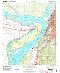
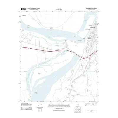
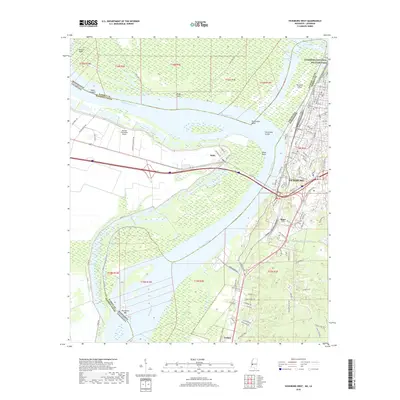
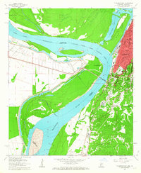 1962 Vicksburg West1963 Print · USGSVicksburg and the Mississippi River bluffs are seen here in the early sixties, as the river's shifting path reshaped the state line. Genealogists can locate family landmarks like Mt Pilgrim Ch, Glass-McIntyre Sch, and the rail junction at Delta.3 unique versions available
 - 1963 Map of Mound, 1964 Print
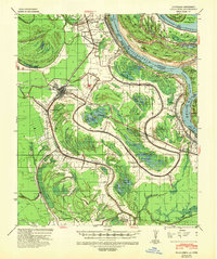
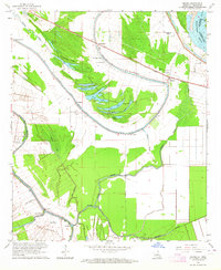 1963 Mound1964 Print · USGSMadison Parish and the Mississippi River border appear here in the early sixties, showing a landscape of oxbow lakes and bayou settlements. Genealogists can locate family-named landmarks and rural hubs like Thomastown, Thomas Chapel, and the Indian Mounds near Coleman.2 unique versions available
 - 1964 Map of Vicksburg
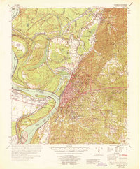 1964 Vicksburg1964 Print · USGSVicksburg and the Mississippi River loops are shown here in the mid-1960s, capturing a landscape defined by historic channel shifts and flood control efforts. Genealogists can trace family roots through numerous local landmarks like Culkin Academy, Redwood, and Mt Shiloh Ch.2 unique versions available
 - 1965 Map of Talla Bena
 1965 Talla Bena1965 Print · USGSMadison Parish and the Mississippi Delta are captured here in the mid-sixties, showing a landscape shaped by the Mississippi River and the Illinois Central rail line. Genealogists can locate family landmarks like Silver Cross Cem, Macon Sch, and Bethlehem Ch.3 unique versions available
 - 1982 Map of Tallulah, 1983 Print
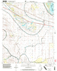
 1982 Tallulah1983 Print · USGSNortheast Louisiana in the early eighties was a landscape of intricate oxbow lakes and railroad towns. Researchers can trace the heritage of parish centers like Tallulah and Winnsboro, or locate rural landmarks near Yucatan Lake and the Illinois Central Gulf tracks.
 - 1984 Map of Jackson
 1984 Jackson1984 Print · USGSCentral Mississippi in the mid-eighties shows a landscape defined by the growing suburbs of Jackson and the riverfront legacy of Vicksburg. Researchers can trace the Natchez Trace Parkway or locate local landmarks like Utica College and Mississippi State Hospital.
 - 1998 Map of Vicksburg West, 2003 Print
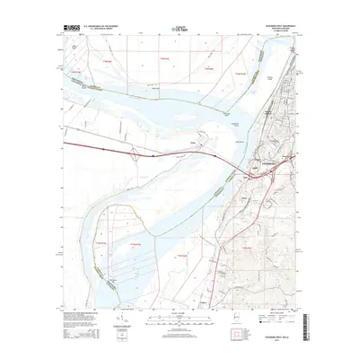
 1998 Vicksburg West2003 Print · USGSVicksburg and the Mississippi River transition into the late twentieth century, showing the enduring geography of the 1863 siege. Researchers can trace the earthworks at Vicksburg Nat Mil Park or locate family roots near Mt Pilgrim Ch and All Saints College.
 - 1998 Map of Mound, 2003 Print
 1998 Mound2003 Print · USGSMadison Parish and the Louisiana-Mississippi border appear here in the late twentieth century, showing a landscape shaped by oxbow lakes and old river bends. Genealogists can locate family landmarks like Thomastown Cem, Indian Mounds, and St John Ch.
 - 2012 Map of Mound, 2012 Print
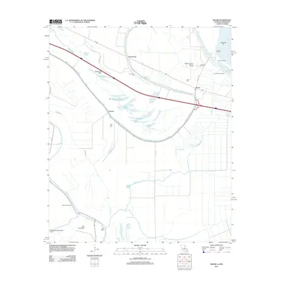 2012 Mound2012 Print · USGSCovers Delta, including Mound, Thomastown, and other nearby areas
 - 2012 Map of Vicksburg West, 2012 Print
 2012 Vicksburg West2012 Print · USGSCovers Delta, including Vicksburg, Cedars, and other nearby areas
 - 2015 Map of Mound, 2015 Print
 2015 Mound2015 Print · USGSCovers Delta, including Mound, Thomastown, and other nearby areas
 - 2015 Map of Vicksburg West, 2015 Print
 2015 Vicksburg West2015 Print · USGSCovers Delta, including Vicksburg, Cedars, and other nearby areas
 - 2018 Map of Mound, 2018 Print
 2018 Mound2018 Print · USGSCovers Delta, including Mound, Thomastown, and other nearby areas
 - 2018 Map of Vicksburg West, 2018 Print
 2018 Vicksburg West2018 Print · USGSCovers Delta, including Vicksburg, Cedars, and other nearby areas
 - 2020 Map of Mound, 2020 Print
 2020 Mound2020 Print · USGSCovers Delta, including Mound, Thomastown, and other nearby areas
 - 2020 Map of Vicksburg West, 2020 Print
 2020 Vicksburg West2020 Print · USGSCovers Delta, including Vicksburg, Cedars, and other nearby areas
 - 2024 Map of Vicksburg West, 2024 Print
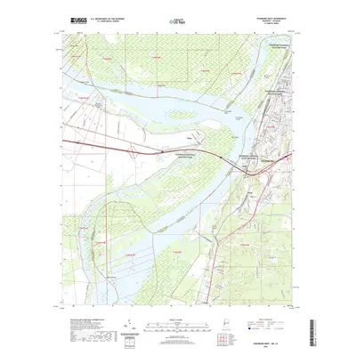
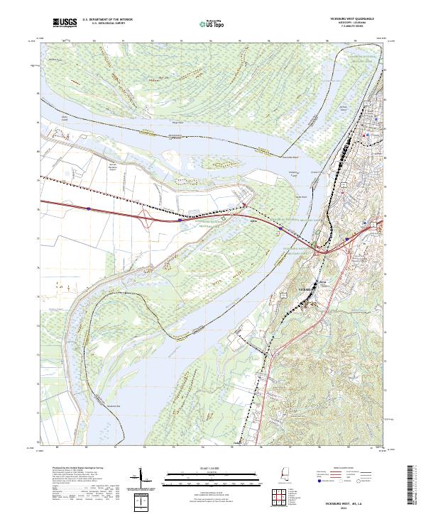 2024 Vicksburg West2024 Print · USGSThe riverfront at Vicksburg and the sprawling grounds of the Vicksburg National Military Park are shown here in modern detail. Researchers can trace the legacy of the Civil War at Grants Canal or locate local landmarks like the Warren County Courthouse and the Q and C Ferry crossing.
Showing maps 1-25 of 26
Top cities near Delta
Frequently asked questions
- What are the different types of historical maps available for Delta?
- What is the oldest map of Delta?
- Where can I purchase historical maps of Delta for my home or office?
- Where can I download high-res historical maps of Delta?
- Are there historical topographic maps available for Delta?
- Is there historical aerial imagery available for Delta?
- Where are historical maps of Delta sourced from?