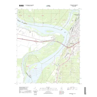
2018 Map of Vicksburg West
USGS Topo · Published 2018About this map
The Mississippi River defines this landscape where Mississippi and Louisiana meet, carving a complex path of oxbows and cutoffs. The city of Vicksburg sits on the high eastern bluffs, overlooking the expansive river bottomlands and the strategic Centennial Lake, a remnant of the river's former course. To the north, the Vicksburg National Military Park preserves the hallowed ground of the 1863 siege, while across the water, the Louisiana side reveals a landscape of working plantations and levees, including the Hannah Plantation Airport.
Find a feature on this map
111 named features on this map. Tap any name to fly to it.
Don’t see what you’re looking for? This feature index may not catch every label — zoom into the map to look around manually.
Map Details
Editions of this 2018 Vicksburg West Map
This is the sole edition of this map. No revisions or reprints were ever made.
Other maps of this area

1909 · Millikens Bend
USGS Topo · 1:24,000

1909 · Mound
USGS Topo · 1:24,000

1910 · Mound
USGS Topo · 1:31,680

1918 · Vicksburg
USGS Topo · 1:62,500

1939 · Talla Bena
USGS Topo · 1:62,500

1939 · Yokena
USGS Topo · 1:62,500

1941 · Vicksburg
USGS Topo · 1:62,500

1955 · Jackson
USGS Topo · 1:250,000

1961 · Jackson
USGS Topo · 1:250,000

1962 · Jackson
USGS Topo · 1:250,000