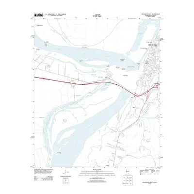
2012 Map of Vicksburg West
USGS Topo · Published 2012About this map
Vicksburg sits at a critical bend in the Mississippi River, its geography defined by a complex network of man-made alterations and natural shifts. This survey highlights the legacy of the Civil War-era Grants Canal alongside the Yazoo River Diversion Canal, illustrating how the river's path was permanently reshaped to maintain the city's status as a deep-water port after the river naturally cut through at Centennial Cutoff. The landscape is a mix of urban neighborhoods like Speeds Addition and Jonestown and the industrial riparian features of De Soto Island.
Find a feature on this map
104 named features on this map. Tap any name to fly to it.
Don’t see what you’re looking for? This feature index may not catch every label — zoom into the map to look around manually.
Map Details
Editions of this 2012 Vicksburg West Map
This is the sole edition of this map. No revisions or reprints were ever made.
Other maps of this area

1909 · Millikens Bend
USGS Topo · 1:24,000

1909 · Mound
USGS Topo · 1:24,000

1910 · Mound
USGS Topo · 1:31,680

1918 · Vicksburg
USGS Topo · 1:62,500

1939 · Talla Bena
USGS Topo · 1:62,500

1939 · Yokena
USGS Topo · 1:62,500

1941 · Vicksburg
USGS Topo · 1:62,500

1955 · Jackson
USGS Topo · 1:250,000

1961 · Jackson
USGS Topo · 1:250,000

1962 · Jackson
USGS Topo · 1:250,000