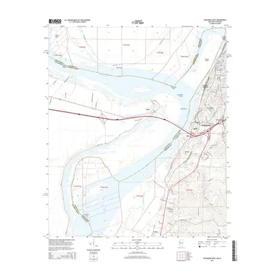
2015 Map of Vicksburg West
USGS Topo · Published 2015About this map
The Mississippi River creates a complex landscape of oxbows and islands at the border of Warren County and Madison Parish. The river's historical shifts are visible through features like Centennial Lake and the Centennial Cutoff, which separated De Soto Island from the mainland. On the eastern bank, the city of Vicksburg sits atop the bluffs, its perimeter marked by the extensive grounds of Vnmp.
Find a feature on this map
96 named features on this map. Tap any name to fly to it.
Don’t see what you’re looking for? This feature index may not catch every label — zoom into the map to look around manually.
Map Details
Editions of this 2015 Vicksburg West Map
This is the sole edition of this map. No revisions or reprints were ever made.
Other maps of this area

1909 · Millikens Bend
USGS Topo · 1:24,000

1909 · Mound
USGS Topo · 1:24,000

1910 · Mound
USGS Topo · 1:31,680

1918 · Vicksburg
USGS Topo · 1:62,500

1939 · Talla Bena
USGS Topo · 1:62,500

1939 · Yokena
USGS Topo · 1:62,500

1941 · Vicksburg
USGS Topo · 1:62,500

1955 · Jackson
USGS Topo · 1:250,000

1961 · Jackson
USGS Topo · 1:250,000

1962 · Jackson
USGS Topo · 1:250,000