Old Maps of Madison Parish, Louisiana for Hiking & Exploration
Hike through history with 181 historic maps of Madison Parish. Explore old trails, ghost towns, and forgotten backroads — perfect for outdoor adventurers and local explorers.
- Rediscover forgotten places: Map out old mining camps, roads, and footpaths that no longer exist on modern maps.
- Layer with modern tools: Combine with LiDAR or satellite views to plan hikes through historical terrain.
- Made for exploration: Popular among hikers, overlanders, and local history lovers.
Use these maps to find adventure and explore the hidden past of Madison Parish.
Madison Parish, LA maps
(181)- 1909 Map of Millikens Bend
 1909 Millikens Bend1909 Print · USGSMadison Parish and the Mississippi River front are captured during the peak of the plantation era. Researchers can trace historic family lands like Sparta and Huon Plantation, or locate rural landmarks such as Paradise Church and Hews Store.3 unique versions available
 - 1909 Map of Tallulah
 1909 Tallulah1909 Print · USGSMadison Parish at the turn of the century shows a landscape defined by its rail junctions and expansive estates. Genealogists can locate named family lands like Shelby Plantation and trace rural congregational history at Zion Flower Church.
 - 1909 Map of Mound
 1909 Mound1909 Print · USGSMadison Parish plantations and bayous are meticulously detailed in this 1909 survey as they appeared at the dawn of the twentieth century. Researchers can trace the legacy of the Vicksburg Shreveport and Pacific Railroad and locate ancestral sites like Solomon Temple Church or Mound.2 unique versions available
 - 1910 Map of Mound
 1910 Mound1910 Print · USGSMadison Parish in the early 1900s shows a landscape of productive riverbottom plantations and railroad commerce. Genealogists can trace family holdings and rural landmarks like California Plantation, Thomastown, and the Indian Mounds near the local rail siding.2 unique versions available
 - 1918 Map of Vicksburg
 1918 Vicksburg1918 Print · USGSVicksburg and the Mississippi River bluffs are shown in great detail during the early twentieth century. Researchers can locate Civil War landmarks like Grants Canal and Vicksburg National Military Park or trace family roots near Blakeley and Cedars.4 unique versions available
 - 1935 Map of Winnsboro, 1936 Print
 1935 Winnsboro1936 Print · USGSFranklin Parish in the mid-1930s is a landscape of railroad towns and timber landings defined by the winding Macon Bayou. Researchers can trace the Missouri Pacific line through Winnsboro or locate the many historic river crossings like Eureka Ferry and Killens Ferry.2 unique versions available
 - 1935 Map of Baskinton, 1936 Print
 1935 Baskinton1936 Print · USGSNortheast Louisiana in the mid-1930s is defined by its drainage basins and river landings between the rail towns of Rayville and Delhi. Genealogists can locate rural landmarks such as Hill Ridge Ch & Sch, Baskinton, and landings like Sunrise Ldg.
 - 1935 Map of Waverly, 1938 Print
 1935 Waverly1938 Print · USGSThe Louisiana delta in the mid-1930s shows a landscape defined by the winding Tensas River and early industrial expansion. Trace the remnants of a Logging Railroad Abandoned and the growth of trackside settlements like Delhi and Quebec.2 unique versions available
 - 1935 Map of Shackleford Lake, 1942 Print
 1935 Shackleford Lake1942 Print · USGSThe Tensas River basin in the 1930s shows a complex network of logging railroads and river landings essential to the local timber economy. Genealogists and local historians can trace family sites at Marydale Plantation, Stonewall Ch, and the settlement at Newlight.2 unique versions available
 - 1939 Map of Onward
 1939 Onward1939 Print · USGSThe Mississippi Delta in the late 1930s shows a landscape of river-bend settlements and bayou-side commerce before modern infrastructure took hold. You can trace the Illinois Central railroad through Smedes and Kelso or locate family landmarks like Haynes Bluff and the Lumber Yard at Valley Park.3 unique versions available
 - 1939 Map of Talla Bena, 1941 Print
 1939 Talla Bena1941 Print · USGSMadison Parish and the Mississippi River bank appear here just before the war, when the river was undergoing significant engineering. You can trace the rail lines through Tallulah, find family-named points like My Wifes (Or Paw Paw) Island, and locate historic river landings including Sparta Ldg.2 unique versions available
 - 1939 Map of Yokena, 1942 Print
 1939 Yokena1942 Print · USGSThe Mississippi riverfront south of Vicksburg was a complex landscape of engineering and rural community just before the Second World War. Researchers can trace the Yazoo and Mississippi Valley RR and find local landmarks like Rocky Springs and the Hardscrabble Sch.2 unique versions available
 - 1939 Map of Alsatia, 1953 Print
 1939 Alsatia1953 Print · USGSThe river-driven landscape of the Louisiana and Mississippi border is shown here during a period of massive hydraulic engineering. Researchers can trace the shifting river channel and rail-stop settlements like Alsatia, Fitler PO, and Sondheimer.2 unique versions available
 - 1941 Map of Vicksburg, 1946 Print
 1941 Vicksburg1946 Print · USGSVicksburg and its riverfront were entering the war years when this survey was updated, documenting a landscape of strategic waterway engineering. Genealogists can trace family roots at Redwood, Beechwood, or Culkin Academy and locate the National Cem.3 unique versions available
 - 1955 Map of Jackson
 1955 Jackson1955 Print · USGSThe Lower Mississippi Valley at the middle of the century reveals a landscape of deep river meanders and growing rail hubs. Genealogists and historians can trace the mid-century footprints of Vicksburg National Military Park, old river landings at Port Gibson, and the rail corridors of the Illinois Central Railroad.3 unique versions available
 - 1958 Map of Baskinton
 1958 Baskinton1958 Print · USGSRichland and Franklin Parishes in the late fifties show a landscape transitioning between traditional bayou life and the post-war energy boom. Researchers can locate vanished rural landmarks like Hunters Chapel, the Delhi Refining Co, and old river stops like Indian Ldg.2 unique versions available
 - 1958 Map of Shackleford Lake
 1958 Shackleford Lake1958 Print · USGSTensas Parish was a landscape of timber and river landings in the mid-1950s, where the logging industry and the river's flow dictated local life. Genealogists and historians can trace the foundations of communities at Marydale Plantation, Magnolia Sch & Ch, and ancient sites like the Indian Mounds.
 - 1958 Map of Winnsboro
 1958 Winnsboro1958 Print · USGSThe fertile landscape of Franklin Parish comes to life in the late 1950s, showing a region defined by the Missouri Pacific Railroad and the winding Macon Bayou. Genealogists and local historians can trace family locations near landmarks like True Light Cem & Ch, the Franklin Parish Training Sch, and Lorelein.
 - 1959 Map of Mitchiner, 1962 Print
 1959 Mitchiner1962 Print · USGSNortheastern Louisiana at the end of the fifties reveals a landscape of ancient earthworks and rising energy production. Genealogists can trace family roots through Bethany Cem & Ch, Adams Sch, and the historical significance of Poverty Pt.2 unique versions available
 - 1961 Map of Jackson
 1961 Jackson1961 Print · USGSThe Lower Mississippi Delta and the state capital area are captured here during the post-war era of infrastructure expansion. Researchers can trace the complex river oxbows and rail lines connecting Vicksburg, Yazoo City, and the Illinois Central Railroad network.
 - 1961 Map of Waverly, 1963 Print
 1961 Waverly1963 Print · USGSIn the early 1960s, these Northeast Louisiana parishes were defined by their winding bayous and the reach of the timber industry. Genealogists can trace family roots through several rural churches like Midway Church or Zion Pilgrim No 2 Church and the centrally located Waverly Cem.2 unique versions available
 - 1962 Map of Jackson
 1962 Jackson1962 Print · USGSThe Mississippi Delta and the state capital region are mapped here in the early sixties, showing a landscape defined by the great river and the growing city of JACKSON. Genealogists can trace family roots through numerous landmarks like Cedar Hill Cem, rural stops on the Illinois Central RR, and historic sites like Champion Hill.2 unique versions available
 - 1962 Map of Vicksburg West, 1963 Print
 1962 Vicksburg West1963 Print · USGSVicksburg and the Mississippi River bluffs are seen here in the early sixties, as the river's shifting path reshaped the state line. Genealogists can locate family landmarks like Mt Pilgrim Ch, Glass-McIntyre Sch, and the rail junction at Delta.3 unique versions available
 - 1962 Map of Long Lake, 1963 Print
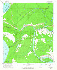 1962 Long Lake1963 Print · USGSThe riverlands of Warren County were undergoing a major industrial transformation in the early sixties. Genealogists and historians can trace the development of the Vicksburg Industrial Harbor and locate local landmarks like Pilgrims Rest Ch and Browns Point.3 unique versions available
 - 1963 Map of Grand Gulf, 1964 Print
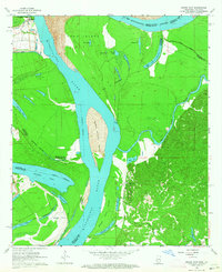 1963 Grand Gulf1964 Print · USGSThe Mississippi River borderlands in the early 1960s reveal a landscape of shifting channels and Civil War memory. Genealogists and historians can trace the Old Railroad grade near Grand Gulf or locate local landmarks like Spring Hill Ch and Point Pleasant.3 unique versions available
Showing maps 1-25 of 181
Top cities of Madison Parish
Frequently asked questions
- What are the different types of historical maps available for Madison Parish?
- What is the oldest map of Madison Parish?
- Where can I purchase historical maps of Madison Parish for my home or office?
- Where can I download high-res historical maps of Madison Parish?
- Are there historical topographic maps available for Madison Parish?
- Is there historical aerial imagery available for Madison Parish?
- Where are historical maps of Madison Parish sourced from?