1990s Maps of St. James Parish, Louisiana
Explore 5 historic maps of St. James Parish from the 1990s. These maps offer a rare glimpse into what life looked like during the 1990s — showing old roads, neighborhoods, homes, and landmarks that have changed or disappeared over time.
Whether you're researching your family's past, planning a metal detecting trip, or studying how St. James Parish's landscape evolved across the 1990s, these high-resolution maps are a powerful tool for exploring the history of this region.
- Focus on a specific era: All maps on this page are from the 1990s, giving you a focused view of this time period.
- See what’s changed: Compare century-old streets, trails, and buildings to today's modern landscape using overlays and satellite layers.
- Research with precision: Use these maps for genealogy, historical research, land use analysis, or educational projects.
- View, download, or print: Maps are fully viewable online in high resolution, and can be downloaded or printed for your own records.
Start exploring St. James Parish's history through authentic maps from the 1990s. This is your window into the past.
St. James Parish, LA maps
(5)- 1998 Map of Lagan, 2000 Print
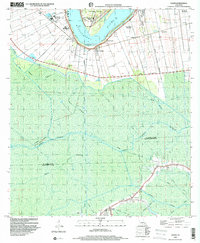 1998 Lagan2000 Print · USGSThe Mississippi River's legendary plantation country is captured here during the late 1990s as industrial and agricultural worlds intersect. Genealogists can trace historic estates like Oak Alley and Bessie K or locate family sites at Roseland Cem and St Lukes Ch.
 - 1998 Map of Lower Vacherie, 2000 Print
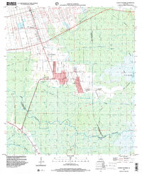 1998 Lower Vacherie2000 Print · USGSThe St. James Parish backcountry at the close of the century reveals the enduring geometry of French long-lot plantations meeting the Louisiana swamp. Researchers can trace the transition from Lower Vacherie estates like Webre Steib Plantation to the wild reaches of Lac Des Allemands.
 - 1998 Map of Lutcher, 2001 Print
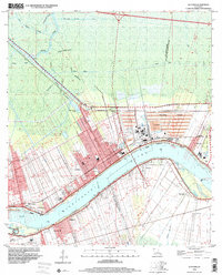 1998 Lutcher2001 Print · USGSThe Mississippi River corridor near the turn of the millennium reveals a blend of historic plantation lands and modern industrial operations. Researchers can trace local heritage through sites like Evergreen Plantation, St Phillips Cem, and the Magnolia School.
 - 1999 Map of Convent, 2000 Print
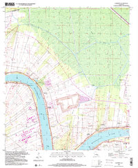 1999 Convent2000 Print · USGSAlong the Mississippi River in the late nineties, the landscape of St. James Parish preserves its plantation-era layout amidst modern industry. Genealogists can trace family roots through riverfront settlements like Convent and landmark estates including Oak Alley Plantation and Belmont.
 - 1999 Map of Donaldsonville, 2000 Print
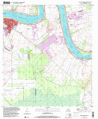 1999 Donaldsonville2000 Print · USGSThe Mississippi River corridor near Donaldsonville appears at a moment of industrial change at the close of the century. Genealogists and local historians can trace legacy sites like Union Plantation, Buena Vista Cem, and Brulie Maurin.
End of results
Showing maps 1-5 of 5
Top cities of St. James Parish
Frequently asked questions
- What are the different types of historical maps available for St. James Parish?
- What is the oldest map of St. James Parish?
- Where can I purchase historical maps of St. James Parish for my home or office?
- Where can I download high-res historical maps of St. James Parish?
- Are there historical topographic maps available for St. James Parish?
- Is there historical aerial imagery available for St. James Parish?
- Where are historical maps of St. James Parish sourced from?