1940s Maps of St. James Parish, Louisiana
Explore 10 historic maps of St. James Parish from the 1940s. These maps offer a rare glimpse into what life looked like during the 1940s — showing old roads, neighborhoods, homes, and landmarks that have changed or disappeared over time.
Whether you're researching your family's past, planning a metal detecting trip, or studying how St. James Parish's landscape evolved across the 1940s, these high-resolution maps are a powerful tool for exploring the history of this region.
- Focus on a specific era: All maps on this page are from the 1940s, giving you a focused view of this time period.
- See what’s changed: Compare century-old streets, trails, and buildings to today's modern landscape using overlays and satellite layers.
- Research with precision: Use these maps for genealogy, historical research, land use analysis, or educational projects.
- View, download, or print: Maps are fully viewable online in high resolution, and can be downloaded or printed for your own records.
Start exploring St. James Parish's history through authentic maps from the 1940s. This is your window into the past.
St. James Parish, LA maps
(10)- 1940 Map of Lagan
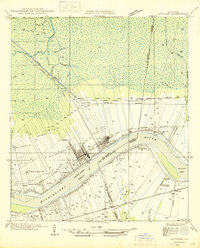
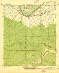 1940 Lagan1940 Print · USGSSt. James Parish at the cusp of the 1940s retains its deep-rooted plantation landscape along the river's edge. Genealogists and historians can trace family landholdings from Oak Alley Plantation to Bessie K and locate rural landmarks like St Lukes Ch and Chegby Sch.2 unique versions available
 - 1940 Map of Madewood
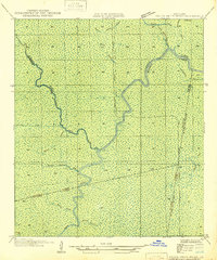
 1940 Madewood1940 Print · USGSAssumption Parish at the end of the 1930s shows a landscape defined by the sugar economy and the wetlands. Genealogists and historians can trace family locations along Bayou Lafourche through old settlements like Madewood, Albemarle, and Aurelia.2 unique versions available
 - 1941 Map of Lac Des Allemands
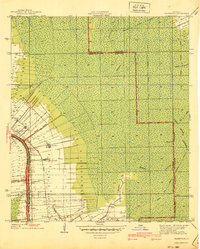
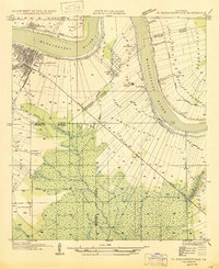
 1941 Lac Des Allemands1941 Print · USGSLafourche Parish at the start of the 1940s reveals a water-bound economy of bayous, swamps, and sugar plantations. Genealogists and researchers can trace local church and school sites like St Lawrence Ch and Choctaw Sch alongside historic holdings such as Melodia Plantation.
 - 1944 Map of Lac Des Allemands
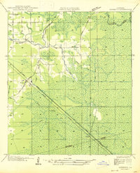
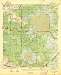 1944 Lac Des Allemands1944 Print · USGSThe swampy interface of St. James and Lafourche parishes comes alive in this mid-century survey of the Mississippi River delta. Genealogists can trace family roots at Golden Star Plantation, Webster Plantation, and community landmarks like St Lawrence Ch.2 unique versions available
 - 1945 Map of New Orleans
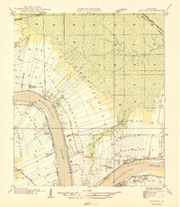
 1945 New Orleans1945 Print · USGSCoastal Louisiana and the Mississippi delta are captured here just after the war, showing the region's transition into a modern industrial and transit hub. Genealogists can trace family settlements along Bayou Teche or identify rail stops for the Illinois Central and Texas & Pacific lines.
 - 1946 Map of Convent
 1946 Convent1946 Print · USGSSt. James Parish life in the 1940s centers on the riverfront plantations and rail-connected settlements along the Mississippi. Researchers can trace family sites near St Josephs Plantation, Oak Alley Plantation, and the community at Convent.
 - 1946 Map of Lutcher
 1946 Lutcher1946 Print · USGSSt. James Parish and the riverfront communities of Lutcher and Gramercy are captured here in the mid-forties, showing the intersection of the Mississippi's bend with the local sugar industry. Researchers can trace historic family lands near Paulina or locate the Longview Sugar Mill and St Joseph Ch.
 - 1946 Map of Petite Amite River
 1946 Petite Amite River1946 Print · USGSCoastal Louisiana at the end of the depression era is revealed here as a wild corridor of bayous and shifting parish lines. Trace the path of the Garville Northern (Abandoned) railroad as it cuts through the swamps near Blind River and Black Lake.
 - 1947 Map of Donaldsonville
 1947 Donaldsonville1947 Print · USGSThe Mississippi River corridor near Donaldsonville comes to life in this mid-century survey of the river's winding path and industrial shoreline. Researchers can trace the rail lines of the Texas and Pacific, find the Saulsberg Refinery, and locate rural landmarks like the Brulie Maurin Sch.
 - 1947 Map of Sorrento
 1947 Sorrento1947 Print · USGSLouisiana's Ascension Parish is captured here in the mid-1940s as a landscape of vital rail corridors and complex drainage systems. Genealogists and historians can trace old homesteads and routes through Sorrento, Saint Amant, and McElroy along the Airline Highway.
End of results
Showing maps 1-10 of 10
Top cities of St. James Parish
Frequently asked questions
- What are the different types of historical maps available for St. James Parish?
- What is the oldest map of St. James Parish?
- Where can I purchase historical maps of St. James Parish for my home or office?
- Where can I download high-res historical maps of St. James Parish?
- Are there historical topographic maps available for St. James Parish?
- Is there historical aerial imagery available for St. James Parish?
- Where are historical maps of St. James Parish sourced from?