1990s Maps of St. Mary Parish, Louisiana
Explore 24 historic maps of St. Mary Parish from the 1990s. These maps offer a rare glimpse into what life looked like during the 1990s — showing old roads, neighborhoods, homes, and landmarks that have changed or disappeared over time.
Whether you're researching your family's past, planning a metal detecting trip, or studying how St. Mary Parish's landscape evolved across the 1990s, these high-resolution maps are a powerful tool for exploring the history of this region.
- Focus on a specific era: All maps on this page are from the 1990s, giving you a focused view of this time period.
- See what’s changed: Compare century-old streets, trails, and buildings to today's modern landscape using overlays and satellite layers.
- Research with precision: Use these maps for genealogy, historical research, land use analysis, or educational projects.
- View, download, or print: Maps are fully viewable online in high resolution, and can be downloaded or printed for your own records.
Start exploring St. Mary Parish's history through authentic maps from the 1990s. This is your window into the past.
St. Mary Parish, LA maps
(24)- 1994 Map of Ellerslie, 1998 Print
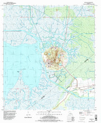
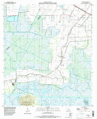
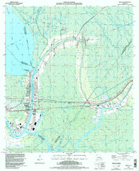
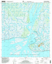
 1994 Ellerslie1998 Print · USGSCoastal St. Mary Parish in the mid-1990s was a landscape shaped by petroleum and the shifting marsh. Researchers can trace industrial growth through the Garden City Gas and Oil Field or locate the settlements of Ellerslie and South Bend.
 - 1994 Map of Morgan City, 1998 Print
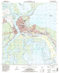 1994 Morgan City1998 Print · USGSThe Atchafalaya basin in the mid-1990s serves as a critical corridor for Louisiana's rail and water commerce. Researchers can trace the industrial footprint of Morgan City, the Southern Pacific rail lines, and local landmarks like Bradley Cem and Bayou Boeuf Lock.
 - 1994 Map of Morgan City SE, 1998 Print
 1994 Morgan City SE1998 Print · USGSCoastal Louisiana in the mid-nineties shows a landscape defined by its intersection of natural waterways and heavy energy production. Researchers can trace the industrial footprint across North Turtle Bayou Gas Field and follow the vital Intracoastal Waterway.
 - 1994 Map of Cypremort Point, 1998 Print
 1994 Cypremort Point1998 Print · USGSCoastal Louisiana near the meeting of the bays is documented here in the mid-nineties, showing the intersection of conservation and industry. You can trace the marshy geography of Marsh Island or locate the active Oil and Gas Field and Cypremort Point settlements.
 - 1994 Map of Point Au Fer NE, 1998 Print
 1994 Point Au Fer NE1998 Print · USGSCoastal Terrebonne Parish appears in the mid-1990s as a dynamic landscape of delta formation and tidal marsh. Researchers can trace the shifting shoreline and waterways like Little Hog Bayou, Shell Island Pass, and the remote Tanks near Little Bay.
 - 1994 Map of Lake Salve, 1998 Print
 1994 Lake Salve1998 Print · USGSCoastal Louisiana's shifting wetlands come into focus in the mid-nineties, showing a complex deltaic landscape where the river meets the bay. Researchers can trace the industrial footprint of the Belle Isle Gas and Oil Field and find isolated high ground like Live Oak Hammock.
 - 1994 Map of Weeks, 1998 Print
 1994 Weeks1998 Print · USGSThe coastal marsh and salt dome landscape of Iberia Parish is captured in the mid-1990s as the industrial and natural worlds intersect. Trace old family sites near Weeks and Ewing Cem, or explore the waterways of Weeks Island and the Intracostal Waterway.
 - 1994 Map of Hammock Lake, 1998 Print
 1994 Hammock Lake1998 Print · USGSThe Louisiana coast and its offshore energy fields are captured in the 1990s as industry met conservation. Trace the development of the West Cote Blanche Oil and Gas Field and the boundaries of Cypremort Point State Park.
 - 1994 Map of Patterson, 1998 Print
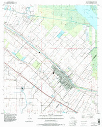
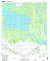
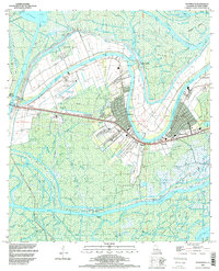 1994 Patterson1998 Print · USGSSt. Mary Parish in the mid-nineties shows a landscape defined by the winding waters of the Lower Atchafalaya River and deep-water bayous. Genealogists and historians can trace the developments of Patterson, Bayou Vista, and Idlewild alongside the Southern Pacific rail line.
 - 1994 Map of Centerville, 1998 Print
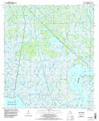
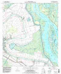 1994 Centerville1998 Print · USGSThe riverine corridor of St. Mary Parish is captured here in the mid-1990s, where traditional settlements line the historic curves of the bayou. Researchers can locate family burial grounds like Caffery Cem and trace the proximity of Garden City to the Atchafalaya Basin Floodway.
 - 1994 Map of Kemper, 1998 Print
 1994 Kemper1998 Print · USGSCoastal Louisiana near the Iberia Parish line is shown in the mid-1990s, where traditional settlements and sugar-country history meet modern maritime infrastructure. Researchers can trace the layout of small communities like Freetown, Four Corners, and Home Place while navigating the intricate channels of Bayou Cypremort.
 - 1994 Map of Marone Point, 1998 Print
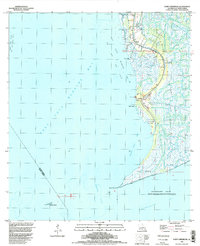
 1994 Marone Point1998 Print · USGSSt. Mary Parish's coastal landscape is captured in the mid-nineties, showing the intersection of industrial energy and marshland geography. Trace the development of the Cote Blanche Island Oil and Gas Field and landmarks like Cote Blanche Landing.
 - 1994 Map of Point Chevreuil, 1998 Print
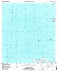
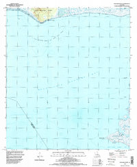
 1994 Point Chevreuil1998 Print · USGSCoastal St. Mary Parish in the mid-1990s reveals a landscape of tidal marshes and industrial oil fields at the edge of the Gulf. Trace the reach of the Bayou Sale Oil and Gas Field and locate local landmarks like the South Bend Cem and Luke Landing.
 - 1994 Map of Morgan City SW, 1998 Print
 1994 Morgan City SW1998 Print · USGSCoastal Terrebonne and St. Mary Parishes are shown in the mid-1990s as a complex network of marshes and industrial sites. Researchers can trace the extensive development of the Bateman Lake Gas and Oil Field and the waterways of Avoca Island.
 - 1994 Map of Franklin, 1998 Print
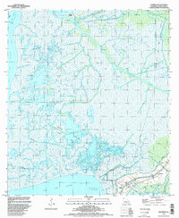
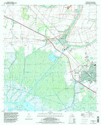 1994 Franklin1998 Print · USGSCoastal St. Mary Parish in the mid-1990s reveals a landscape shaped by sugar production, oil exploration, and the deep-water bayou system. Researchers can trace the boundaries of Bodin Plantation and Lucy Plantation or locate landmarks like Gold Mine and the Chitimacha Indian Res.
 - 1994 Map of Amelia, 1998 Print
 1994 Amelia1998 Print · USGSCoastal Louisiana in the mid-nineties shows an intricate landscape of energy extraction and waterborne commerce centered on Amelia. Researchers can trace the industrial footprint of the Amelia Gas Field and locate local landmarks like St Andrews Cem and the Indian Mound.
 - 1994 Map of Jeanerette, 1998 Print
 1994 Jeanerette1998 Print · USGSThe Bayou Teche corridor in the mid-nineties shows a landscape of deep-rooted sugar country and emerging energy infrastructure. Genealogists can locate family landmarks like Boynton Cem, the settlement of Patoutville, and the Iberia Oil and Gas Field.
 - 1994 Map of North Bend, 1998 Print
 1994 North Bend1998 Print · USGSSt. Mary Parish at the end of the century reveals a coastal landscape defined by energy extraction and managed waterways. Trace family roots at North Bend Cem or Shadyside-Fairfax Cem, and locate former settlements like Ricohoc and Midway.
 - 1994 Map of Belle Isle, 1998 Print
 1994 Belle Isle1998 Print · USGSThe coastal marshes of St. Mary Parish are captured in the mid-nineties, showing a landscape defined by the energy industry and delta hydrology. Researchers can trace dredging and development via the Belle Isle Oil and Gas Field and the Wax Lake Outlet.
 - 1998 Map of Belle Isle, 2000 Print
 1998 Belle Isle2000 Print · USGSThe Louisiana coast near the turn of the millennium was a maze of shifting delta marsh and industrial development. Researchers can trace the complex waterways around Belle Isle, locating remote landmarks like Negro Hammock and the Gas Field.
 - 1998 Map of Point Au Fer, 2001 Print
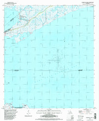
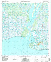
 1998 Point Au Fer2001 Print · USGSThe Louisiana coast at the turn of the millennium reveals a delicate balance of marshland and maritime industry. Researchers can trace the parish lines across Point Au Fer Island and locate coastal landmarks like the lighthouse on Eugene Island and the Locust Field.
 - 1998 Map of Point Au Fer NE, 2001 Print
 1998 Point Au Fer NE2001 Print · USGSCoastal Terrebonne and St. Mary Parishes are captured here at the end of the twentieth century, showing the shifting delta where the river meets the sea. Researchers can trace the hydrography of the Lower Atchafalaya River and navigate through Shell Island Pass.
 - 1998 Map of Plumb Bayou, 2002 Print
 1998 Plumb Bayou2002 Print · USGSThe Louisiana coastal marshes come alive in the late nineties, showing a landscape of industry and nature. Trace the extraction history of the West Deer Island Oil Field and explore landmarks like Halters Island (Rabbit Island).
 - 1999 Map of Charenton, 2000 Print
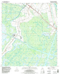
 1999 Charenton2000 Print · USGSSt. Mary Parish at the close of the twentieth century shows a landscape defined by the winding Bayou Teche and the vast Atchafalaya Basin Floodway. Genealogists and historians can locate family landmarks in Charenton and Sorrel or trace the industrial footprints of the local Oil and Gas Field.
End of results
Showing maps 1-24 of 24
Top cities of St. Mary Parish
- Morgan City historical maps
- Franklin historical maps
- Patterson historical maps
- Berwick historical maps
- Bayou Vista historical maps
- Baldwin historical maps
See more
Frequently asked questions
- What are the different types of historical maps available for St. Mary Parish?
- What is the oldest map of St. Mary Parish?
- Where can I purchase historical maps of St. Mary Parish for my home or office?
- Where can I download high-res historical maps of St. Mary Parish?
- Are there historical topographic maps available for St. Mary Parish?
- Is there historical aerial imagery available for St. Mary Parish?
- Where are historical maps of St. Mary Parish sourced from?