1980s Maps of Tensas Parish, Louisiana
Explore 13 historic maps of Tensas Parish from the 1980s. These maps offer a rare glimpse into what life looked like during the 1980s — showing old roads, neighborhoods, homes, and landmarks that have changed or disappeared over time.
Whether you're researching your family's past, planning a metal detecting trip, or studying how Tensas Parish's landscape evolved across the 1980s, these high-resolution maps are a powerful tool for exploring the history of this region.
- Focus on a specific era: All maps on this page are from the 1980s, giving you a focused view of this time period.
- See what’s changed: Compare century-old streets, trails, and buildings to today's modern landscape using overlays and satellite layers.
- Research with precision: Use these maps for genealogy, historical research, land use analysis, or educational projects.
- View, download, or print: Maps are fully viewable online in high resolution, and can be downloaded or printed for your own records.
Start exploring Tensas Parish's history through authentic maps from the 1980s. This is your window into the past.
Tensas Parish, LA maps
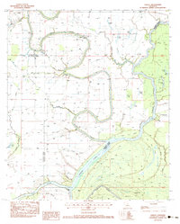
(13)- 1982 Map of Tallulah, 1983 Print
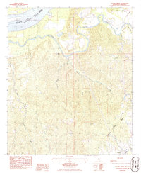
 1982 Tallulah1983 Print · USGSNortheast Louisiana in the early eighties was a landscape of intricate oxbow lakes and railroad towns. Researchers can trace the heritage of parish centers like Tallulah and Winnsboro, or locate rural landmarks near Yucatan Lake and the Illinois Central Gulf tracks.
 - 1983 Map of Oakley, 1984 Print
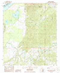
 1983 Oakley1984 Print · USGSThe alluvial plains of Franklin Parish in the early eighties reveal a landscape shaped by water and wood. Genealogists and local researchers can trace the old crossing at Kendrick Ferry Bridge and locate rural landmarks like Oak Bluff and the Pentecostal Ch.
 - 1983 Map of Foules, 1984 Print
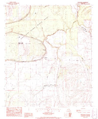
 1983 Foules1984 Print · USGSThe Tensas River basin in the early 1980s reveals a landscape defined by oxbow lakes and rural parish life. Researchers can locate family landmarks like Elder Shade Cem, New Light Ch, and the small settlement at Foules along the railroad.
 - 1983 Map of Crowville, 1984 Print
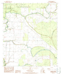
 1983 Crowville1984 Print · USGSFranklin Parish in the early eighties shows a landscape shaped by the winding Bayou Macon and a network of rural settlements. Genealogists can trace family landmarks like the Masonic Cem, Swampers (Killians Ferry), and numerous local congregations including Magnolia Ch.2 unique versions available
 - 1983 Map of Como, 1984 Print
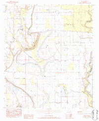 1983 Como1984 Print · USGSThe alluvial wetlands of Franklin and Tensas Parishes are captured here in the early 1980s, defined by the winding Bayou Macon. Genealogists and local historians can locate State Place Cem, the community of Como, and the Boat Landing along the Tensas River.
 - 1984 Map of Natchez
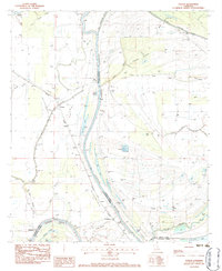
 1984 Natchez1984 Print · USGSThe Mississippi-Louisiana borderlands in the mid-eighties show a landscape defined by the winding Mississippi River and its rail networks. Trace family history at the Natchez National Cemetery or explore the river towns of Vidalia and Ferriday.
 - 1986 Map of St. Joseph
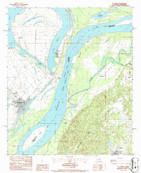 1986 St. Joseph1986 Print · USGSThe Mississippi River winds through Tensas Parish and Claiborne County in the mid-eighties, dividing the flat Louisiana oxbows from the Mississippi bluffs. Researchers can find Windsor Ruins, the Alcorn State University campus, and local landmarks like the Indian Mound and St. Joseph.
 - 1986 Map of Widows Creek
 1986 Widows Creek1986 Print · USGSClaiborne County in the mid-1980s reveals a landscape shaped by the winding Bayou Pierre and the legendary Natchez Trace Parkway. Genealogists and historians can trace the small community of Russum or locate the Old RR Grade and scattered CEM sites.
 - 1986 Map of Rodney
 1986 Rodney1986 Print · USGSThe river bluffs of Jefferson County are captured here in the mid-1980s as the modern Natchez Trace Parkway meets the ancient river corridor. Genealogists and historians can locate the historic settlement of Rodney and the campus of Alcorn State University among the oxbows of Rodney Lake and Flatland Lake.
 - 1987 Map of Westwood
 1987 Westwood1987 Print · USGSThe Louisiana Delta bottomlands are shown in detail during the late twentieth century, centered on the Tensas River. Genealogists and historians can trace the rural settlements of Westwood and Dearborn or locate Indian Mounds and a local Cem.
 - 1987 Map of NewLight
 1987 NewLight1987 Print · USGSThe Louisiana Delta landscape in the late 1980s is defined by river conservation and small crossroad communities. Researchers can trace the layout of Newlight and Marydale or locate significant landmarks like the Indian Mound and Skeeter Lake.
 - 1987 Map of Saranac
 1987 Saranac1987 Print · USGSTensas Parish in the late twentieth century is shown as a complex landscape of delta wetlands and managed waterways. Researchers can trace the layout of Newellton and Saranac or locate cultural landmarks like the Indian Mounds and local Cem.
 - 1987 Map of Tensas Bluff
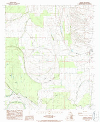
 1987 Tensas Bluff1987 Print · USGSThe Tensas River bottomlands in the late 1980s show a landscape of conservation and river-driven geography. Trace the Old RR Grade and discover family-named landmarks like Trusler Lake and the distinctive Tensas Bluff.
End of results
Showing maps 1-13 of 13
Top cities of Tensas Parish
Frequently asked questions
- What are the different types of historical maps available for Tensas Parish?
- What is the oldest map of Tensas Parish?
- Where can I purchase historical maps of Tensas Parish for my home or office?
- Where can I download high-res historical maps of Tensas Parish?
- Are there historical topographic maps available for Tensas Parish?
- Is there historical aerial imagery available for Tensas Parish?
- Where are historical maps of Tensas Parish sourced from?