Old Maps of Tensas Parish, Louisiana for Academic Research
Study the evolution of Tensas Parish with 161 high-resolution historic maps. Whether you're teaching, researching, or modeling changes in land use, these maps provide essential visual documentation of urban, environmental, and geographic change.
- Analyze long-term change: Track patterns in development, transportation, and natural features.
- Ideal for environmental or urban studies: Support academic projects with primary historical map data.
- Use in the classroom or lab: Educators and researchers rely on these maps to bring historical context to life.
These maps are a powerful tool for teaching, research, and visualizing how Tensas Parish has changed over the decades.
Tensas Parish, LA maps
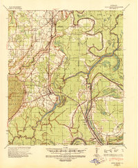
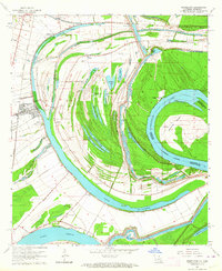
(161)- 1909 Map of Delta Bridge
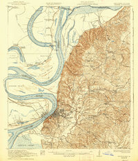
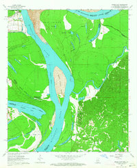
 1909 Delta Bridge1909 Print · USGSTensas Parish was a landscape of riverfront estates and early rail lines in the years before the Great War. Researchers can trace ancestral property lines and community centers like Oneonta Plantation, Rock of Ages Church, and the St Louis Iron Mountain and Southern Railroad.
 - 1909 Map of Lake Bruen
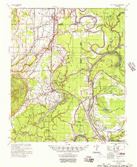
 1909 Lake Bruen1909 Print · USGSTensas Parish life in the early 1900s centered on the massive Mississippi oxbow and the fertile soils of the delta. Researchers can trace historic family holdings like Bellevue and Panola or locate local landmarks including Zion Baptist Church and the St Joseph Station.
 - 1921 Map of Natchez
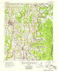
 1921 Natchez1921 Print · USGSThe Mississippi River bluffs and floodplain come alive in this early 1920s survey of the Natchez region and its Louisiana neighbors. Genealogists can trace family roots through numerous sites like Taconey Plantation, the Adams County Poor Farm, and Quitman School.
 - 1922 Map of Natchez, 1938 Print
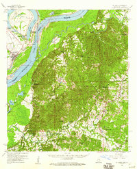
 1922 Natchez1938 Print · USGSThe Mississippi River's shifting path at Natchez in the early twentieth century reveals a landscape of working plantations and thriving river ports. Researchers can trace land holdings at Windemere, locate rural sites like the Poor Farm, or follow the Yazoo and Mississippi Valley rail line.2 unique versions available
 - 1935 Map of Winnsboro, 1936 Print
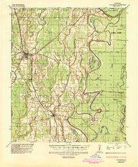 1935 Winnsboro1936 Print · USGSFranklin Parish in the mid-1930s is a landscape of railroad towns and timber landings defined by the winding Macon Bayou. Researchers can trace the Missouri Pacific line through Winnsboro or locate the many historic river crossings like Eureka Ferry and Killens Ferry.2 unique versions available
 - 1935 Map of Shackleford Lake, 1942 Print
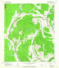
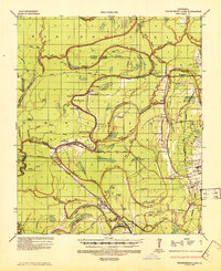 1935 Shackleford Lake1942 Print · USGSThe Tensas River basin in the 1930s shows a complex network of logging railroads and river landings essential to the local timber economy. Genealogists and local historians can trace family sites at Marydale Plantation, Stonewall Ch, and the settlement at Newlight.2 unique versions available
 - 1939 Map of Lorman, 1942 Print
 1939 Lorman1942 Print · USGSThe Mississippi River borderlands thrive with plantation life and early educational institutions during the late nineteen-thirties. You can trace family roots through numerous cemetery-school-church complexes like Richland Sch Ch & Cem and the grounds of Alcorn A & M College.
 - 1939 Map of Natchez, 1943 Print
 1939 Natchez1943 Print · USGSThe Mississippi River corridor and Natchez area appear in the late thirties as a landscape of river-bottom plantations and bluff-top estates. Genealogists can locate family landmarks like Hole in the Wall Plantation, Briars Plantation, and Gilfield Ch & Sch.3 unique versions available
 - 1939 Map of Locust Ridge, 1965 Print
 1939 Locust Ridge1965 Print · USGSThe Mississippi Delta in the late 1930s reveals a land of sprawling plantations and bayou settlements along the Louisiana border. Genealogists can trace family landmarks like the Mayflower Cem, Maryland Plantation Cem, and New St Mark Ch among the meanders of the river.
 - 1941 Map of Sicily Island, 1943 Print
 1941 Sicily Island1943 Print · USGSLouisiana's delta country comes alive in the 1940s as a complex network of bayous, landings, and rail lines. Genealogists and historians can trace the foundations of local life through rural landmarks like Sunnyside Sch & Ch, several Indian Mounds, and the Missouri Pacific rail corridor.2 unique versions available
 - 1953 Map of Natchez, 1966 Print
 1953 Natchez1966 Print · USGSSouthwest Mississippi and the Louisiana border country come alive in this mid-century survey of the river valley and forest lands. Researchers can trace the rail lines of the Illinois Central RR and locate rural hubs like Gloster and Ferriday.3 unique versions available
 - 1955 Map of Jackson
 1955 Jackson1955 Print · USGSThe Lower Mississippi Valley at the middle of the century reveals a landscape of deep river meanders and growing rail hubs. Genealogists and historians can trace the mid-century footprints of Vicksburg National Military Park, old river landings at Port Gibson, and the rail corridors of the Illinois Central Railroad.3 unique versions available
 - 1956 Map of Natchez
 1956 Natchez1956 Print · USGSThe Mississippi River borderlands and the Pine Hills come alive in this mid-fifties study of the Natchez region. Genealogists and historians can trace rail-era towns along the Illinois Central RR and explore the oxbows of Lake Bruin and Lake Concordia.
 - 1957 Map of Sicily Island
 1957 Sicily Island1957 Print · USGSCatahoula Parish and the surrounding lowlands are captured in the late 1950s, showing a landscape shaped by the Tensas River and its many bayous. Genealogists can trace family roots at New Zion Ch & Cem 37, Loam Land Sch & Cem, or the old Lee Bayou School House.2 unique versions available
 - 1958 Map of Shackleford Lake
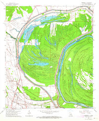
 1958 Shackleford Lake1958 Print · USGSTensas Parish was a landscape of timber and river landings in the mid-1950s, where the logging industry and the river's flow dictated local life. Genealogists and historians can trace the foundations of communities at Marydale Plantation, Magnolia Sch & Ch, and ancient sites like the Indian Mounds.
 - 1958 Map of Winnsboro
 1958 Winnsboro1958 Print · USGSThe fertile landscape of Franklin Parish comes to life in the late 1950s, showing a region defined by the Missouri Pacific Railroad and the winding Macon Bayou. Genealogists and local historians can trace family locations near landmarks like True Light Cem & Ch, the Franklin Parish Training Sch, and Lorelein.
 - 1958 Map of St. Joseph, 1960 Print
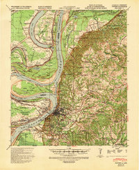
 1958 St. Joseph1960 Print · USGSThe Mississippi River borderlands in the late fifties reveal a landscape of plantation ruins and rising hills between Tensas Parish and Claiborne County. Genealogists can trace family footprints at St Joseph, the Windsor Ruins, and rural landmarks like Alcorn Sch and Mt Zion Ch.4 unique versions available
 - 1959 Map of Natchez
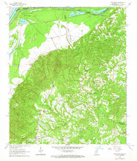
 1959 Natchez1959 Print · USGSSouthwestern Mississippi and eastern Louisiana are captured in the late fifties, showing a landscape defined by the winding Mississippi River and the timbered Homochitto National Forest. Researchers can trace the sprawling Illinois Central RR and find rural landmarks like Union Church and Camp Van Dorn (Abandoned).
 - 1961 Map of Jackson
 1961 Jackson1961 Print · USGSThe Lower Mississippi Delta and the state capital area are captured here during the post-war era of infrastructure expansion. Researchers can trace the complex river oxbows and rail lines connecting Vicksburg, Yazoo City, and the Illinois Central Railroad network.
 - 1962 Map of Jackson
 1962 Jackson1962 Print · USGSThe Mississippi Delta and the state capital region are mapped here in the early sixties, showing a landscape defined by the great river and the growing city of JACKSON. Genealogists can trace family roots through numerous landmarks like Cedar Hill Cem, rural stops on the Illinois Central RR, and historic sites like Champion Hill.2 unique versions available
 - 1963 Map of Grand Gulf, 1964 Print
 1963 Grand Gulf1964 Print · USGSThe Mississippi River borderlands in the early 1960s reveal a landscape of shifting channels and Civil War memory. Genealogists and historians can trace the Old Railroad grade near Grand Gulf or locate local landmarks like Spring Hill Ch and Point Pleasant.3 unique versions available
 - 1963 Map of Gretna Green, 1964 Print
 1963 Gretna Green1964 Print · USGSTensas Parish life in the early sixties is centered on the winding waters of Big Choctaw Bayou and its surrounding plantations. Researchers can trace local genealogy through community hubs like Gretna Green and Wavertree Plantation or find old family sites like New China Grove Ch and Mayflower Cem.2 unique versions available
 - 1963 Map of Somerset, 1964 Print
 1963 Somerset1964 Print · USGSThe Mississippi River bottomlands in the early sixties reveal a landscape shaped by water and rail. Genealogists and local historians can trace family sites at Somerset Cem, find rural churches like St John Ch, or locate old river stops at Palmyra Landing.2 unique versions available
 - 1963 Map of Pine Ridge, 1964 Print
 1963 Pine Ridge1964 Print · USGSThe Mississippi riverfront and the bluffs of Adams County are captured here in the early sixties as petroleum exploration expanded through the hills. Genealogists can locate numerous rural landmarks like Painters Cem, Linwood Ch, and Daughters of Zion Ch.3 unique versions available
 - 1963 Map of Newellton, 1964 Print
 1963 Newellton1964 Print · USGSThe riverfront of Tensas Parish in the early sixties was a landscape of dramatic oxbows and deep agricultural roots. Researchers can trace family history through local landmarks like Newellton Cem, St Matthew Ch, and the small settlement at Balmoral.2 unique versions available
Showing maps 1-25 of 161
Top cities of Tensas Parish
Frequently asked questions
- What are the different types of historical maps available for Tensas Parish?
- What is the oldest map of Tensas Parish?
- Where can I purchase historical maps of Tensas Parish for my home or office?
- Where can I download high-res historical maps of Tensas Parish?
- Are there historical topographic maps available for Tensas Parish?
- Is there historical aerial imagery available for Tensas Parish?
- Where are historical maps of Tensas Parish sourced from?