1960s Maps of Tensas Parish, Louisiana
Explore 15 historic maps of Tensas Parish from the 1960s. These maps offer a rare glimpse into what life looked like during the 1960s — showing old roads, neighborhoods, homes, and landmarks that have changed or disappeared over time.
Whether you're researching your family's past, planning a metal detecting trip, or studying how Tensas Parish's landscape evolved across the 1960s, these high-resolution maps are a powerful tool for exploring the history of this region.
- Focus on a specific era: All maps on this page are from the 1960s, giving you a focused view of this time period.
- See what’s changed: Compare century-old streets, trails, and buildings to today's modern landscape using overlays and satellite layers.
- Research with precision: Use these maps for genealogy, historical research, land use analysis, or educational projects.
- View, download, or print: Maps are fully viewable online in high resolution, and can be downloaded or printed for your own records.
Start exploring Tensas Parish's history through authentic maps from the 1960s. This is your window into the past.
Tensas Parish, LA maps
(15)- 1961 Map of Jackson
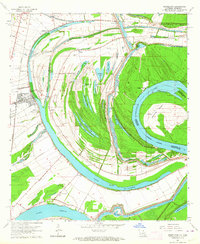
 1961 Jackson1961 Print · USGSThe Lower Mississippi Delta and the state capital area are captured here during the post-war era of infrastructure expansion. Researchers can trace the complex river oxbows and rail lines connecting Vicksburg, Yazoo City, and the Illinois Central Railroad network.
 - 1962 Map of Jackson
 1962 Jackson1962 Print · USGSThe Mississippi Delta and the state capital region are mapped here in the early sixties, showing a landscape defined by the great river and the growing city of JACKSON. Genealogists can trace family roots through numerous landmarks like Cedar Hill Cem, rural stops on the Illinois Central RR, and historic sites like Champion Hill.2 unique versions available
 - 1963 Map of Grand Gulf, 1964 Print
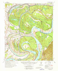
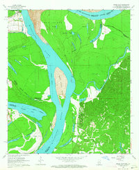 1963 Grand Gulf1964 Print · USGSThe Mississippi River borderlands in the early 1960s reveal a landscape of shifting channels and Civil War memory. Genealogists and historians can trace the Old Railroad grade near Grand Gulf or locate local landmarks like Spring Hill Ch and Point Pleasant.3 unique versions available
 - 1963 Map of Gretna Green, 1964 Print
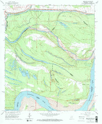
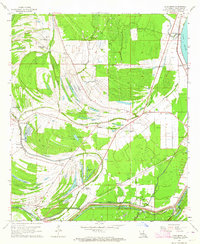
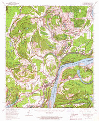
 1963 Gretna Green1964 Print · USGSTensas Parish life in the early sixties is centered on the winding waters of Big Choctaw Bayou and its surrounding plantations. Researchers can trace local genealogy through community hubs like Gretna Green and Wavertree Plantation or find old family sites like New China Grove Ch and Mayflower Cem.2 unique versions available
 - 1963 Map of Somerset, 1964 Print
 1963 Somerset1964 Print · USGSThe Mississippi River bottomlands in the early sixties reveal a landscape shaped by water and rail. Genealogists and local historians can trace family sites at Somerset Cem, find rural churches like St John Ch, or locate old river stops at Palmyra Landing.2 unique versions available
 - 1963 Map of Pine Ridge, 1964 Print
 1963 Pine Ridge1964 Print · USGSThe Mississippi riverfront and the bluffs of Adams County are captured here in the early sixties as petroleum exploration expanded through the hills. Genealogists can locate numerous rural landmarks like Painters Cem, Linwood Ch, and Daughters of Zion Ch.3 unique versions available
 - 1963 Map of Newellton, 1964 Print
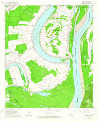
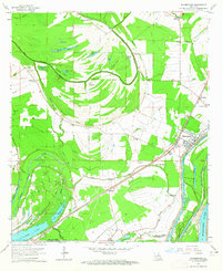
 1963 Newellton1964 Print · USGSThe riverfront of Tensas Parish in the early sixties was a landscape of dramatic oxbows and deep agricultural roots. Researchers can trace family history through local landmarks like Newellton Cem, St Matthew Ch, and the small settlement at Balmoral.2 unique versions available
 - 1963 Map of Bedford, 1964 Print
 1963 Bedford1964 Print · USGSThe shifting Mississippi River floodplain comes into sharp focus in the early sixties at the border of Louisiana and Mississippi. Researchers can trace land changes across Diamond Island and locate family history at Crystal Springs Cem or Hodges Cem.2 unique versions available
 - 1963 Map of Spokane, 1964 Print
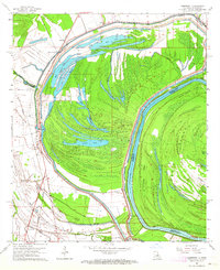
 1963 Spokane1964 Print · USGSThe Mississippi Delta riverfront comes alive in the early 1960s, showing a landscape shaped by oxbow lakes and large plantations. Trace family history and land use through Alabama Plantation, Spokane, and St Paul Cem.2 unique versions available
 - 1963 Map of Chamblee, 1964 Print
 1963 Chamblee1964 Print · USGSThe Mississippi River's shifting bends and cutoffs in the early 1960s reveal a landscape of islands and oil fields along the Louisiana-Mississippi border. Genealogists and historians can trace the locations of Durango Plantation, Myrtle Grove Cem, and the village of Chamblee.2 unique versions available
 - 1963 Map of Lake Bruin, 1964 Print
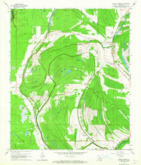
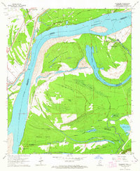
 1963 Lake Bruin1964 Print · USGSTensas Parish in the early sixties is a landscape of expansive plantations and ancient river bends along the Mississippi. Genealogists and historians can trace family-named sites like Thistle Ridge Plantation, remote burial grounds such as Gold Bell Cem, and the small settlement of Wilsonia.2 unique versions available
 - 1963 Map of Waterproof, 1964 Print
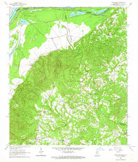
 1963 Waterproof1964 Print · USGSNortheastern Louisiana in the 1960s was a landscape shaped by its river systems and agricultural heritage. Researchers can trace family roots through the Arcola and Winona estates or locate community landmarks like Richland Ch and Waterproof.2 unique versions available
 - 1965 Map of Davis Island
 1965 Davis Island1965 Print · USGSThe Mississippi River and its intricate floodplains define this mid-1960s survey of the Louisiana and Mississippi border. Genealogists and historians can trace family locations near Newellton, Somerset Cem, and the historic Grand Gulf Mil Mon.3 unique versions available
 - 1965 Map of Natchez, 1967 Print
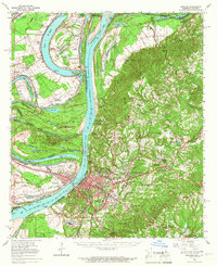 1965 Natchez1967 Print · USGSThe Mississippi River floodplain and the bluffs of Adams County are seen here in the mid-sixties, capturing a landscape of massive plantations and river engineering. Trace family sites at Hole in the Wall Plantation or Vidalia and locate landmarks like Jefferson Military College.2 unique versions available
 - 1965 Map of Locust Ridge, 1967 Print
 1965 Locust Ridge1967 Print · USGSThe Louisiana-Mississippi riverlands are captured here in the mid-1960s, showing the intricate oxbow lakes and rail-connected settlements along the river's edge. Researchers can locate family-named estates like Winona Plantation and rural landmarks like Choctaw Chapel and the Shiloh Ch.2 unique versions available
End of results
Showing maps 1-15 of 15
Top cities of Tensas Parish
Frequently asked questions
- What are the different types of historical maps available for Tensas Parish?
- What is the oldest map of Tensas Parish?
- Where can I purchase historical maps of Tensas Parish for my home or office?
- Where can I download high-res historical maps of Tensas Parish?
- Are there historical topographic maps available for Tensas Parish?
- Is there historical aerial imagery available for Tensas Parish?
- Where are historical maps of Tensas Parish sourced from?