Old Maps of West Feliciana Parish, Louisiana for Academic Research
Study the evolution of West Feliciana Parish with 70 high-resolution historic maps. Whether you're teaching, researching, or modeling changes in land use, these maps provide essential visual documentation of urban, environmental, and geographic change.
- Analyze long-term change: Track patterns in development, transportation, and natural features.
- Ideal for environmental or urban studies: Support academic projects with primary historical map data.
- Use in the classroom or lab: Educators and researchers rely on these maps to bring historical context to life.
These maps are a powerful tool for teaching, research, and visualizing how West Feliciana Parish has changed over the decades.
West Feliciana Parish, LA maps
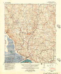
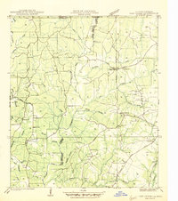
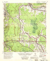
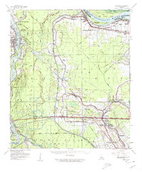
(70)- 1906 Map of Bayou Sara
 1906 Bayou Sara1906 Print · USGSCovers West Feliciana Parish, including Baton Rouge, Central, and other nearby areas3 unique versions available
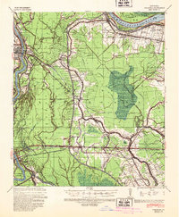
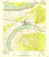
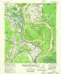
 - 1939 Map of St. Francisville
 1939 St. Francisville1939 Print · USGSCovers West Feliciana Parish, including Saint Francisville, St. Francisville, and other nearby areas3 unique versions available
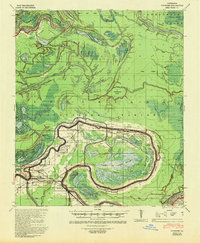
 - 1939 Map of Artonish, 1945 Print
 1939 Artonish1945 Print · USGSCovers West Feliciana Parish, including Union Point, Loch Leven, and other nearby areas
 - 1939 Map of Fordoche, 1948 Print
 1939 Fordoche1948 Print · USGSCovers West Feliciana Parish, including Melville, Krotz Springs, and other nearby areas2 unique versions available
 - 1941 Map of Lost Creek
 1941 Lost Creek1941 Print · USGSCovers West Feliciana Parish, including Wilson, Norwood, and other nearby areas
 - 1941 Map of Voorhies, 1943 Print
 1941 Voorhies1943 Print · USGSCovers West Feliciana Parish, including Moreauville, Red Fish, and other nearby areas2 unique versions available
 - 1941 Map of Batchelor, 1944 Print
 1941 Batchelor1944 Print · USGSCovers West Feliciana Parish, including Morganza, Keller, and other nearby areas
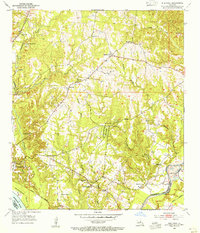
 - 1945 Map of Jackson
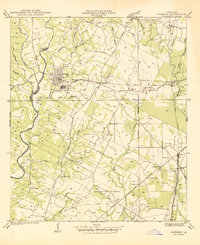 1945 Jackson1945 Print · USGSCovers West Feliciana Parish, including Jackson, Cole, and other nearby areas
 - 1945 Map of Lost Creek
 1945 Lost Creek1945 Print · USGSCovers West Feliciana Parish, including Wilson, Norwood, and other nearby areas
 - 1953 Map of New Roads, 1954 Print
 1953 New Roads1954 Print · USGSCovers West Feliciana Parish, including New Roads, Leavel, and other nearby areas
 - 1953 Map of Natchez, 1966 Print
 1953 Natchez1966 Print · USGSCovers West Feliciana Parish, including Natchez, McComb, and other nearby areas3 unique versions available
 - 1954 Map of Port Hudson, 1955 Print
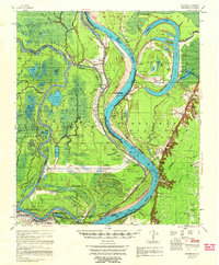
 1954 Port Hudson1955 Print · USGSCovers West Feliciana Parish, including Waterloo, Riddle, and other nearby areas
 - 1954 Map of Elm Park, 1955 Print
 1954 Elm Park1955 Print · USGSCovers West Feliciana Parish, including St. Francisville, Freeland, and other nearby areas
 - 1954 Map of Jackson, 1955 Print
 1954 Jackson1955 Print · USGSCovers West Feliciana Parish, including Jackson, Cole, and other nearby areas4 unique versions available
 - 1954 Map of Artonish, 1966 Print
 1954 Artonish1966 Print · USGSCovers West Feliciana Parish, including Union Point, Loch Leven, and other nearby areas
 - 1954 Map of Baton Rouge, 1974 Print
 1954 Baton Rouge1974 Print · USGSCovers West Feliciana Parish, including New Orleans, Baton Rouge, and other nearby areas2 unique versions available
 - 1955 Map of Artonish
 1955 Artonish1955 Print · USGSCovers West Feliciana Parish, including Union Point, Loch Leven, and other nearby areas
 - 1955 Map of Fordoche
 1955 Fordoche1955 Print · USGSCovers West Feliciana Parish, including Melville, Krotz Springs, and other nearby areas
 - 1955 Map of Batchelor
 1955 Batchelor1955 Print · USGSCovers West Feliciana Parish, including Morganza, Keller, and other nearby areas
 - 1956 Map of Natchez
 1956 Natchez1956 Print · USGSCovers West Feliciana Parish, including Natchez, McComb, and other nearby areas
 - 1956 Map of Baton Rouge
 1956 Baton Rouge1956 Print · USGSCovers West Feliciana Parish, including New Orleans, Baton Rouge, and other nearby areas
 - 1958 Map of Artonish
 1958 Artonish1958 Print · USGSCovers West Feliciana Parish, including Union Point, Loch Leven, and other nearby areas
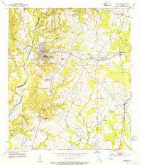
 - 1958 Map of Clinton, 1959 Print
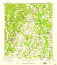 1958 Clinton1959 Print · USGSCovers West Feliciana Parish, including Jackson, Clinton, and other nearby areas3 unique versions available
 - 1959 Map of Natchez
 1959 Natchez1959 Print · USGSCovers West Feliciana Parish, including Natchez, McComb, and other nearby areas
 - 1959 Map of Fordoche, 1962 Print
 1959 Fordoche1962 Print · USGSCovers West Feliciana Parish, including Melville, Krotz Springs, and other nearby areas2 unique versions available
Showing maps 1-25 of 70
Top cities of West Feliciana Parish
Frequently asked questions
- What are the different types of historical maps available for West Feliciana Parish?
- What is the oldest map of West Feliciana Parish?
- Where can I purchase historical maps of West Feliciana Parish for my home or office?
- Where can I download high-res historical maps of West Feliciana Parish?
- Are there historical topographic maps available for West Feliciana Parish?
- Is there historical aerial imagery available for West Feliciana Parish?
- Where are historical maps of West Feliciana Parish sourced from?