1900s (20th Century) Maps of County, Maine
Explore 406 historic maps of County from the 1900s (20th Century). These maps offer a rare glimpse into what life looked like during the 1900s — showing old roads, neighborhoods, homes, and landmarks that have changed or disappeared over time.
Whether you're researching your family's past, planning a metal detecting trip, or studying how County's landscape evolved across the 1900s, these high-resolution maps are a powerful tool for exploring the history of this region.
- Focus on a specific era: All maps on this page are from the 1900s, giving you a focused view of this time period.
- See what’s changed: Compare century-old streets, trails, and buildings to today's modern landscape using overlays and satellite layers.
- Research with precision: Use these maps for genealogy, historical research, land use analysis, or educational projects.
- View, download, or print: Maps are fully viewable online in high resolution, and can be downloaded or printed for your own records.
Start exploring County's history through authentic maps from the 1900s. This is your window into the past.
County, ME maps
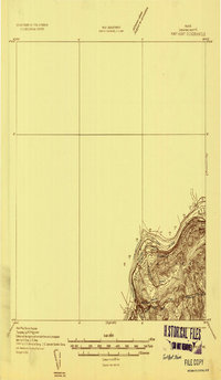
(406)- 1921 Map of Van Buren
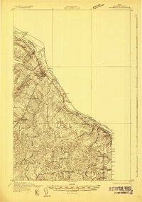
 1921 Van Buren1921 Print · USGSThe northern Maine border and New Brunswick frontier appear here in the early 1920s, as mapped for military strategic use. Genealogists and rail historians can trace the paths of the Grand Trunk R. R. through Van Buren and Hamlin, or locate settlements like Keegan and Bellefleur.
 - 1927 Map of Stockholm
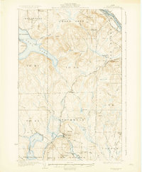
 1927 Stockholm1927 Print · USGSNorthern Aroostook County's borderlands and timber country are captured here in the late twenties during the height of the rail-and-river economy. Researchers can trace rural school districts like Berquist Sch, the Caniba Mill, and the Bangor and Aroostook railroad stops.
 - 1927 Map of Square Lake
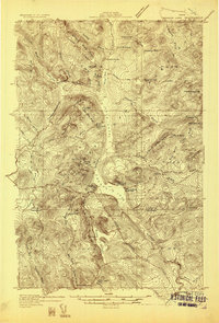
 1927 Square Lake1927 Print · USGSAroostook County's deep woods and connected waterways are captured here in the late 1920s, showing a landscape of timber camps and small school districts. You can trace the rural network of numbered schoolhouses and shoreline landmarks like Larriveau Mill, Red Point City, and Guerette Sch.
 - 1928 Map of Eagle Lake
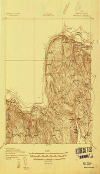
 1928 Eagle Lake1928 Print · USGSAroostook County's northern timberlands and rail sidings are meticulously mapped here in the late 1920s. Genealogists can trace family roots through the Violette Settlement, St Marks Ch, and numerous country schools like Shakespeare Sch.5 unique versions available
 - 1928 Map of Winterville
 1928 Winterville1928 Print · USGSWinterville Plantation and the surrounding Aroostook timberlands are captured here in the late twenties, before modern development. Genealogists and historians can trace rail stops like Quimby PO and Nixon Siding or locate the old 15 R 6 Sch.4 unique versions available
 - 1929 Map of Portage
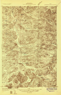
 1929 Portage1929 Print · USGSNorthern Maine timber country comes to life in the late 1920s as logging camps and rail lines penetrate the deep woods. Genealogists and historians can trace the early industrial landscape through the Old Shingle Mill, Holts Sch, and numerous family-named camps like McDugal Camp.3 unique versions available
 - 1929 Map of Caribou
 1929 Caribou1929 Print · USGSAroostook County's potato and timber country is shown here in the late twenties, centered on the growing hubs of Caribou and Washburn. Researchers can trace family roots through dozens of local schoolhouses and the New Sweden Station and Post Office.
 - 1930 Map of Greenlaw
 1930 Greenlaw1930 Print · USGSAroostook County was a hub of timber and rail activity in the early thirties, defined by remote camps and a developing backcountry road network. Genealogists and historians can trace old routes like the Old Military Road and locate sites such as Seven Mile Camp and Greenlaw Crossing.5 unique versions available
 - 1930 Map of Allagash
 1930 Allagash1930 Print · USGSThe northern Maine frontier at the turn of the 1930s was a landscape of remote river settlements and deep woods. Genealogists and historians can trace family locations along the St John River at Dickey, and find community landmarks like St Paul Ch and Henderson Sch.4 unique versions available
 - 1930 Map of Fort Fairfield
 1930 Fort Fairfield1930 Print · USGSThe international border of Aroostook County comes into focus in the 1930s, showing a landscape of rail-driven agriculture and rural school districts. Genealogists and historians can trace family-named landmarks like Cote Corner, Noyes Mill, and the Riverside Cemetery.
 - 1930 Map of St Francis
 1930 St Francis1930 Print · USGSThe Maine-Canada borderland comes alive in the early thirties as a hub of rail-and-river activity along the St John River. Genealogists and researchers can trace family lands near St Francis, local schoolhouses like Harding Sch, and logging sites like Saucier Camp.5 unique versions available
 - 1931 Map of Square Lake
 1931 Square Lake1931 Print · USGSAroostook County's lake country in the early 1930s shows a landscape of timber camps and small rural settlements. Genealogists and historians can trace schools like Guerrette Sch and Thomas Sch or locate family-named landmarks like Ouellette and Yerxa Camp.4 unique versions available
 - 1931 Map of Fish River Lake
 1931 Fish River Lake1931 Print · USGSAroostook County was a hub of remote milling and sporting life in the early 1930s. Genealogists and historians can locate specific sites like Wheelock Mill, Blanchards Depot Camp, and the Fire Tower monitoring the timberlands.4 unique versions available
 - 1931 Map of Ashland
 1931 Ashland1931 Print · USGSAroostook County logging and rail life are detailed here in the early 1930s, centered on the Ashland and Sheridan settlements. Researchers can trace rural school districts from McClellan Sch to Garfield Sch or locate industrial sites like Newlands Mill and the Squapan Dam.
 - 1931 Map of Mooseleuk Lake
 1931 Mooseleuk Lake1931 Print · USGSThe Aroostook and Piscataquis county borderlands are shown here in the early thirties as a vast expanse of timber and water. Trace the locations of remote outposts like Big Machias Lake Camps and the Great Northern Dam.2 unique versions available
 - 1931 Map of Eagle Lake
 1931 Eagle Lake1931 Print · USGSThe Aroostook County borderlands in the early thirties were a landscape of remote timber camps and French-Acadian settlements along the river bends. Genealogists and local historians can trace family-named sites like Violette Settlement, Labby Michaud PO, and the Plourde Mill.4 unique versions available
 - 1931 Map of Van Buren
 1931 Van Buren1931 Print · USGSThe international border at the St John River comes to life in the early 1930s. Trace the rail lines of the Canadian Pacific or locate local landmarks like Septieme Isle and the Berube Sch.
 - 1931 Map of Portage
 1931 Portage1931 Print · USGSAroostook County's deep woods and logging heritage are preserved here as they appeared between the wars, from the shores of Portage Lake to the remote camps of Westmanland. Researchers can trace the early rail network of the Bangor and Aroostook or locate industrial sites like the Old Shingle Mill.3 unique versions available
 - 1931 Map of Stockholm
 1931 Stockholm1931 Print · USGSUpper Aroostook County in the late twenties shows a landscape defined by the railroad and the timber industry. Genealogists can trace family footprints through rural schoolhouses like Gervais Sch and early settlements including California and Jemtland.4 unique versions available
 - 1931 Map of Winterville
 1931 Winterville1931 Print · USGSThe North Woods of Maine are seen here in the early 1930s, when logging camps and the railroad were the primary lifelines of the region. Local historians can trace family-named sites like McNally and Nixon or locate isolated structures like T 15 R 6 Sch.4 unique versions available
 - 1932 Map of Umsaskis Lake
 1932 Umsaskis Lake1932 Print · USGSThe northern Maine wilderness of the early 1930s is documented here as a landscape of timber camps and remote warden stations. Researchers can trace the era's logging infrastructure through sites like Churchill Depot, Harvey Farm, and the American Realty Depot Camp.4 unique versions available
 - 1932 Map of Frenchville
 1932 Frenchville1932 Print · USGSAroostook County's international borderland and rail network are meticulously detailed in the early 1930s, showing the intersection of Maine and New Brunswick. Genealogists can trace numerous local landmarks including St David Ch, Dionne Corner, and a series of numbered rural schools like School No 15.2 unique versions available
 - 1932 Map of Fort Kent
 1932 Fort Kent1932 Print · USGSThe northern reaches of the Maine border are captured here during the 1930s, centering on the international river crossing at Fort Kent. Genealogists and historians can trace rail and road networks including the Bangor and Aroostook Main Line and the settlement at Daigle.4 unique versions available
 - 1932 Map of Musquacook Lakes
 1932 Musquacook Lakes1932 Print · USGSThe North Maine Woods are captured in the early 1930s as a remote network of timber lands and glacial lakes. Trace the primitive logging routes of the California Road and Tote Road past camps like Howes Camp and the five Musquacook Lakes.4 unique versions available
 - 1932 Map of Caribou
 1932 Caribou1932 Print · USGSAroostook County's river valleys and rail corridors are shown here just before the mid-century, mapping a landscape of tight-knit townships and rural schoolhouses. Genealogists can trace family roots through labels like New Sweden Sta and PO, Barnum Ch, and the Hammond Sch.2 unique versions available
Showing maps 1-25 of 406
Top cities of County
- Presque Isle historical maps
- Caribou historical maps
- Houlton historical maps
- Fort Kent historical maps
- Fort Fairfield historical maps
- Madawaska historical maps
See more
Frequently asked questions
- What are the different types of historical maps available for County?
- What is the oldest map of County?
- Where can I purchase historical maps of County for my home or office?
- Where can I download high-res historical maps of County?
- Are there historical topographic maps available for County?
- Is there historical aerial imagery available for County?
- Where are historical maps of County sourced from?