1970s Maps of County, Maine
Explore 120 historic maps of County from the 1970s. These maps offer a rare glimpse into what life looked like during the 1970s — showing old roads, neighborhoods, homes, and landmarks that have changed or disappeared over time.
Whether you're researching your family's past, planning a metal detecting trip, or studying how County's landscape evolved across the 1970s, these high-resolution maps are a powerful tool for exploring the history of this region.
- Focus on a specific era: All maps on this page are from the 1970s, giving you a focused view of this time period.
- See what’s changed: Compare century-old streets, trails, and buildings to today's modern landscape using overlays and satellite layers.
- Research with precision: Use these maps for genealogy, historical research, land use analysis, or educational projects.
- View, download, or print: Maps are fully viewable online in high resolution, and can be downloaded or printed for your own records.
Start exploring County's history through authentic maps from the 1970s. This is your window into the past.
County, ME maps
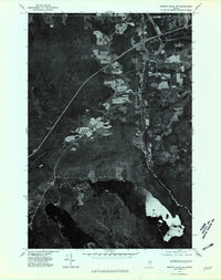
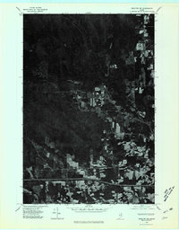
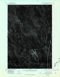
(120)- 1975 Map of Island Falls SW, 1980 Print
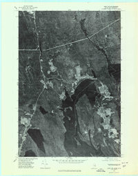
 1975 Island Falls SW1980 Print · USGSPenobscot County timberlands and farms are captured here in the mid-1970s through high-altitude aerial photography. Researchers can trace land-use patterns and property boundaries near Patten and Halls Corner, or locate landmarks like Crystal Lake.
 - 1975 Map of Amity SE, 1980 Print
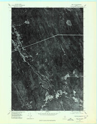
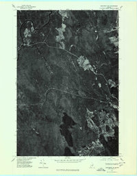
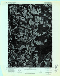
 1975 Amity SE1980 Print · USGSThe Maine and New Brunswick border comes into focus in the mid-1970s, showcasing the remote timberlands and waterways along the international line. Trace the small settlements of Orient and Fosterville flanking the deep Chiputneticook Lakes.2 unique versions available
 - 1975 Map of Houlton SW, 1980 Print
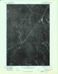
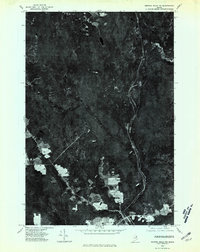
 1975 Houlton SW1980 Print · USGSSouthern Aroostook County is seen during the mid-seventies in this detailed orthophoto survey of Maine’s agricultural borderlands. Researchers can trace rural road networks and farmstead clearings around Linneus, New Limerick, and the banks of the Meduxnekeag River.
 - 1975 Map of Amity SW, 1980 Print
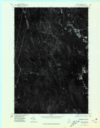
 1975 Amity SW1980 Print · USGSAroostook County timberlands are seen in detail during the 1970s, as logging roads and river bends define the landscape. Researchers can trace the clearings of small settlements like Haynesville and North Bancroft along the winding Mattawamkeag River.
 - 1975 Map of Sherman SE, 1980 Print
 1975 Sherman SE1980 Print · USGSSouthern Aroostook County is seen during the mid-seventies, showing the intersection of logging roads and small townships. Family historians can trace property clearings and landscape changes near Silver Ridge, Monarda, and Plunkett Pond.
 - 1975 Map of Danforth NE, 1980 Print
 1975 Danforth NE1980 Print · USGSThe international boundary at the Maine-New Brunswick line is captured here in the mid-seventies, showing the lakeside settlements along the eastern border. Genealogists can trace early homestead footprints near Danforth and landing sites like Butterfield Landing.
 - 1975 Map of Smyrna Mills SE, 1980 Print
 1975 Smyrna Mills SE1980 Print · USGSAroostook County's deep woods and water bodies are captured in this mid-seventies aerial survey. Researchers can trace the timber-rich terrain around Meduxnekeag Lake, Skitaccooke Lake, and the heights of Timoney Mountain.
 - 1975 Map of Mattawamkeag NW, 1980 Print
 1975 Mattawamkeag NW1980 Print · USGSThe Maine timberlands near Penobscot are documented here in the mid-1970s through detailed aerial imagery of the dense forest canopy. Genealogists and environmental researchers can trace the natural shoreline of Salmon Stream Lake and the paths of Wyman Brook.
 - 1975 Map of Smyrna Mills SW, 1980 Print
 1975 Smyrna Mills SW1980 Print · USGSAroostook County during the mid-seventies reveals the relationship between northern Maine's forest industry and its riverside settlements. Researchers can trace the development of Oakfield and Dyer Brook or locate old crossings at Red Bridge along the East Branch Mattawamkeag.
 - 1975 Map of Sherman SW, 1980 Print
 1975 Sherman SW1980 Print · USGSSouthern Penobscot County is shown in the mid-1970s, revealing the traditional layout of Maine's timber and farming communities. Genealogists can trace the rural crossroads and property boundaries near Benedicta, Sherman Mills, and Plunkett Pond.
 - 1975 Map of Danforth NW, 1980 Print
 1975 Danforth NW1980 Print · USGSAroostook County's wooded interior is documented in the mid-1970s, showcasing the remote settlements and river systems of northern Maine. Researchers can trace land use around South Bancroft and locate properties between Mattawamkeag River and Lower Hot Brook Lake.
 - 1975 Map of Wytopitlock NW, 1980 Print
 1975 Wytopitlock NW1980 Print · USGSAroostook County's timberlands are shown in detail during the mid-seventies, revealing the intersection of forest and water. Researchers can trace the winding Macwahoc Stream and the corridor near Reed as they appeared decades ago.
 - 1975 Map of Wytopitlock SW, 1980 Print
 1975 Wytopitlock SW1980 Print · USGSThe settlement of Kingman and the winding Mattawamkeag River are shown here during the mid-seventies. Researchers can trace the drainage patterns and historical woodlots along Molunkus Stream and Mattagodus Stream.
 - 1975 Map of Amity NW, 1980 Print
 1975 Amity NW1980 Print · USGSAroostook County's deep timberlands are captured in this mid-seventies aerial survey, showing the isolated pockets of Maine's backwoods life. Researchers can trace rural property lines and clearings at Wilcox Settlement and Estabrook Settlement or locate Elevenmile Lake.
 - 1975 Map of Houlton NW, 1980 Print
 1975 Houlton NW1980 Print · USGSAroostook County's deep woods and agricultural clearings are preserved in this mid-seventies orthophotoquad. Researchers can trace the path of Moose Brook as it winds through a landscape defined by timber harvest patterns and rural property lines.
 - 1975 Map of Mattawamkeag Lake SW, 1980 Print
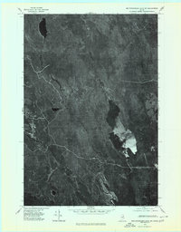 1975 Mattawamkeag Lake SW1980 Print · USGSAroostook County was a dense expanse of timber and water in the mid-seventies, as seen in this detailed aerial record. Researchers can trace the winding course of Wytopitlock Stream and locate remote land features near Wytopitlock Lake.2 unique versions available
 - 1975 Map of Sherman NW, 1980 Print
 1975 Sherman NW1980 Print · USGSPenobscot County, Maine, is captured in this mid-1970s aerial survey, showing the agricultural heart of the region. Researchers can trace the layout of northern settlements like Patten and Sherman Station alongside the East Branch Molunkus Stream.
 - 1975 Map of Island Falls NW, 1980 Print
 1975 Island Falls NW1980 Print · USGSThe Maine woods near Island Falls are captured in the mid-1970s via high-altitude aerial photography. Trace the literal shorelines of Rockabema Lake and Pleasant Lake or locate the remote peaks of Green Mtn and Pickett Mtn.
 - 1975 Map of Sherman NE, 1980 Print
 1975 Sherman NE1980 Print · USGSAgricultural fields and forest land in Aroostook County appear as they did in the mid-seventies in this detailed aerial survey. Trace the rural layout of Golden Ridge and the shores of Macwahoc Lake to see property lines and woodlots of the era.
 - 1975 Map of Smyrna Mills NE, 1980 Print
 1975 Smyrna Mills NE1980 Print · USGSAroostook County's southern timberlands and farming communities are captured here in the mid-seventies via detailed aerial orthophotography. Trace the rural crossroads of Smyrna Center and Ludlow, or locate shoreline properties on Cochrane Lake.
 - 1975 Map of Wytopitlock NE, 1980 Print
 1975 Wytopitlock NE1980 Print · USGSNorthern Maine timberlands and riverfront settlements are captured in this mid-1970s aerial survey. Trace the historic footprints of Bancroft and Wytopitlock along the winding Mattawamkeag River.
 - 1975 Map of Mattawamkeag Lake NE, 1980 Print
 1975 Mattawamkeag Lake NE1980 Print · USGSCovers County, including Linneus, TA R2 WELS, and other nearby areas
 - 1975 Map of Mattawamkeag SW, 1980 Print
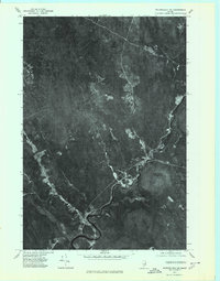
 1975 Mattawamkeag SW1980 Print · USGSPenobscot County is captured in this mid-1970s aerial survey, revealing the dense woodlands and waterways of the Maine interior. Researchers can trace the riverbank settlement at Jordan Mills and the reach of Mattaseunk Lake.
 - 1975 Map of Houlton NE, 1980 Print
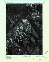
 1975 Houlton NE1980 Print · USGSAroostook County agriculture meets the Canadian border in the mid-seventies, showing the intricate patchwork of potato fields and timberlands. Researchers can trace the development of Houlton and the rural layout of Starkey Corners along the Meduxnekeag River.
 - 1975 Map of Smyrna Mills NW, 1980 Print
 1975 Smyrna Mills NW1980 Print · USGSAroostook County's timber and agricultural lands are seen during the mid-seventies in this detailed orthophoto study. Researchers can trace the layout of small settlements at Smyrna Mills and Shorey or locate property clearings along Pervere Ridge.
Showing maps 1-25 of 120
Top cities of County
- Presque Isle historical maps
- Caribou historical maps
- Houlton historical maps
- Fort Kent historical maps
- Fort Fairfield historical maps
- Madawaska historical maps
See more
Frequently asked questions
- What are the different types of historical maps available for County?
- What is the oldest map of County?
- Where can I purchase historical maps of County for my home or office?
- Where can I download high-res historical maps of County?
- Are there historical topographic maps available for County?
- Is there historical aerial imagery available for County?
- Where are historical maps of County sourced from?