1990s Maps of County, Maine
Explore 10 historic maps of County from the 1990s. These maps offer a rare glimpse into what life looked like during the 1990s — showing old roads, neighborhoods, homes, and landmarks that have changed or disappeared over time.
Whether you're researching your family's past, planning a metal detecting trip, or studying how County's landscape evolved across the 1990s, these high-resolution maps are a powerful tool for exploring the history of this region.
- Focus on a specific era: All maps on this page are from the 1990s, giving you a focused view of this time period.
- See what’s changed: Compare century-old streets, trails, and buildings to today's modern landscape using overlays and satellite layers.
- Research with precision: Use these maps for genealogy, historical research, land use analysis, or educational projects.
- View, download, or print: Maps are fully viewable online in high resolution, and can be downloaded or printed for your own records.
Start exploring County's history through authentic maps from the 1990s. This is your window into the past.
County, ME maps
(10)- 1993 Map of Van Buren
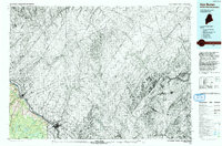 1993 Van Buren1993 Print · USGSCovers County, including Van Buren, Connor Township, and other nearby areas
 - 1993 Map of Houlton
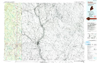 1993 Houlton1993 Print · USGSCovers County, including Woodstock, Houlton, and other nearby areas
 - 1993 Map of Fort Fairfield
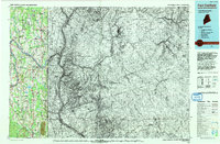 1993 Fort Fairfield1993 Print · USGSCovers County, including Presque Isle, Caribou, and other nearby areas
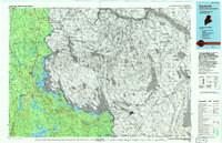
 - 1993 Map of Clayton Lake, 1994 Print
 1993 Clayton Lake1994 Print · USGSCovers County, including Lac-Frontière, Sainte-Félicité, and other nearby areas
 - 1993 Map of Allagash, 1994 Print
 1993 Allagash1994 Print · USGSCovers County, including Saint-Pascal, Allagash, and other nearby areas
 - 1993 Map of Montmagny, 1994 Print
 1993 Montmagny1994 Print · USGSCovers County, including Lévis, Montmagny, and other nearby areas
 - 1994 Map of Danforth
 1994 Danforth1994 Print · USGSCovers County, including Linneus, Danforth, and other nearby areas
 - 1994 Map of Presque Isle
 1994 Presque Isle1994 Print · USGSCovers County, including Presque Isle, Caribou, and other nearby areas
 - 1994 Map of Oakfield
 1994 Oakfield1994 Print · USGSCovers County, including Linneus, Patten, and other nearby areas
 - 1994 Map of Madawaska
 1994 Madawaska1994 Print · USGSCovers County, including Edmundston, Fort Kent, and other nearby areas
End of results
Showing maps 1-10 of 10
Top cities of County
- Presque Isle historical maps
- Caribou historical maps
- Houlton historical maps
- Fort Kent historical maps
- Fort Fairfield historical maps
- Madawaska historical maps
See more
Frequently asked questions
- What are the different types of historical maps available for County?
- What is the oldest map of County?
- Where can I purchase historical maps of County for my home or office?
- Where can I download high-res historical maps of County?
- Are there historical topographic maps available for County?
- Is there historical aerial imagery available for County?
- Where are historical maps of County sourced from?