Old Maps of E Township, Maine for Genealogy
Trace your family roots with 52 historic maps of E Township. These high-res maps reveal old neighborhoods, homesites, landmarks, and streets — helping you uncover where your ancestors lived and how the area evolved over time.
- Explore historic neighborhoods: Identify where your relatives may have lived in the 1800s or 1900s.
- Compare maps over time: Trace the changes in streets, buildings, and landmarks for multi-generational research.
- Perfect for genealogy & ancestry research: Used by family historians and researchers to map out lineage and migration.
These maps are an incredible resource for exploring your personal connection to E Township's past.
E Township, ME maps
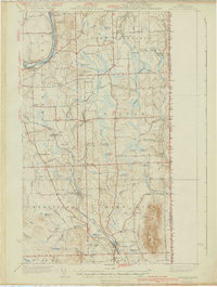
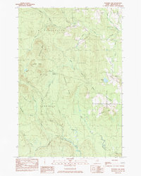
(52)- 1934 Map of Bridgewater
 1934 Bridgewater1934 Print · USGSAroostook County's border with New Brunswick is detailed here during the mid-1930s, highlighting the Bangor and Aroostook rail network. Genealogists can locate family landmarks like Jewells Corner, Snow Settlement, and Robinson Sta.
 - 1935 Map of Howe Brook
 1935 Howe Brook1935 Print · USGSRemote Aroostook County is shown here in the mid-1930s, when logging camps and the railroad defined the local landscape. Genealogists and researchers can trace the Bangor and Aroostook rail line to find vanished hubs like Little Canada and Weeksboro.
 - 1935 Map of Presque Isle
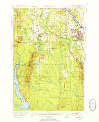
 1935 Presque Isle1935 Print · USGSAroostook County agriculture and industry are at their peak in the 1930s, centered on the river-and-rail hub of Presque Isle. Genealogists and historians can trace dozens of rural schoolhouses like Richardson Sch and find landmarks such as the Landing Field and the State Experimental Farm.3 unique versions available
 - 1936 Map of Mars Hill
 1936 Mars Hill1936 Print · USGSIn the mid-1930s, the rural landscapes of Easton and Blaine were defined by the Bangor and Aroostook RR and a dense network of country schools. Genealogists can trace family landmarks like Pine Tree Cem, Ross Sch, and Morison Mill along the international border.
 - 1938 Map of Bridgewater
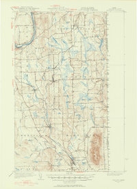
 1938 Bridgewater1938 Print · USGSEastern Aroostook County is shown here during the mid-1930s, documenting the vital rail and border connections of the era. Researchers can trace the old paths of the Bangor and Ar00stook railroad and locate community landmarks like Snow Settlement and Flagstaff Sch.3 unique versions available
 - 1939 Map of Howe Brook
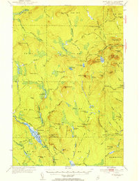
 1939 Howe Brook1939 Print · USGSAroostook County was a hub for timber and rail in the mid-1930s, defined by its remote township grids and wilderness camps. Genealogists and historians can trace old railroad stops at Weeksboro and Saunders or locate early sporting sites like the Mineola Hunting Club.3 unique versions available
 - 1940 Map of Mars Hill
 1940 Mars Hill1940 Print · USGSAroostook County was a hub of rail and river commerce in the late 1930s, defined by its connection to the Canadian border. You can trace early schoolhouse locations like Maple Grove Sch and the industrial roots of Monson Mill and Easton Station.3 unique versions available
 - 1951 Map of Mars Hill
 1951 Mars Hill1951 Print · USGSAroostook County's borderlands and rail corridors are preserved here in the mid-century, before modernization reshaped the potato-growing heartland. Genealogists and historians can trace family roots through sites like Kings Grove Cem, East Ridge Ch, and the many stops along the BANGOR AND AROOSTOOK railroad.3 unique versions available
 - 1951 Map of Bridgewater, 1952 Print
 1951 Bridgewater1952 Print · USGSAroostook County's borderlands are captured here at mid-century, showing the vital rail and road networks connecting Maine to New Brunswick. Genealogists can locate old rural landmarks like Flagstaff Sch, Snow Settlement, and the Monticello Sta.3 unique versions available
 - 1953 Map of Bridgewater
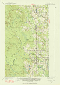
 1953 Bridgewater1953 Print · USGSThe Maine-New Brunswick borderlands are captured here in the early 1950s, showing a landscape shaped by the Bangor and Aroostook rail line. Researchers can trace historic school sites like Bratton Sch and family-named corners such as Jewells Corner or Snow Settlement.
 - 1953 Map of Presque Isle, 1955 Print
 1953 Presque Isle1955 Print · USGSCentral Aroostook County is seen here during the mid-century expansion of Presque Isle, featuring a landscape shaped by rail and river. Researchers can trace the early Presque Isle Air Force Base, old schoolhouses like Hillside Sch, and landmarks including Hedgehog Mountain.5 unique versions available
 - 1954 Map of Howe Brook, 1955 Print
 1954 Howe Brook1955 Print · USGSAroostook County's deep woods are documented in the mid-fifties, showing a landscape of timber-industry rail and seasonal sporting camps. Researchers can locate remote outposts like Old Klondike Camp, the community of Little Canada, and the Bangor and Ar00stook line.2 unique versions available
 - 1954 Map of Presque Isle, 1968 Print
 1954 Presque Isle1968 Print · USGSNorth Woods logging and rail history come alive in this mid-century survey of the Maine-Quebec borderlands. Genealogists and historians can trace the Bangor and Aroostook railroad through timber hubs like Ashland, Smyrna Mills, and Presque Isle.2 unique versions available
 - 1958 Map of Presque Isle
 1958 Presque Isle1958 Print · USGSThe Aroostook timber and potato country is captured here during the late fifties, showing the vital rail-to-river network of Northern Maine. Genealogists and historians can trace the Bangor & Aroostook RR through Mapleton and Ashland, or locate remote sites like Chamberlain Farm and Seven Islands.
 - 1959 Map of Woodstock, 1975 Print
 1959 Woodstock1975 Print · USGSNorthern Maine and New Brunswick meet along the river valleys in the late fifties, showcasing an era of international rail and river commerce. Genealogists can trace family roots through border towns like Woodstock and Houlton, or along the lines of the Bangor & Aroostook railroad.
 - 1960 Map of Presque Isle
 1960 Presque Isle1960 Print · USGSNorthern Maine during the mid-century was a land of timber, rails, and strategic airfields. Genealogists and historians can trace the growth of Presque Isle and Ashland or explore the remote northern reaches of Baxter State Park and Presque Isle AFB.3 unique versions available
 - 1963 Map of Woodstock
 1963 Woodstock1963 Print · USGSThe Maine-New Brunswick borderlands come alive in the early sixties, showing the vital river-and-rail connection between Houlton and Woodstock. Genealogists and historians can trace the paths of the Canadian Pacific RR and locate rural communities like Stickney and Upper Kent.
 - 1965 Map of Howe Brook, 1968 Print
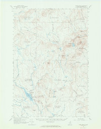 1965 Howe Brook1968 Print · USGSAroostook County was a landscape of timber and rail in the mid-1960s, dominated by unorganized townships and hunting camps. You can trace the Bangor and Aroostook railroad as it passes through Weeksboro and by lookout towers on Howe Brook Mtn and Number Nine Mtn.2 unique versions available
 - 1975 Map of Howe Brook NE, 1981 Print
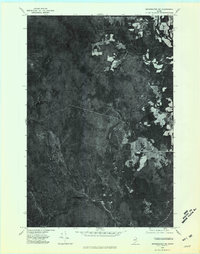
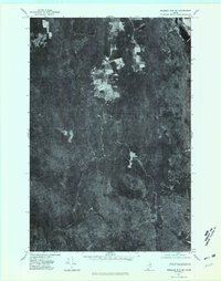
 1975 Howe Brook NE1981 Print · USGSAroostook County's deep timberlands are captured in this mid-seventies aerial survey of the North Woods. Genealogists and historians can trace the specific terrain surrounding Number Nine Lake, Presque Isle Lake, and Maple Mountain.
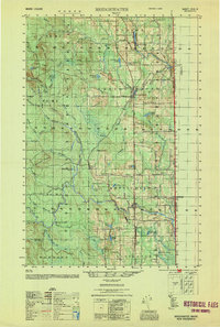
 - 1975 Map of Bridgewater NW, 1981 Print
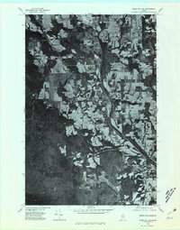
 1975 Bridgewater NW1981 Print · USGSNorthern Maine's timberlands and early agricultural clearings are captured in this mid-seventies aerial survey of the Aroostook County woods. Researchers can trace the rugged topography of Nineteen Mountain and the remote shores of Ketchum Lake.
 - 1975 Map of Mars Hill SW, 1981 Print
 1975 Mars Hill SW1981 Print · USGSThe Aroostook County countryside near Westfield is shown here in the mid-seventies through detailed aerial photography. Researchers can trace land boundaries, forest edges, and water bodies like Prestile Stream and Bennett Lake.
 - 1975 Map of Presque Isle SE, 1981 Print
 1975 Presque Isle SE1981 Print · USGSNorthern Maine forest and farmland emerge in this mid-seventies aerial study of the Aroostook landscape. Researchers can trace the winding course of Presque Isle Stream and identify early land clearings near Quaggy Joe and Echo Lake.
 - 1981 Map of Brooklin
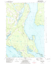 1981 Brooklin1981 Print · USGSCoastal Hancock County is captured here in the early 1980s, showcasing the traditional maritime settlements between Blue Hill Bay and Eggemoggin Reach. Genealogists can trace family names at Pine Grove Cemetery and Freethy Cemetery or explore the docks at Center Harbor.
 - 1984 Map of Echo Lake
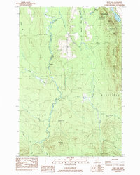 1984 Echo Lake1984 Print · USGSThe Aroostook County highlands come into sharp focus in the mid-1980s, centered on the rugged peaks of the state's first park. Researchers can trace land divisions across Westfield and Chapman, or locate remote spots like Deadmans Corner and Echo Lake.
 - 1984 Map of Packard Lake
 1984 Packard Lake1984 Print · USGSAroostook County's timberlands and river forks are captured here in the mid-1980s. Local researchers can trace old parcel lines like the Cox Patent and explore the surroundings of Packard Lake, Nineteen Mtn, and the Advent Swamp.
Showing maps 1-25 of 52
Top cities near E Township
- Presque Isle historical maps
- Fort Fairfield historical maps
- Mapleton historical maps
- Mars Hill historical maps
- Easton historical maps
- Littleton historical maps
See more
Frequently asked questions
- What are the different types of historical maps available for E Township?
- What is the oldest map of E Township?
- Where can I purchase historical maps of E Township for my home or office?
- Where can I download high-res historical maps of E Township?
- Are there historical topographic maps available for E Township?
- Is there historical aerial imagery available for E Township?
- Where are historical maps of E Township sourced from?