1960s Maps of Saint Croix Township, Maine
Explore 3 historic maps of Saint Croix Township from the 1960s. These maps offer a rare glimpse into what life looked like during the 1960s — showing old roads, neighborhoods, homes, and landmarks that have changed or disappeared over time.
Whether you're researching your family's past, planning a metal detecting trip, or studying how Saint Croix Township's landscape evolved across the 1960s, these high-resolution maps are a powerful tool for exploring the history of this region.
- Focus on a specific era: All maps on this page are from the 1960s, giving you a focused view of this time period.
- See what’s changed: Compare century-old streets, trails, and buildings to today's modern landscape using overlays and satellite layers.
- Research with precision: Use these maps for genealogy, historical research, land use analysis, or educational projects.
- View, download, or print: Maps are fully viewable online in high resolution, and can be downloaded or printed for your own records.
Start exploring Saint Croix Township's history through authentic maps from the 1960s. This is your window into the past.
Saint Croix Township, ME maps
(3)- 1960 Map of Presque Isle
 1960 Presque Isle1960 Print · USGSNorthern Maine during the mid-century was a land of timber, rails, and strategic airfields. Genealogists and historians can trace the growth of Presque Isle and Ashland or explore the remote northern reaches of Baxter State Park and Presque Isle AFB.3 unique versions available
 - 1965 Map of Howe Brook, 1968 Print
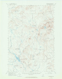 1965 Howe Brook1968 Print · USGSAroostook County was a landscape of timber and rail in the mid-1960s, dominated by unorganized townships and hunting camps. You can trace the Bangor and Aroostook railroad as it passes through Weeksboro and by lookout towers on Howe Brook Mtn and Number Nine Mtn.2 unique versions available
 - 1965 Map of Oxbow, 1969 Print
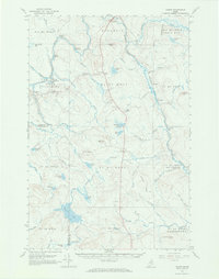 1965 Oxbow1969 Print · USGSNorthern Maine's timberlands are documented here in the mid-sixties, focusing on the remote settlements of Oxbow Plantation and Masardis. Researchers can trace the Houlton Trail or locate local landmarks like the East End Sch and Camp Violette.3 unique versions available
End of results
Showing maps 1-3 of 3
Top cities near Saint Croix Township
- Ashland historical maps
- Oakfield historical maps
- New Limerick historical maps
- Westfield historical maps
- Smyrna historical maps
- Ludlow historical maps
See more
Top neighborhoods of Saint Croix Township
Frequently asked questions
- What are the different types of historical maps available for Saint Croix Township?
- What is the oldest map of Saint Croix Township?
- Where can I purchase historical maps of Saint Croix Township for my home or office?
- Where can I download high-res historical maps of Saint Croix Township?
- Are there historical topographic maps available for Saint Croix Township?
- Is there historical aerial imagery available for Saint Croix Township?
- Where are historical maps of Saint Croix Township sourced from?